Property Record
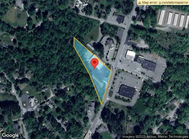
967 Route 390, Cresco, PA 18326
NEARBY LISTINGS FOR SALE OR LEASE
Property Detail
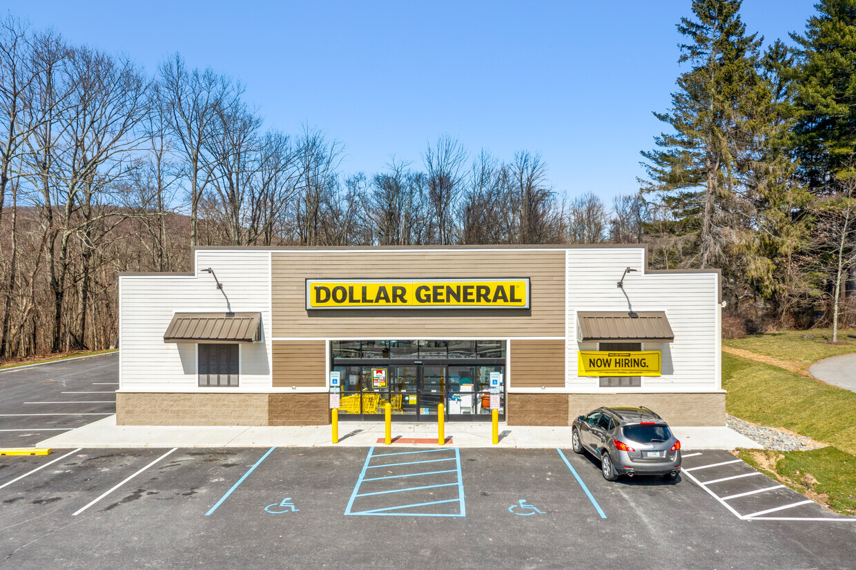
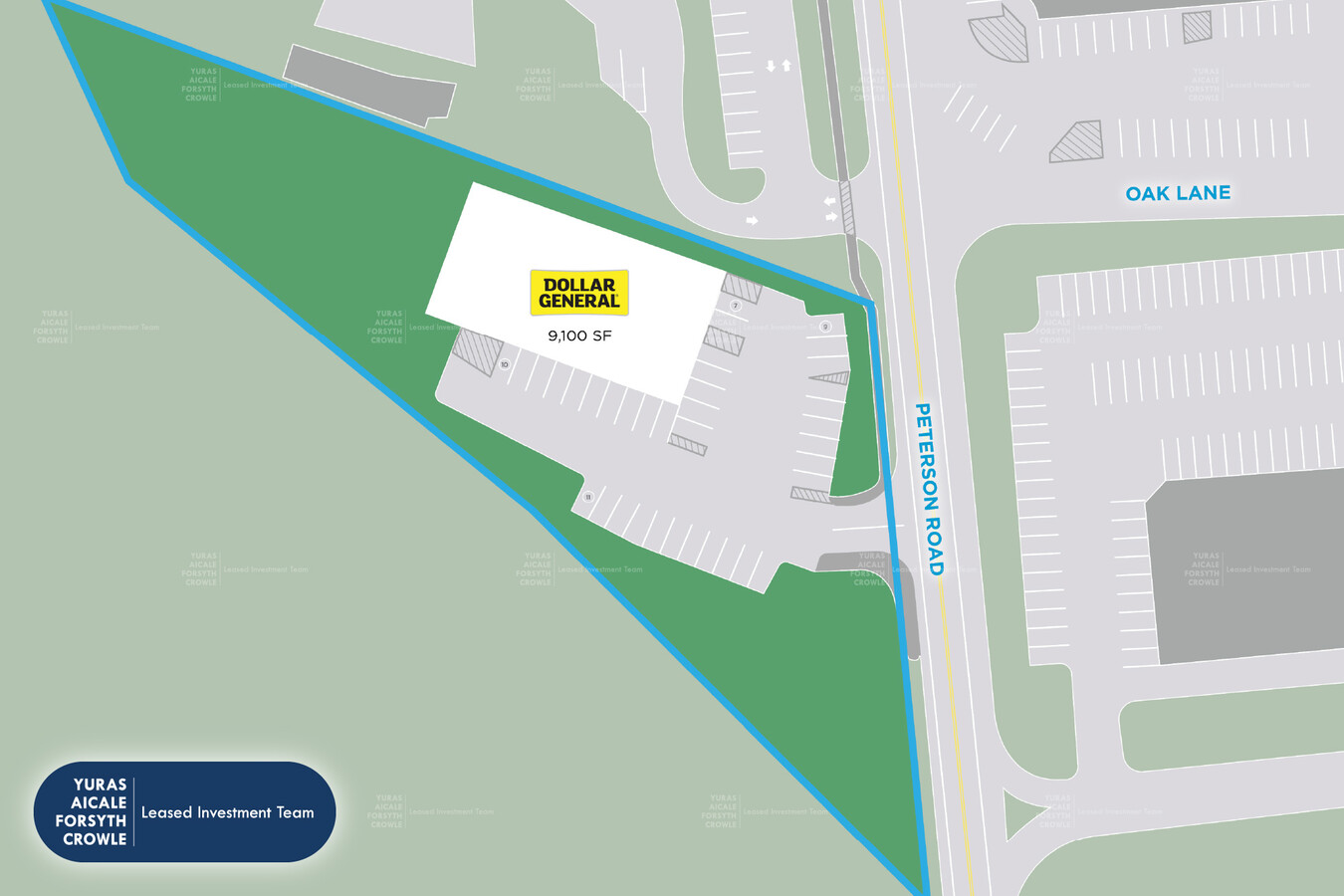
967 Route 390
Storebuilding
Monroe
AE
Pennsylvania
42089C0117E
1.85 AC
2024
Monroe County
2024
Philadelphia
300201
East Stroudsburg, PA
8,968 SF
01.14.1.46-3
DEMOGRAPHICS near 967 Route 390
1 Mile
3 Mile
5 Mile
2024 Total Population
2,153
4,779
15,534
2029 Population
2,267
4,902
15,688
Pop Growth 2024-2029
+ 5.29%
+ 2.57%
+ 0.99%
Average Age
46
46
43
2024 Total Households
998
2,118
5,950
HH Growth 2024-2029
+ 5.61%
+ 3.02%
+ 1.13%
Median Household Inc
$45,127
$64,323
$73,227
Avg Household Size
2.20
2.30
2.60
2024 Avg HH Vehicles
2.00
2.00
2.00
Median Home Value
$172,187
$197,483
$183,785
Median Year Built
1985
1986
1988
Nearby Places
- Restaurants
- Banks
- Shops
- Fitness
- Groceries
PUBLIC TRANSPORTATION
AIRPORT
Wilkes-Barre/Scranton International
DRIVE
WALK
Distance
Wilkes-Barre/Scranton International
59 min
42.5 mi
Freight Ports
Maher Terminal
DRIVE
WALK
Distance
Maher Terminal
115 min
84.3 mi
SALE & LEASE HISTORY
LISTING DATE
SALE/LEASE

Apr 16, 2024
For Sale
Nearby Properties
Address
Land Use
TOTAL SIZE
Lot Size
Zoning
Address
Land Use
TOTAL SIZE
Lot Size
Zoning
64,756 SF
27.30 AC
R-1
Address
Land Use
TOTAL SIZE
Lot Size
Zoning
612 SF
3,166 AC
C
Address
Land Use
TOTAL SIZE
Lot Size
Zoning
12,446 SF
3.02 AC
MU-V
Address
Land Use
TOTAL SIZE
Lot Size
Zoning
69,028 SF
13.90 AC
I
Address
Land Use
TOTAL SIZE
Lot Size
Zoning
62,004 SF
22.03 AC
MU-V
Address
Land Use
TOTAL SIZE
Lot Size
Zoning
427 AC
RR
Address
Land Use
TOTAL SIZE
Lot Size
Zoning
15,476 SF
1.36 AC
MU-V
Address
Land Use
TOTAL SIZE
Lot Size
Zoning
Address
Land Use
TOTAL SIZE
Lot Size
Zoning
21,480 SF
0.88 AC
MU-V
Address
Land Use
TOTAL SIZE
Lot Size
Zoning
644 SF
28.49 AC
MU-V
Address
Land Use
TOTAL SIZE
Lot Size
Zoning
1,145.83 AC
C
Address
Land Use
TOTAL SIZE
Lot Size
Zoning
1,672 SF
15.35 AC
I
Address
Land Use
TOTAL SIZE
Lot Size
Zoning
Address
Land Use
TOTAL SIZE
Lot Size
Zoning
8,968 SF
1.85 AC
MU-V
Address
Land Use
TOTAL SIZE
Lot Size
Zoning
272.13 AC
OSC
Address
Land Use
TOTAL SIZE
Lot Size
Zoning
478.72 AC
C
Address
Land Use
TOTAL SIZE
Lot Size
Zoning
34,000 SF
15.70 AC
MU-V
Address
Land Use
TOTAL SIZE
Lot Size
Zoning
7,500 SF
2.66 AC
B1
Address
Land Use
TOTAL SIZE
Lot Size
Zoning
11,344 SF
2.83 AC
R-1
Address
Land Use
TOTAL SIZE
Lot Size
Zoning
7,560 SF
1.17 AC
MU-V
Address
Land Use
TOTAL SIZE
Lot Size
Zoning
2,224 SF
2 AC
Address
Land Use
TOTAL SIZE
Lot Size
Zoning
86.35 AC
I
Address
Land Use
TOTAL SIZE
Lot Size
Zoning
6,960 SF
25.85 AC
RR
Address
Land Use
TOTAL SIZE
Lot Size
Zoning
9,329 SF
3.60 AC
MU-V
Address
Land Use
TOTAL SIZE
Lot Size
Zoning
7,588 SF
1.66 AC
MU-V
Address
Land Use
TOTAL SIZE
Lot Size
Zoning
3,084 SF
1.10 AC
MU-V
Address
Land Use
TOTAL SIZE
Lot Size
Zoning
5,072 SF
6.15 AC
R
Address
Land Use
TOTAL SIZE
Lot Size
Zoning
11,520 SF
5.01 AC
R
Address
Land Use
TOTAL SIZE
Lot Size
Zoning
Address
Land Use
TOTAL SIZE
Lot Size
Zoning
330 AC
C
The World's #1 Commercial Real Estate Marketplace
Connect with us
© 2025 CoStar Group
The information above has been obtained from sources believed reliable. While we do not doubt its accuracy we have not verified it and make no guarantee, warranty or representation about it. It is your responsibility to independently confirm its accuracy and completeness. Any projections, opinions, assumptions, or estimates used are for example only and do not represent the current or future performance of the property. The value of this transaction to you depends on tax and other factors which should be evaluated by your tax, financial, and legal advisors. You and your advisors should conduct a careful, independent investigation of the property to determine to your satisfaction the suitability of the property for your needs.