Property Record
970 Harding Hwy, Penns Grove, NJ 08069


NEARBY LISTINGS FOR SALE OR LEASE
Property Detail
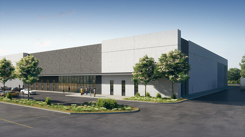
970 Harding Hwy
Philadelphia
FACILITY NAME: IN-LIEU TAX PAYMENT
Philadelphia-Camden-Wilmington, PA-NJ-DE-MD
Salem
02 00250-0000-00003-0000-X
New Jersey
Taxexempt
3
0
41.27 AC
2024
Salem County
020600
DEMOGRAPHICS near 970 Harding Hwy
1 Mile
3 Mile
5 Mile
2024 Total Population
558
3,877
21,967
2029 Population
561
3,921
22,343
Pop Growth 2024-2029
+ 0.54%
+ 1.13%
+ 1.71%
Average Age
47
44
41
2024 Total Households
220
1,512
8,295
HH Growth 2024-2029
+ 0.45%
+ 1.19%
+ 1.63%
Median Household Inc
$68,055
$76,701
$70,646
Avg Household Size
2.40
2.40
2.60
2024 Avg HH Vehicles
2.00
2.00
2.00
Median Home Value
$216,216
$184,821
$184,353
Median Year Built
1954
1958
1961
Nearby Places
- Restaurants
- Banks
- Shops
- Fitness
- Groceries
PUBLIC TRANSPORTATION
AIRPORT
Philadelphia International
DRIVE
WALK
Distance
Philadelphia International
36 min
23.8 mi
Freight Ports
Port of Wilmington, RI
DRIVE
WALK
Distance
Port of Wilmington, RI
20 min
11.1 mi
SALE & LEASE HISTORY
LISTING DATE
SALE/LEASE

Oct 30, 2019
For Lease
Nearby Properties
Address
Land Use
TOTAL SIZE
Lot Size
Zoning
Address
Land Use
TOTAL SIZE
Lot Size
Zoning
118.77 AC
GC
Address
Land Use
TOTAL SIZE
Lot Size
Zoning
29.05 AC
GC
Address
Land Use
TOTAL SIZE
Lot Size
Zoning
Address
Land Use
TOTAL SIZE
Lot Size
Zoning
2,744 SF
126.81 AC
Address
Land Use
TOTAL SIZE
Lot Size
Zoning
10.28 AC
IC
Address
Land Use
TOTAL SIZE
Lot Size
Zoning
118.77 AC
GC
Address
Land Use
TOTAL SIZE
Lot Size
Zoning
10.08 AC
IC
Address
Land Use
TOTAL SIZE
Lot Size
Zoning
11.76 AC
GC
Address
Land Use
TOTAL SIZE
Lot Size
Zoning
Address
Land Use
TOTAL SIZE
Lot Size
Zoning
41.27 AC
GC
Address
Land Use
TOTAL SIZE
Lot Size
Zoning
47.91 AC
IC
Address
Land Use
TOTAL SIZE
Lot Size
Zoning
29.05 AC
GC
Address
Land Use
TOTAL SIZE
Lot Size
Zoning
2.16 AC
Address
Land Use
TOTAL SIZE
Lot Size
Zoning
28,842 SF
0.80 AC
LR
Address
Land Use
TOTAL SIZE
Lot Size
Zoning
9,715 SF
4.47 AC
Address
Land Use
TOTAL SIZE
Lot Size
Zoning
Address
Land Use
TOTAL SIZE
Lot Size
Zoning
9,920 SF
4.31 AC
Address
Land Use
TOTAL SIZE
Lot Size
Zoning
54.60 AC
Address
Land Use
TOTAL SIZE
Lot Size
Zoning
2,712 SF
4.03 AC
LR
Address
Land Use
TOTAL SIZE
Lot Size
Zoning
9,158 SF
6.35 AC
GC
Address
Land Use
TOTAL SIZE
Lot Size
Zoning
1,422 SF
1.39 AC
LR
Address
Land Use
TOTAL SIZE
Lot Size
Zoning
21,580 SF
3.58 AC
AGR
Address
Land Use
TOTAL SIZE
Lot Size
Zoning
3,173 SF
36.79 AC
CONS
Address
Land Use
TOTAL SIZE
Lot Size
Zoning
29.13 AC
AGR
Address
Land Use
TOTAL SIZE
Lot Size
Zoning
Address
Land Use
TOTAL SIZE
Lot Size
Zoning
11.70 AC
IC
Address
Land Use
TOTAL SIZE
Lot Size
Zoning
4,608 SF
1.66 AC
RR
Address
Land Use
TOTAL SIZE
Lot Size
Zoning
11.80 AC
GC
Address
Land Use
TOTAL SIZE
Lot Size
Zoning
14.84 AC
IC
The World's #1 Commercial Real Estate Marketplace
Connect with us
© 2025 CoStar Group
The information above has been obtained from sources believed reliable. While we do not doubt its accuracy we have not verified it and make no guarantee, warranty or representation about it. It is your responsibility to independently confirm its accuracy and completeness. Any projections, opinions, assumptions, or estimates used are for example only and do not represent the current or future performance of the property. The value of this transaction to you depends on tax and other factors which should be evaluated by your tax, financial, and legal advisors. You and your advisors should conduct a careful, independent investigation of the property to determine to your satisfaction the suitability of the property for your needs.