Property Record
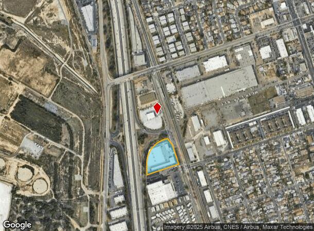
970 Industrial Blvd, Chula Vista, CA 91911

NEARBY LISTINGS FOR SALE OR LEASE
-
-
-
-
No Photo
-
-
-
-
View all Chula Vista listings for sale on LoopNet.com
Property Detail
970 Industrial Blvd
617-010-35
Rancho De La Nacion Sec 165
Shipyard
QSEC 165 W H PAR A PER DOC18-490998 IN W H OF TR 000505
X
San Diego
06073C2152G
California
2024
2.81 AC
2024
Chula Vista
013103
San Diego
99,999 SF
San Diego-Carlsbad, CA
DEMOGRAPHICS near 970 Industrial Blvd
1 Mile
3 Mile
5 Mile
2024 Total Population
18,383
165,874
344,917
2029 Population
18,106
164,190
341,097
Pop Growth 2024-2029
(1.51%)
(1.02%)
(1.11%)
Average Age
37
39
39
2024 Total Households
5,641
52,442
104,281
HH Growth 2024-2029
(1.74%)
(1.17%)
(1.25%)
Median Household Inc
$60,994
$64,983
$71,802
Avg Household Size
3.10
3.00
3.20
2024 Avg HH Vehicles
2.00
2.00
2.00
Median Home Value
$484,769
$583,709
$624,554
Median Year Built
1965
1969
1973
Nearby Places
- Restaurants
- Banks
- Shops
- Fitness
- Groceries
PUBLIC TRANSPORTATION
TRANSIT/SUBWAY
Palomar Street (Blue Line - San Diego Metropolitan Transit System Trolley (San Diego Trolley))
DRIVE
WALK
Distance
Palomar Street (Blue Line - San Diego Metropolitan Transit System Trolley (San Diego Trolley))
2 min
18 min
0.9 mi
AIRPORT
San Diego International
DRIVE
WALK
Distance
San Diego International
16 min
12.6 mi
Freight Ports
Port of San Diego
DRIVE
WALK
Distance
Port of San Diego
12 min
8.6 mi
Nearby Properties
Address
Land Use
TOTAL SIZE
Lot Size
Zoning
Address
Land Use
TOTAL SIZE
Lot Size
Zoning
11.42 AC
CP
Address
Land Use
TOTAL SIZE
Lot Size
Zoning
19.90 AC
C
Address
Land Use
TOTAL SIZE
Lot Size
Zoning
25.35 AC
UC-7
Address
Land Use
TOTAL SIZE
Lot Size
Zoning
15 AC
UC-14
Address
Land Use
TOTAL SIZE
Lot Size
Zoning
9.84 AC
C
Address
Land Use
TOTAL SIZE
Lot Size
Zoning
24.06 AC
R3
Address
Land Use
TOTAL SIZE
Lot Size
Zoning
8.96 AC
C-6
Address
Land Use
TOTAL SIZE
Lot Size
Zoning
6.03 AC
R3
Address
Land Use
TOTAL SIZE
Lot Size
Zoning
6.67 AC
RM-2-5
Address
Land Use
TOTAL SIZE
Lot Size
Zoning
6.85 AC
IL
Address
Land Use
TOTAL SIZE
Lot Size
Zoning
4.70 AC
R3
Address
Land Use
TOTAL SIZE
Lot Size
Zoning
16,410 SF
C-6
Address
Land Use
TOTAL SIZE
Lot Size
Zoning
77,397 SF
4.10 AC
R3
Address
Land Use
TOTAL SIZE
Lot Size
Zoning
7.52 AC
CTP
Address
Land Use
TOTAL SIZE
Lot Size
Zoning
7.36 AC
RM-2-5
Address
Land Use
TOTAL SIZE
Lot Size
Zoning
1.05 AC
C-6
Address
Land Use
TOTAL SIZE
Lot Size
Zoning
5.28 AC
CC-4-5
Address
Land Use
TOTAL SIZE
Lot Size
Zoning
9.10 AC
RM-1-1
Address
Land Use
TOTAL SIZE
Lot Size
Zoning
1.43 AC
C-6
Address
Land Use
TOTAL SIZE
Lot Size
Zoning
9,999 SF
1.88 AC
C-6
Address
Land Use
TOTAL SIZE
Lot Size
Zoning
1.43 AC
UC-2
Address
Land Use
TOTAL SIZE
Lot Size
Zoning
4.71 AC
R3
Address
Land Use
TOTAL SIZE
Lot Size
Zoning
79,724 SF
2.38 AC
V-3
Address
Land Use
TOTAL SIZE
Lot Size
Zoning
91,326 SF
2.42 AC
CCP
Address
Land Use
TOTAL SIZE
Lot Size
Zoning
4.18 AC
UC-15
Address
Land Use
TOTAL SIZE
Lot Size
Zoning
95,996 SF
8.34 AC
PC
Address
Land Use
TOTAL SIZE
Lot Size
Zoning
32,670 SF
0.75 AC
V-1
Address
Land Use
TOTAL SIZE
Lot Size
Zoning
9,764 SF
20.67 AC
Marine Ter
Address
Land Use
TOTAL SIZE
Lot Size
Zoning
69,408 SF
2.26 AC
R3D
The World's #1 Commercial Real Estate Marketplace
Connect with us
© 2025 CoStar Group
The information above has been obtained from sources believed reliable. While we do not doubt its accuracy we have not verified it and make no guarantee, warranty or representation about it. It is your responsibility to independently confirm its accuracy and completeness. Any projections, opinions, assumptions, or estimates used are for example only and do not represent the current or future performance of the property. The value of this transaction to you depends on tax and other factors which should be evaluated by your tax, financial, and legal advisors. You and your advisors should conduct a careful, independent investigation of the property to determine to your satisfaction the suitability of the property for your needs.