Property Record
9715 S Robert Trl, Inver Grove Heights, MN 55077
NEARBY LISTINGS FOR SALE OR LEASE
-
-
View all Inver Grove Heights listings for lease on LoopNet.com
Property Detail
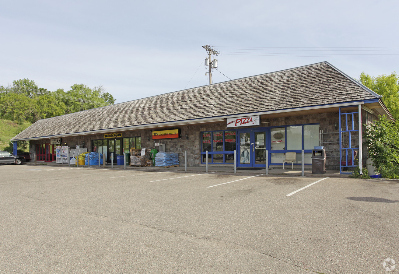
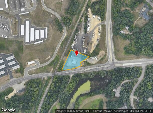
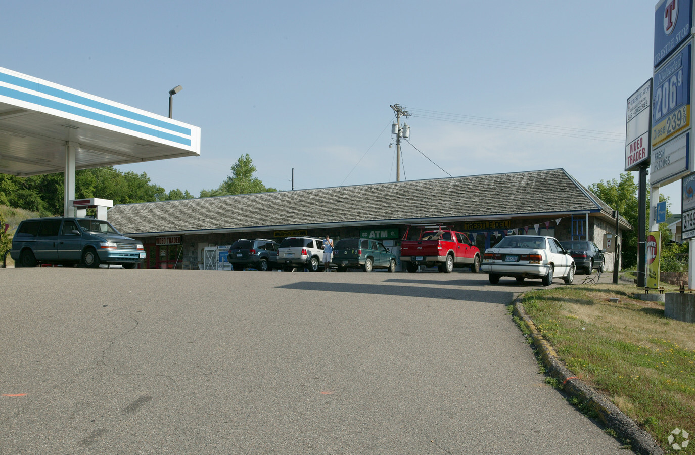
9715 S Robert Trl
20-01900-52-030
SECTION 19 TWN 27 RANGE 22 19 27 22 PT OF NW 1/4 OF SW 1/4 BEG AT INT HGWY #1 & RR N ON RR 244.5 FT SE 93D 45M 252.5FT TO HGWY SW ON HGWY TO BEG
Commercialnec
Dakota
X
Minnesota
27037C0115E
30
2024
0.80 AC
2023
Eagan
060508
Minneapolis/St Paul
7,200 SF
Minneapolis-St. Paul-Bloomington, MN-WI
DEMOGRAPHICS near 9715 S Robert Trl
1 Mile
3 Mile
5 Mile
2024 Total Population
4,224
35,185
111,793
2029 Population
4,273
35,873
114,244
Pop Growth 2024-2029
+ 1.16%
+ 1.96%
+ 2.19%
Average Age
40
40
40
2024 Total Households
1,386
12,823
43,098
HH Growth 2024-2029
+ 1.15%
+ 1.82%
+ 2.16%
Median Household Inc
$165,186
$124,620
$104,963
Avg Household Size
3.00
2.70
2.50
2024 Avg HH Vehicles
2.00
2.00
2.00
Median Home Value
$440,219
$418,224
$378,850
Median Year Built
1992
1990
1989
Nearby Places
- Restaurants
- Banks
- Shops
- Fitness
- Groceries
PUBLIC TRANSPORTATION
AIRPORT
Minneapolis-St Paul International/Wold-Chamberlain
DRIVE
WALK
Distance
Minneapolis-St Paul International/Wold-Chamberlain
19 min
10.8 mi
Freight Ports
Port Milwaukee
DRIVE
WALK
Distance
Port Milwaukee
375 min
337.1 mi
SALE & LEASE HISTORY
LISTING DATE
SALE/LEASE

Sep 25, 2016
For Lease
Nearby Properties
Address
Land Use
TOTAL SIZE
Lot Size
Zoning
Address
Land Use
TOTAL SIZE
Lot Size
Zoning
587,427 SF
87.26 AC
Address
Land Use
TOTAL SIZE
Lot Size
Zoning
1,286,074 SF
45.30 AC
Address
Land Use
TOTAL SIZE
Lot Size
Zoning
Address
Land Use
TOTAL SIZE
Lot Size
Zoning
247,451 SF
9.57 AC
Address
Land Use
TOTAL SIZE
Lot Size
Zoning
284,876 SF
29.54 AC
Address
Land Use
TOTAL SIZE
Lot Size
Zoning
159,341 SF
2.82 AC
Address
Land Use
TOTAL SIZE
Lot Size
Zoning
168,846 SF
7.30 AC
Address
Land Use
TOTAL SIZE
Lot Size
Zoning
217,832 SF
15.13 AC
Address
Land Use
TOTAL SIZE
Lot Size
Zoning
227,382 SF
13.14 AC
Address
Land Use
TOTAL SIZE
Lot Size
Zoning
128,798 SF
4.22 AC
Address
Land Use
TOTAL SIZE
Lot Size
Zoning
174,678 SF
24.36 AC
Address
Land Use
TOTAL SIZE
Lot Size
Zoning
358,532 SF
17.36 AC
Address
Land Use
TOTAL SIZE
Lot Size
Zoning
93,995 SF
26.16 AC
Address
Land Use
TOTAL SIZE
Lot Size
Zoning
151,348 SF
43.45 AC
Address
Land Use
TOTAL SIZE
Lot Size
Zoning
135,959 SF
16.72 AC
Address
Land Use
TOTAL SIZE
Lot Size
Zoning
64,870 SF
39.24 AC
Address
Land Use
TOTAL SIZE
Lot Size
Zoning
122,400 SF
8.79 AC
Address
Land Use
TOTAL SIZE
Lot Size
Zoning
128,188 SF
8.50 AC
Address
Land Use
TOTAL SIZE
Lot Size
Zoning
115,770 SF
11.94 AC
Address
Land Use
TOTAL SIZE
Lot Size
Zoning
370,704 SF
67.94 AC
Address
Land Use
TOTAL SIZE
Lot Size
Zoning
274,071 SF
28.06 AC
Address
Land Use
TOTAL SIZE
Lot Size
Zoning
102,300 SF
17.60 AC
Address
Land Use
TOTAL SIZE
Lot Size
Zoning
116,549 SF
11.95 AC
Address
Land Use
TOTAL SIZE
Lot Size
Zoning
85,619 SF
22.10 AC
Address
Land Use
TOTAL SIZE
Lot Size
Zoning
88,110 SF
7.88 AC
Address
Land Use
TOTAL SIZE
Lot Size
Zoning
185,715 SF
11.50 AC
Address
Land Use
TOTAL SIZE
Lot Size
Zoning
113,227 SF
14.52 AC
Address
Land Use
TOTAL SIZE
Lot Size
Zoning
121,400 SF
2.82 AC
Address
Land Use
TOTAL SIZE
Lot Size
Zoning
120,000 SF
8.77 AC
Address
Land Use
TOTAL SIZE
Lot Size
Zoning
55,080 SF
22.83 AC
The World's #1 Commercial Real Estate Marketplace
Connect with us
© 2025 CoStar Group
The information above has been obtained from sources believed reliable. While we do not doubt its accuracy we have not verified it and make no guarantee, warranty or representation about it. It is your responsibility to independently confirm its accuracy and completeness. Any projections, opinions, assumptions, or estimates used are for example only and do not represent the current or future performance of the property. The value of this transaction to you depends on tax and other factors which should be evaluated by your tax, financial, and legal advisors. You and your advisors should conduct a careful, independent investigation of the property to determine to your satisfaction the suitability of the property for your needs.