Property Record
975 Utica Ridge Pl, Bettendorf, IA 52722
NEARBY LISTINGS FOR SALE OR LEASE
Property Detail
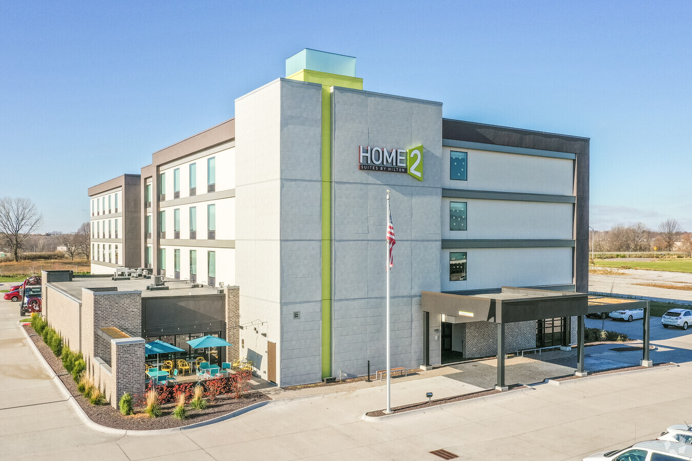
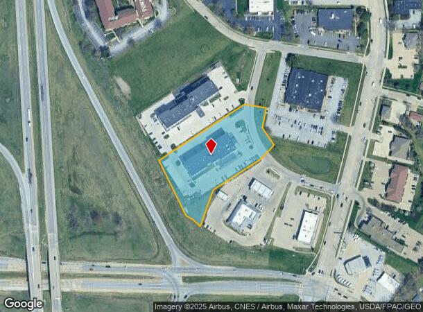
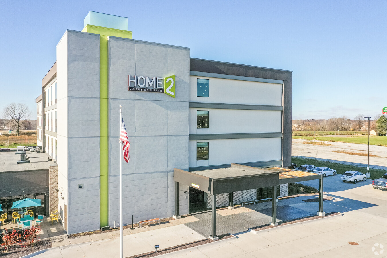
975 Utica Ridge Pl
841737702
Utica Hills Point
Hotelormotel
UTICA HILLS POINT LOT: 2
X
Scott
19163C0360H
Iowa
2024
2.66 AC
2024
Davenport/Moline
013600
Davenport/Moline/Rock Island
61,637 SF
Davenport-Moline-Rock Island, IA-IL
DEMOGRAPHICS near 975 Utica Ridge Pl
1 Mile
3 Mile
5 Mile
2024 Total Population
9,009
66,253
161,799
2029 Population
8,912
65,939
160,485
Pop Growth 2024-2029
(1.08%)
(0.47%)
(0.81%)
Average Age
41
40
39
2024 Total Households
3,734
27,956
67,147
HH Growth 2024-2029
(1.12%)
(0.55%)
(0.85%)
Median Household Inc
$87,705
$77,020
$59,660
Avg Household Size
2.40
2.30
2.30
2024 Avg HH Vehicles
2.00
2.00
2.00
Median Home Value
$197,749
$218,285
$167,946
Median Year Built
1970
1973
1962
Nearby Places
- Restaurants
- Banks
- Shops
- Fitness
- Groceries
PUBLIC TRANSPORTATION
AIRPORT
Quad Cities International
DRIVE
WALK
Distance
Quad Cities International
29 min
15.1 mi
Freight Ports
Port Milwaukee
DRIVE
WALK
Distance
Port Milwaukee
237 min
210.7 mi
Nearby Properties
Address
Land Use
TOTAL SIZE
Lot Size
Zoning
Address
Land Use
TOTAL SIZE
Lot Size
Zoning
7,934 SF
8.41 AC
Address
Land Use
TOTAL SIZE
Lot Size
Zoning
157,798 SF
25.36 AC
Address
Land Use
TOTAL SIZE
Lot Size
Zoning
157,587 SF
33.92 AC
Address
Land Use
TOTAL SIZE
Lot Size
Zoning
92,431 SF
40.01 AC
Address
Land Use
TOTAL SIZE
Lot Size
Zoning
247,196 SF
13.39 AC
Address
Land Use
TOTAL SIZE
Lot Size
Zoning
2,045 SF
29.48 AC
Address
Land Use
TOTAL SIZE
Lot Size
Zoning
128,100 SF
14.65 AC
Address
Land Use
TOTAL SIZE
Lot Size
Zoning
4,518 SF
6.27 AC
Address
Land Use
TOTAL SIZE
Lot Size
Zoning
27,306 SF
50.57 AC
Address
Land Use
TOTAL SIZE
Lot Size
Zoning
5,296 SF
67.13 AC
Address
Land Use
TOTAL SIZE
Lot Size
Zoning
123,823 SF
6.46 AC
Address
Land Use
TOTAL SIZE
Lot Size
Zoning
1,800 SF
60.85 AC
Address
Land Use
TOTAL SIZE
Lot Size
Zoning
7,614 SF
17.91 AC
Address
Land Use
TOTAL SIZE
Lot Size
Zoning
133,809 SF
8.30 AC
Address
Land Use
TOTAL SIZE
Lot Size
Zoning
3,044 SF
17.67 AC
Address
Land Use
TOTAL SIZE
Lot Size
Zoning
50,882 SF
5.10 AC
Address
Land Use
TOTAL SIZE
Lot Size
Zoning
6,128 SF
15.04 AC
Address
Land Use
TOTAL SIZE
Lot Size
Zoning
76,808 SF
1.94 AC
Address
Land Use
TOTAL SIZE
Lot Size
Zoning
3,250 SF
40.35 AC
Address
Land Use
TOTAL SIZE
Lot Size
Zoning
111,979 SF
7.05 AC
Address
Land Use
TOTAL SIZE
Lot Size
Zoning
156,632 SF
17.67 AC
Address
Land Use
TOTAL SIZE
Lot Size
Zoning
64,661 SF
147 AC
Address
Land Use
TOTAL SIZE
Lot Size
Zoning
71,820 SF
5.71 AC
Address
Land Use
TOTAL SIZE
Lot Size
Zoning
2,587 SF
14.79 AC
Address
Land Use
TOTAL SIZE
Lot Size
Zoning
16,563 SF
12.71 AC
Address
Land Use
TOTAL SIZE
Lot Size
Zoning
84,002 SF
21.76 AC
Address
Land Use
TOTAL SIZE
Lot Size
Zoning
3,200 SF
15.49 AC
Address
Land Use
TOTAL SIZE
Lot Size
Zoning
115,968 SF
2.93 AC
Address
Land Use
TOTAL SIZE
Lot Size
Zoning
226,764 SF
23.52 AC
The World's #1 Commercial Real Estate Marketplace
Connect with us
© 2025 CoStar Group
The information above has been obtained from sources believed reliable. While we do not doubt its accuracy we have not verified it and make no guarantee, warranty or representation about it. It is your responsibility to independently confirm its accuracy and completeness. Any projections, opinions, assumptions, or estimates used are for example only and do not represent the current or future performance of the property. The value of this transaction to you depends on tax and other factors which should be evaluated by your tax, financial, and legal advisors. You and your advisors should conduct a careful, independent investigation of the property to determine to your satisfaction the suitability of the property for your needs.