Property Record
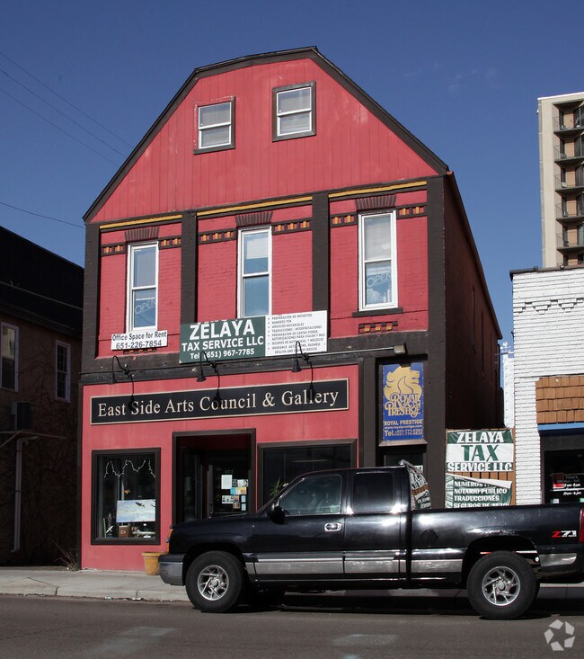
977 Payne Ave, Saint Paul, MN 55130


NEARBY LISTINGS FOR SALE OR LEASE
Property Detail
977 Payne Ave
Minneapolis-St. Paul-Bloomington, MN-WI
J R Weide Re L28-30B15 L1-2B16
29-29-22-13-0157
J R WEIDE RE L28-30B15 L1-2B16 EX W 29 4/10 FT LOT 5 BLK 16
Storebuilding
Ramsey
X
Minnesota
27037C0050E
5
2024
0.03 AC
2025
Woodbury
031000
Minneapolis/St Paul
4,200 SF
DEMOGRAPHICS near 977 Payne Ave
1 Mile
3 Mile
5 Mile
2024 Total Population
24,726
160,986
340,327
2029 Population
23,741
156,403
332,132
Pop Growth 2024-2029
(3.98%)
(2.85%)
(2.41%)
Average Age
33
35
37
2024 Total Households
7,466
58,042
132,161
HH Growth 2024-2029
(4.19%)
(2.80%)
(2.44%)
Median Household Inc
$55,261
$57,468
$66,148
Avg Household Size
3.00
2.60
2.40
2024 Avg HH Vehicles
2.00
2.00
2.00
Median Home Value
$194,184
$222,921
$257,652
Median Year Built
1948
1958
1960
Nearby Places
Map Layers
Map Styles
 Street
 Aerial
- Restaurants
- Banks
- Shops
- Fitness
- Groceries
PUBLIC TRANSPORTATION
COMMUTER RAIL
DRIVE
WALK
Distance
7 min
2.2 mi
AIRPORT
Minneapolis-St Paul International/Wold-Chamberlain
DRIVE
WALK
Distance
Minneapolis-St Paul International/Wold-Chamberlain
25 min
11.9 mi
SALE & LEASE HISTORY
LISTING DATE
SALE/LEASE

Jul 26, 2017
For Lease
Aug 22, 2017
For Lease
Nearby Properties
Address
Land Use
TOTAL SIZE
Lot Size
Zoning
Address
Land Use
TOTAL SIZE
Lot Size
Zoning
384,515 SF
18.04 AC
Address
Land Use
TOTAL SIZE
Lot Size
Zoning
384,515 SF
1.33 AC
Address
Land Use
TOTAL SIZE
Lot Size
Zoning
582,896 SF
14 AC
Address
Land Use
TOTAL SIZE
Lot Size
Zoning
825,463 SF
7.04 AC
Address
Land Use
TOTAL SIZE
Lot Size
Zoning
646,900 SF
7.66 AC
Address
Land Use
TOTAL SIZE
Lot Size
Zoning
32,854 SF
5.55 AC
Address
Land Use
TOTAL SIZE
Lot Size
Zoning
404,491 SF
27.01 AC
Address
Land Use
TOTAL SIZE
Lot Size
Zoning
408.23 AC
Address
Land Use
TOTAL SIZE
Lot Size
Zoning
420,177 SF
2.13 AC
Address
Land Use
TOTAL SIZE
Lot Size
Zoning
516,325 SF
16.81 AC
Address
Land Use
TOTAL SIZE
Lot Size
Zoning
759,622 SF
2.66 AC
Address
Land Use
TOTAL SIZE
Lot Size
Zoning
786,042 SF
2.10 AC
Address
Land Use
TOTAL SIZE
Lot Size
Zoning
643,305 SF
1.93 AC
Address
Land Use
TOTAL SIZE
Lot Size
Zoning
7.41 AC
Address
Land Use
TOTAL SIZE
Lot Size
Zoning
793,465 SF
1.93 AC
Address
Land Use
TOTAL SIZE
Lot Size
Zoning
3,050 SF
58.60 AC
Address
Land Use
TOTAL SIZE
Lot Size
Zoning
160,800 SF
5.05 AC
Address
Land Use
TOTAL SIZE
Lot Size
Zoning
393,443 SF
3.75 AC
Address
Land Use
TOTAL SIZE
Lot Size
Zoning
260,739 SF
3.04 AC
Address
Land Use
TOTAL SIZE
Lot Size
Zoning
3.13 AC
Address
Land Use
TOTAL SIZE
Lot Size
Zoning
47,670 SF
179 AC
Address
Land Use
TOTAL SIZE
Lot Size
Zoning
207.61 AC
Address
Land Use
TOTAL SIZE
Lot Size
Zoning
364,480 SF
8.33 AC
Address
Land Use
TOTAL SIZE
Lot Size
Zoning
444,819 SF
0.86 AC
Address
Land Use
TOTAL SIZE
Lot Size
Zoning
290,482 SF
1.46 AC
Address
Land Use
TOTAL SIZE
Lot Size
Zoning
13.10 AC
Address
Land Use
TOTAL SIZE
Lot Size
Zoning
401,435 SF
1.92 AC
Address
Land Use
TOTAL SIZE
Lot Size
Zoning
343,308 SF
2.90 AC
Address
Land Use
TOTAL SIZE
Lot Size
Zoning
406,352 SF
1.52 AC
Address
Land Use
TOTAL SIZE
Lot Size
Zoning
32,159 SF
448.26 AC
The World's #1 Commercial Real Estate Marketplace
Connect with us
© 2025 CoStar Group
The information above has been obtained from sources believed reliable. While we do not doubt its accuracy we have not verified it and make no guarantee, warranty or representation about it. It is your responsibility to independently confirm its accuracy and completeness. Any projections, opinions, assumptions, or estimates used are for example only and do not represent the current or future performance of the property. The value of this transaction to you depends on tax and other factors which should be evaluated by your tax, financial, and legal advisors. You and your advisors should conduct a careful, independent investigation of the property to determine to your satisfaction the suitability of the property for your needs.