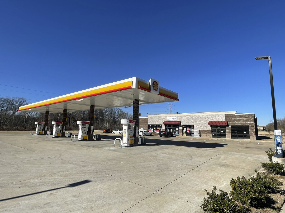
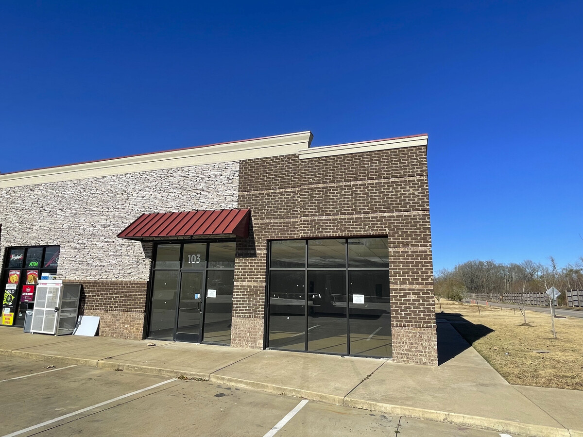
Property Record
9770 Walnut Grove Rd, Cordova, TN 38018
NEARBY LISTINGS FOR SALE OR LEASE
Property Detail
9770 Walnut Grove Rd
Memphis, TN-MS-AR
Woodland Hills Ii Pd Ph 9 P/O Area 10
D0-215-0-0731
Shelby
Storebuilding
Tennessee
X
1.05 AC
47157C0340F
Cordova
5,100 SF
Memphis
DEMOGRAPHICS near 9770 Walnut Grove Rd
1 Mile
3 Mile
5 Mile
2024 Total Population
1,265
34,150
107,482
2029 Population
1,244
33,202
104,651
Pop Growth 2024-2029
(1.66%)
(2.78%)
(2.63%)
Average Age
38
39
40
2024 Total Households
457
12,676
41,013
HH Growth 2024-2029
(1.75%)
(2.92%)
(2.68%)
Median Household Inc
$113,333
$108,790
$98,860
Avg Household Size
2.70
2.70
2.60
2024 Avg HH Vehicles
2.00
2.00
2.00
Median Home Value
$380,821
$342,657
$318,681
Median Year Built
2005
1998
1993
Nearby Places
- Restaurants
- Banks
- Shops
- Fitness
- Groceries
PUBLIC TRANSPORTATION
AIRPORT
Memphis International
DRIVE
WALK
Distance
Memphis International
31 min
20.6 mi
Freight Ports
Port of Shreveport
DRIVE
WALK
Distance
Port of Shreveport
427 min
390.6 mi
SALE & LEASE HISTORY
LISTING DATE
SALE/LEASE

Dec 10, 2021
For Lease
Nearby Properties
Address
Land Use
TOTAL SIZE
Lot Size
Zoning
Address
Land Use
TOTAL SIZE
Lot Size
Zoning
93,713 SF
17.70 AC
CA
Address
Land Use
TOTAL SIZE
Lot Size
Zoning
35,313 SF
22.81 AC
RU-3
Address
Land Use
TOTAL SIZE
Lot Size
Zoning
126,790 SF
35.47 AC
R-1
Address
Land Use
TOTAL SIZE
Lot Size
Zoning
43.88 AC
R-10
Address
Land Use
TOTAL SIZE
Lot Size
Zoning
19.15 AC
CA
Address
Land Use
TOTAL SIZE
Lot Size
Zoning
29,090 SF
22.71 AC
CA
Address
Land Use
TOTAL SIZE
Lot Size
Zoning
124.99 AC
R-1
Address
Land Use
TOTAL SIZE
Lot Size
Zoning
36,966 SF
16.83 AC
CA
Address
Land Use
TOTAL SIZE
Lot Size
Zoning
29,090 SF
11.51 AC
CA
Address
Land Use
TOTAL SIZE
Lot Size
Zoning
20,835 SF
12.61 AC
RU-2
Address
Land Use
TOTAL SIZE
Lot Size
Zoning
31,368 SF
26.18 AC
CA
Address
Land Use
TOTAL SIZE
Lot Size
Zoning
44,266 SF
4.19 AC
IH
Address
Land Use
TOTAL SIZE
Lot Size
Zoning
43,296 SF
4.55 AC
R-1
Address
Land Use
TOTAL SIZE
Lot Size
Zoning
33,971 SF
2.99 AC
EMP
Address
Land Use
TOTAL SIZE
Lot Size
Zoning
22,268 SF
74.53 AC
CA
Address
Land Use
TOTAL SIZE
Lot Size
Zoning
56,950 SF
7.39 AC
CA
Address
Land Use
TOTAL SIZE
Lot Size
Zoning
10,168 SF
2 AC
R-1
Address
Land Use
TOTAL SIZE
Lot Size
Zoning
77,083 SF
7.61 AC
EMP
Address
Land Use
TOTAL SIZE
Lot Size
Zoning
20.16 AC
R-1
Address
Land Use
TOTAL SIZE
Lot Size
Zoning
19,375 SF
2 AC
CA
Address
Land Use
TOTAL SIZE
Lot Size
Zoning
11,800 SF
1.41 AC
CMU-1
Address
Land Use
TOTAL SIZE
Lot Size
Zoning
31,672 SF
15.04 AC
CA
Address
Land Use
TOTAL SIZE
Lot Size
Zoning
18 AC
CA
Address
Land Use
TOTAL SIZE
Lot Size
Zoning
20,400 SF
1.88 AC
CA
Address
Land Use
TOTAL SIZE
Lot Size
Zoning
55.52 AC
CA
Address
Land Use
TOTAL SIZE
Lot Size
Zoning
63.67 AC
CA
Address
Land Use
TOTAL SIZE
Lot Size
Zoning
37.67 AC
R-1
Address
Land Use
TOTAL SIZE
Lot Size
Zoning
26,605 SF
4.39 AC
R-6
Address
Land Use
TOTAL SIZE
Lot Size
Zoning
56,764 SF
5.10 AC
CA
Address
Land Use
TOTAL SIZE
Lot Size
Zoning
7,601 SF
1.84 AC
CA
The World's #1 Commercial Real Estate Marketplace
Connect with us
© 2025 CoStar Group
The information above has been obtained from sources believed reliable. While we do not doubt its accuracy we have not verified it and make no guarantee, warranty or representation about it. It is your responsibility to independently confirm its accuracy and completeness. Any projections, opinions, assumptions, or estimates used are for example only and do not represent the current or future performance of the property. The value of this transaction to you depends on tax and other factors which should be evaluated by your tax, financial, and legal advisors. You and your advisors should conduct a careful, independent investigation of the property to determine to your satisfaction the suitability of the property for your needs.