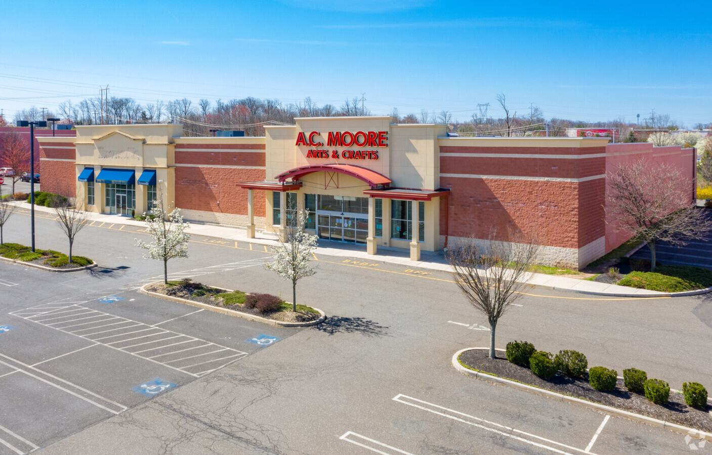
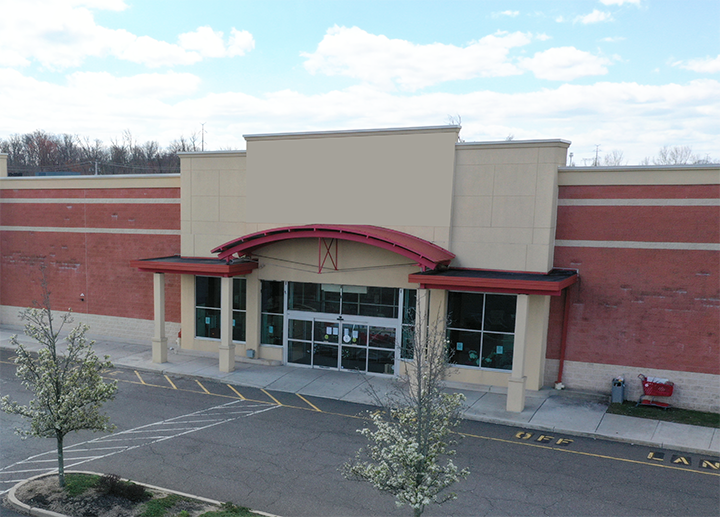
Property Record
980 Bethlehem Pike, Glenside, PA 19038


NEARBY LISTINGS FOR SALE OR LEASE
Property Detail
980 Bethlehem Pike
Philadelphia-Camden-Wilmington, PA-NJ-DE-MD
Property/P Clark Hopkins
46-00-00313-001
307 X IRR 3.69 AC
Storemultistory
Montgomery
X
Pennsylvania
42091C0276G
9
2024
3.69 AC
2024
Ft Wash/Spring House
210400
Philadelphia
40,296 SF
DEMOGRAPHICS near 980 Bethlehem Pike
1 Mile
3 Mile
5 Mile
2024 Total Population
5,872
67,176
155,951
2029 Population
5,920
68,290
157,887
Pop Growth 2024-2029
+ 0.82%
+ 1.66%
+ 1.24%
Average Age
43
43
43
2024 Total Households
2,368
25,463
58,726
HH Growth 2024-2029
+ 0.76%
+ 1.61%
+ 1.18%
Median Household Inc
$110,726
$109,179
$116,237
Avg Household Size
2.50
2.50
2.60
2024 Avg HH Vehicles
2.00
2.00
2.00
Median Home Value
$325,699
$402,192
$428,189
Median Year Built
1993
1982
1981
Nearby Places
- Restaurants
- Banks
- Shops
- Fitness
- Groceries
PUBLIC TRANSPORTATION
COMMUTER RAIL
Chestnut Hill East (R7 - Southeastern Pennsylvania Transportation Authority Regional Rail (SEPTA Regional Rail))
DRIVE
WALK
Distance
Chestnut Hill East (R7 - Southeastern Pennsylvania Transportation Authority Regional Rail (SEPTA Regional Rail))
3 min
1.3 mi
Chestnut Hill West (R8 - Southeastern Pennsylvania Transportation Authority Regional Rail (SEPTA Regional Rail))
DRIVE
WALK
Distance
Chestnut Hill West (R8 - Southeastern Pennsylvania Transportation Authority Regional Rail (SEPTA Regional Rail))
4 min
1.7 mi
AIRPORT
Philadelphia International
DRIVE
WALK
Distance
Philadelphia International
42 min
23.0 mi
Trenton Mercer
DRIVE
WALK
Distance
Trenton Mercer
47 min
33.1 mi
Freight Ports
Port of Philadelphia
DRIVE
WALK
Distance
Port of Philadelphia
23 min
12.4 mi
SALE & LEASE HISTORY
LISTING DATE
SALE/LEASE

May 01, 2020
For Lease
Jun 16, 2021
For Lease
Apr 27, 2020
For Lease
Apr 27, 2020
For Lease
Apr 27, 2020
For Lease
Apr 27, 2020
For Lease
Apr 26, 2020
For Lease
Apr 26, 2020
For Lease
Apr 26, 2020
For Lease
Apr 01, 2020
For Lease
Nearby Properties
Address
Land Use
TOTAL SIZE
Lot Size
Zoning
Address
Land Use
TOTAL SIZE
Lot Size
Zoning
638,776 SF
20 AC
RM2
Address
Land Use
TOTAL SIZE
Lot Size
Zoning
563,768 SF
20.20 AC
RM2
Address
Land Use
TOTAL SIZE
Lot Size
Zoning
952,830 SF
95.86 AC
IAAA
Address
Land Use
TOTAL SIZE
Lot Size
Zoning
733,282 SF
88.07 AC
LIM
Address
Land Use
TOTAL SIZE
Lot Size
Zoning
510,312 SF
51.75 AC
IA
Address
Land Use
TOTAL SIZE
Lot Size
Zoning
649,400 SF
55.03 AC
R1
Address
Land Use
TOTAL SIZE
Lot Size
Zoning
568,410 SF
33.08 AC
RMX1
Address
Land Use
TOTAL SIZE
Lot Size
Zoning
467,639 SF
123.58 AC
IAAA
Address
Land Use
TOTAL SIZE
Lot Size
Zoning
249,341 SF
21.82 AC
CA2
Address
Land Use
TOTAL SIZE
Lot Size
Zoning
415,059 SF
11.59 AC
RSD3
Address
Land Use
TOTAL SIZE
Lot Size
Zoning
211,200 SF
1.46 AC
CMX2
Address
Land Use
TOTAL SIZE
Lot Size
Zoning
57,301 SF
49.77 AC
SPPOA
Address
Land Use
TOTAL SIZE
Lot Size
Zoning
170,842 SF
16.51 AC
RSD1
Address
Land Use
TOTAL SIZE
Lot Size
Zoning
263,000 SF
5.31 AC
RM2
Address
Land Use
TOTAL SIZE
Lot Size
Zoning
148,293 SF
7.45 AC
RM2
Address
Land Use
TOTAL SIZE
Lot Size
Zoning
705,687 SF
19.89 AC
C1
Address
Land Use
TOTAL SIZE
Lot Size
Zoning
234,934 SF
43.63 AC
AA
Address
Land Use
TOTAL SIZE
Lot Size
Zoning
233,235 SF
7.93 AC
RM2
Address
Land Use
TOTAL SIZE
Lot Size
Zoning
635,387 SF
10.12 AC
C1
Address
Land Use
TOTAL SIZE
Lot Size
Zoning
131,720 SF
4.33 AC
RM2
Address
Land Use
TOTAL SIZE
Lot Size
Zoning
134,345 SF
25.45 AC
RSD1
Address
Land Use
TOTAL SIZE
Lot Size
Zoning
360,524 SF
59.87 AC
INST
Address
Land Use
TOTAL SIZE
Lot Size
Zoning
582,294 SF
9.07 AC
C1
Address
Land Use
TOTAL SIZE
Lot Size
Zoning
615,217 SF
33.52 AC
C2
Address
Land Use
TOTAL SIZE
Lot Size
Zoning
182,130 SF
6.45 AC
RSA3
Address
Land Use
TOTAL SIZE
Lot Size
Zoning
190,492 SF
298.37 AC
AR
Address
Land Use
TOTAL SIZE
Lot Size
Zoning
243,979 SF
15.58 AC
IAA
Address
Land Use
TOTAL SIZE
Lot Size
Zoning
232,000 SF
13.71 AC
RSA3
Address
Land Use
TOTAL SIZE
Lot Size
Zoning
103,898 SF
10.23 AC
CA2
Address
Land Use
TOTAL SIZE
Lot Size
Zoning
86,394 SF
10.26 AC
RSD3
The World's #1 Commercial Real Estate Marketplace
Connect with us
© 2025 CoStar Group
The information above has been obtained from sources believed reliable. While we do not doubt its accuracy we have not verified it and make no guarantee, warranty or representation about it. It is your responsibility to independently confirm its accuracy and completeness. Any projections, opinions, assumptions, or estimates used are for example only and do not represent the current or future performance of the property. The value of this transaction to you depends on tax and other factors which should be evaluated by your tax, financial, and legal advisors. You and your advisors should conduct a careful, independent investigation of the property to determine to your satisfaction the suitability of the property for your needs.