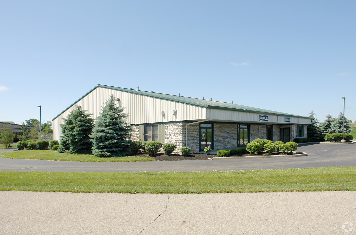
Property Record
9789 Karmar Ct, New Albany, OH 43054


NEARBY LISTINGS FOR SALE OR LEASE
-
-
View all New Albany listings for lease on LoopNet.com
Property Detail
9789 Karmar Ct
Columbus, OH
Zarley Industrial Park
222-000276
KARMAR COURT ZARLEY INDUSTRIAL PK LOT 16
Warehouse
Franklin
X
Ohio
39049C0208K
16
2023
1.01 AC
2023
Westerville
007213
Columbus
7,950 SF
DEMOGRAPHICS near 9789 Karmar Ct
1 Mile
3 Mile
5 Mile
2024 Total Population
3,190
28,964
75,505
2029 Population
3,206
29,054
76,376
Pop Growth 2024-2029
+ 0.50%
+ 0.31%
+ 1.15%
Average Age
38
38
39
2024 Total Households
1,087
12,012
32,474
HH Growth 2024-2029
+ 0.46%
+ 0.17%
+ 0.93%
Median Household Inc
$157,005
$121,318
$101,489
Avg Household Size
2.90
2.40
2.30
2024 Avg HH Vehicles
2.00
2.00
2.00
Median Home Value
$420,181
$392,764
$334,741
Median Year Built
2005
2005
2001
Nearby Places
- Restaurants
- Banks
- Shops
- Fitness
- Groceries
PUBLIC TRANSPORTATION
AIRPORT
John Glenn Columbus International
DRIVE
WALK
Distance
John Glenn Columbus International
18 min
11.0 mi
Rickenbacker International
DRIVE
WALK
Distance
Rickenbacker International
34 min
23.8 mi
Freight Ports
Port of Toledo
DRIVE
WALK
Distance
Port of Toledo
181 min
145.1 mi
SALE & LEASE HISTORY
LISTING DATE
SALE/LEASE

Oct 31, 2023
For Lease
Oct 14, 2024
For Lease
Aug 26, 2020
For Lease
Aug 26, 2020
For Lease
Nearby Properties
Address
Land Use
TOTAL SIZE
Lot Size
Zoning
Address
Land Use
TOTAL SIZE
Lot Size
Zoning
46,000 SF
214.46 AC
Address
Land Use
TOTAL SIZE
Lot Size
Zoning
624,564 SF
104.45 AC
Address
Land Use
TOTAL SIZE
Lot Size
Zoning
159,232 SF
66.44 AC
Address
Land Use
TOTAL SIZE
Lot Size
Zoning
696,736 SF
76.73 AC
Address
Land Use
TOTAL SIZE
Lot Size
Zoning
772,217 SF
98.64 AC
Address
Land Use
TOTAL SIZE
Lot Size
Zoning
1,437,389 SF
234.05 AC
Address
Land Use
TOTAL SIZE
Lot Size
Zoning
163,020 SF
35 AC
Address
Land Use
TOTAL SIZE
Lot Size
Zoning
759,381 SF
31.59 AC
Address
Land Use
TOTAL SIZE
Lot Size
Zoning
271,758 SF
131.45 AC
Address
Land Use
TOTAL SIZE
Lot Size
Zoning
435,273 SF
38.12 AC
Address
Land Use
TOTAL SIZE
Lot Size
Zoning
136,150 SF
19.08 AC
Address
Land Use
TOTAL SIZE
Lot Size
Zoning
67,804 SF
37.90 AC
Address
Land Use
TOTAL SIZE
Lot Size
Zoning
782,832 SF
17.30 AC
Address
Land Use
TOTAL SIZE
Lot Size
Zoning
368,823 SF
28.56 AC
Address
Land Use
TOTAL SIZE
Lot Size
Zoning
266,057 SF
26 AC
Address
Land Use
TOTAL SIZE
Lot Size
Zoning
520,983 SF
40.94 AC
Address
Land Use
TOTAL SIZE
Lot Size
Zoning
506,879 SF
142.43 AC
Address
Land Use
TOTAL SIZE
Lot Size
Zoning
134,144 SF
36.17 AC
Address
Land Use
TOTAL SIZE
Lot Size
Zoning
187,980 SF
41.24 AC
Address
Land Use
TOTAL SIZE
Lot Size
Zoning
754,614 SF
63.55 AC
Address
Land Use
TOTAL SIZE
Lot Size
Zoning
666,126 SF
17.22 AC
Address
Land Use
TOTAL SIZE
Lot Size
Zoning
250,496 SF
15.13 AC
Address
Land Use
TOTAL SIZE
Lot Size
Zoning
201 AC
Address
Land Use
TOTAL SIZE
Lot Size
Zoning
74,394 SF
9.03 AC
Address
Land Use
TOTAL SIZE
Lot Size
Zoning
137,547 SF
29.64 AC
Address
Land Use
TOTAL SIZE
Lot Size
Zoning
416,945 SF
15.01 AC
Address
Land Use
TOTAL SIZE
Lot Size
Zoning
100,116 SF
18.80 AC
Address
Land Use
TOTAL SIZE
Lot Size
Zoning
455,676 SF
8.63 AC
Address
Land Use
TOTAL SIZE
Lot Size
Zoning
372,683 SF
18.14 AC
Address
Land Use
TOTAL SIZE
Lot Size
Zoning
146,988 SF
9 AC
The World's #1 Commercial Real Estate Marketplace
Connect with us
© 2025 CoStar Group
The information above has been obtained from sources believed reliable. While we do not doubt its accuracy we have not verified it and make no guarantee, warranty or representation about it. It is your responsibility to independently confirm its accuracy and completeness. Any projections, opinions, assumptions, or estimates used are for example only and do not represent the current or future performance of the property. The value of this transaction to you depends on tax and other factors which should be evaluated by your tax, financial, and legal advisors. You and your advisors should conduct a careful, independent investigation of the property to determine to your satisfaction the suitability of the property for your needs.