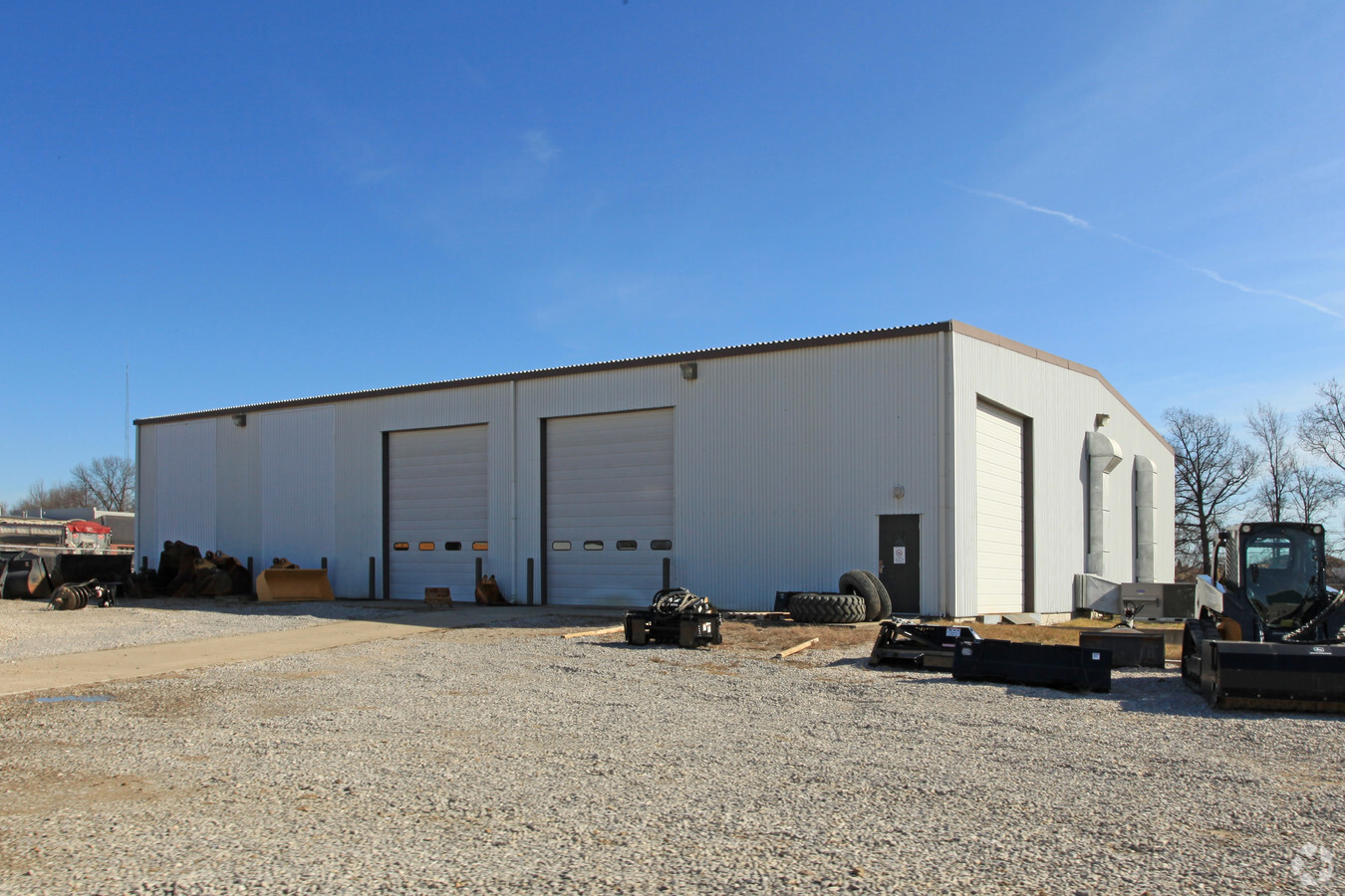
Property Record
9800 Highway 57, Evansville, IN 47725


NEARBY LISTINGS FOR SALE OR LEASE
-
-
View all Evansville listings for sale on LoopNet.com
Property Detail
9800 Highway 57
82-04-23-002-118.023-019
PT SW 1/4 23-5-10
Commercialnec
Vanderburgh
X
Indiana
18163C0109D
7.09 AC
2023
Northside/Airport
2023
Evansville
010204
Evansville, IN-KY
10,500 SF
DEMOGRAPHICS near 9800 Highway 57
1 Mile
3 Mile
5 Mile
2024 Total Population
4,093
19,944
47,512
2029 Population
4,067
19,799
47,201
Pop Growth 2024-2029
(0.64%)
(0.73%)
(0.65%)
Average Age
39
41
42
2024 Total Households
1,535
7,518
19,233
HH Growth 2024-2029
(0.65%)
(0.76%)
(0.69%)
Median Household Inc
$97,446
$95,171
$78,613
Avg Household Size
2.60
2.60
2.40
2024 Avg HH Vehicles
2.00
2.00
2.00
Median Home Value
$199,999
$230,934
$193,797
Median Year Built
2001
1999
1989
Nearby Places
- Restaurants
- Banks
- Shops
- Fitness
- Groceries
PUBLIC TRANSPORTATION
AIRPORT
Evansville Regional
DRIVE
WALK
Distance
Evansville Regional
11 min
3.3 mi
Freight Ports
Port of Toledo
DRIVE
WALK
Distance
Port of Toledo
447 min
384.4 mi
Nearby Properties
Address
Land Use
TOTAL SIZE
Lot Size
Zoning
Address
Land Use
TOTAL SIZE
Lot Size
Zoning
25,700 SF
7.55 AC
Address
Land Use
TOTAL SIZE
Lot Size
Zoning
22.09 AC
Address
Land Use
TOTAL SIZE
Lot Size
Zoning
298,374 SF
18.16 AC
Address
Land Use
TOTAL SIZE
Lot Size
Zoning
461,175 SF
22.84 AC
Address
Land Use
TOTAL SIZE
Lot Size
Zoning
130,550 SF
10.13 AC
Address
Land Use
TOTAL SIZE
Lot Size
Zoning
148,186 SF
6.67 AC
Address
Land Use
TOTAL SIZE
Lot Size
Zoning
227,968 SF
11.05 AC
Address
Land Use
TOTAL SIZE
Lot Size
Zoning
40,289 SF
19.02 AC
Address
Land Use
TOTAL SIZE
Lot Size
Zoning
2,400 SF
14 AC
Address
Land Use
TOTAL SIZE
Lot Size
Zoning
22,794 SF
6.39 AC
Address
Land Use
TOTAL SIZE
Lot Size
Zoning
975 SF
93.41 AC
Address
Land Use
TOTAL SIZE
Lot Size
Zoning
215,153 SF
11.95 AC
Address
Land Use
TOTAL SIZE
Lot Size
Zoning
231,481 SF
17.19 AC
Address
Land Use
TOTAL SIZE
Lot Size
Zoning
8,740 SF
5.97 AC
4
Address
Land Use
TOTAL SIZE
Lot Size
Zoning
26,760 SF
15.11 AC
Address
Land Use
TOTAL SIZE
Lot Size
Zoning
115,127 SF
5.14 AC
Address
Land Use
TOTAL SIZE
Lot Size
Zoning
1,200 SF
26 AC
Address
Land Use
TOTAL SIZE
Lot Size
Zoning
30,270 SF
2.84 AC
Address
Land Use
TOTAL SIZE
Lot Size
Zoning
22,964 SF
15.73 AC
Address
Land Use
TOTAL SIZE
Lot Size
Zoning
122,727 SF
10.32 AC
Address
Land Use
TOTAL SIZE
Lot Size
Zoning
15,359 SF
2.43 AC
Address
Land Use
TOTAL SIZE
Lot Size
Zoning
15,180 SF
3.05 AC
Address
Land Use
TOTAL SIZE
Lot Size
Zoning
53,024 SF
2.86 AC
Address
Land Use
TOTAL SIZE
Lot Size
Zoning
25,310 SF
5 AC
Address
Land Use
TOTAL SIZE
Lot Size
Zoning
22,562 SF
9.28 AC
Address
Land Use
TOTAL SIZE
Lot Size
Zoning
118,680 SF
7.89 AC
Address
Land Use
TOTAL SIZE
Lot Size
Zoning
21,037 SF
7.56 AC
Address
Land Use
TOTAL SIZE
Lot Size
Zoning
41,250 SF
3.23 AC
Address
Land Use
TOTAL SIZE
Lot Size
Zoning
14,758 SF
5 AC
Address
Land Use
TOTAL SIZE
Lot Size
Zoning
28,875 SF
8.68 AC
The World's #1 Commercial Real Estate Marketplace
Connect with us
© 2025 CoStar Group
The information above has been obtained from sources believed reliable. While we do not doubt its accuracy we have not verified it and make no guarantee, warranty or representation about it. It is your responsibility to independently confirm its accuracy and completeness. Any projections, opinions, assumptions, or estimates used are for example only and do not represent the current or future performance of the property. The value of this transaction to you depends on tax and other factors which should be evaluated by your tax, financial, and legal advisors. You and your advisors should conduct a careful, independent investigation of the property to determine to your satisfaction the suitability of the property for your needs.