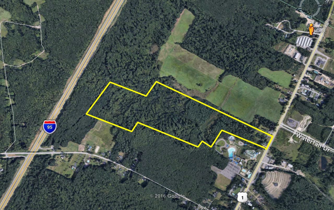
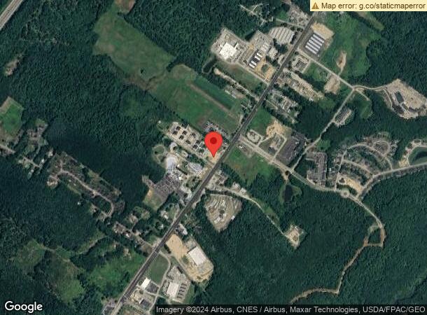
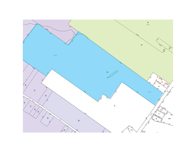
Property Record
5 Merrill Dr, Saco, ME 04072
NEARBY LISTINGS FOR SALE OR LEASE
Property Detail
5 Merrill Dr
SACO-000063-000003-000001
York
Commercialofficeresidentialmixeduse
Maine
X
3
2301550045D
65.84 AC
2024
York County
2024
Portland/South Portland
005200
Portland-South Portland, ME
522 SF
DEMOGRAPHICS near 5 Merrill Dr
1 Mile
3 Mile
5 Mile
2024 Total Population
1,463
17,233
53,817
2029 Population
1,519
18,531
57,226
Pop Growth 2024-2029
+ 3.83%
+ 7.53%
+ 6.33%
Average Age
43
46
44
2024 Total Households
675
7,934
24,111
HH Growth 2024-2029
+ 3.56%
+ 7.97%
+ 6.59%
Median Household Inc
$74,458
$75,522
$70,987
Avg Household Size
2.10
2.10
2.20
2024 Avg HH Vehicles
2.00
2.00
2.00
Median Home Value
$340,833
$357,757
$358,501
Median Year Built
1983
1986
1982
Nearby Places
- Restaurants
- Banks
- Shops
- Fitness
- Groceries
PUBLIC TRANSPORTATION
COMMUTER RAIL
Old Orchard Beach Amtrak (Downeaster - Amtrak)
DRIVE
WALK
Distance
Old Orchard Beach Amtrak (Downeaster - Amtrak)
6 min
3.6 mi
Saco Amtrak Station (Downeaster - Amtrak)
DRIVE
WALK
Distance
Saco Amtrak Station (Downeaster - Amtrak)
10 min
4.7 mi
AIRPORT
Portland International Jetport
DRIVE
WALK
Distance
Portland International Jetport
19 min
10.0 mi
Freight Ports
Portland, ME
DRIVE
WALK
Distance
Portland, ME
20 min
12.6 mi
SALE & LEASE HISTORY
LISTING DATE
SALE/LEASE

Sep 24, 2016
For Sale
Nov 05, 2019
For Sale
Nearby Properties
Address
Land Use
TOTAL SIZE
Lot Size
Zoning
Address
Land Use
TOTAL SIZE
Lot Size
Zoning
113,025 SF
7.30 AC
31
Address
Land Use
TOTAL SIZE
Lot Size
Zoning
Address
Land Use
TOTAL SIZE
Lot Size
Zoning
2,295.68 AC
B-6
Address
Land Use
TOTAL SIZE
Lot Size
Zoning
7.86 AC
B2A
Address
Land Use
TOTAL SIZE
Lot Size
Zoning
2.50 AC
R-1
Address
Land Use
TOTAL SIZE
Lot Size
Zoning
19,725 SF
45.64 AC
16
Address
Land Use
TOTAL SIZE
Lot Size
Zoning
708 SF
52.01 AC
R-4
Address
Land Use
TOTAL SIZE
Lot Size
Zoning
52,582 SF
12.58 AC
B-6
Address
Land Use
TOTAL SIZE
Lot Size
Zoning
3,033 SF
55.01 AC
RD
Address
Land Use
TOTAL SIZE
Lot Size
Zoning
35,714 SF
39.79 AC
MU3
Address
Land Use
TOTAL SIZE
Lot Size
Zoning
104.72 AC
B-6
Address
Land Use
TOTAL SIZE
Lot Size
Zoning
127,292 SF
12.55 AC
I-1
Address
Land Use
TOTAL SIZE
Lot Size
Zoning
47,532 SF
4.76 AC
MZ
Address
Land Use
TOTAL SIZE
Lot Size
Zoning
75,288 SF
6.27 AC
Address
Land Use
TOTAL SIZE
Lot Size
Zoning
7,216 SF
10.40 AC
MZ
Address
Land Use
TOTAL SIZE
Lot Size
Zoning
14.62 AC
31
Address
Land Use
TOTAL SIZE
Lot Size
Zoning
39,552 SF
56.22 AC
B-6
Address
Land Use
TOTAL SIZE
Lot Size
Zoning
5,000 SF
8.30 AC
PMUD
Address
Land Use
TOTAL SIZE
Lot Size
Zoning
45,290 SF
11.60 AC
25
Address
Land Use
TOTAL SIZE
Lot Size
Zoning
5.98 AC
MU3
Address
Land Use
TOTAL SIZE
Lot Size
Zoning
24,192 SF
1.80 AC
BRD
Address
Land Use
TOTAL SIZE
Lot Size
Zoning
1,768 SF
21.12 AC
MZ
Address
Land Use
TOTAL SIZE
Lot Size
Zoning
15,043 SF
10.91 AC
MU3
Address
Land Use
TOTAL SIZE
Lot Size
Zoning
46,250 SF
2.14 AC
RBD
Address
Land Use
TOTAL SIZE
Lot Size
Zoning
2.30 AC
ID
Address
Land Use
TOTAL SIZE
Lot Size
Zoning
54,540 SF
7 AC
I-1
Address
Land Use
TOTAL SIZE
Lot Size
Zoning
46,230 SF
12.10 AC
B-6
Address
Land Use
TOTAL SIZE
Lot Size
Zoning
43.50 AC
R-4
Address
Land Use
TOTAL SIZE
Lot Size
Zoning
29,297 SF
3.24 AC
13
Address
Land Use
TOTAL SIZE
Lot Size
Zoning
33,576 SF
35.42 AC
I-1
The World's #1 Commercial Real Estate Marketplace
Connect with us
© 2025 CoStar Group
The information above has been obtained from sources believed reliable. While we do not doubt its accuracy we have not verified it and make no guarantee, warranty or representation about it. It is your responsibility to independently confirm its accuracy and completeness. Any projections, opinions, assumptions, or estimates used are for example only and do not represent the current or future performance of the property. The value of this transaction to you depends on tax and other factors which should be evaluated by your tax, financial, and legal advisors. You and your advisors should conduct a careful, independent investigation of the property to determine to your satisfaction the suitability of the property for your needs.