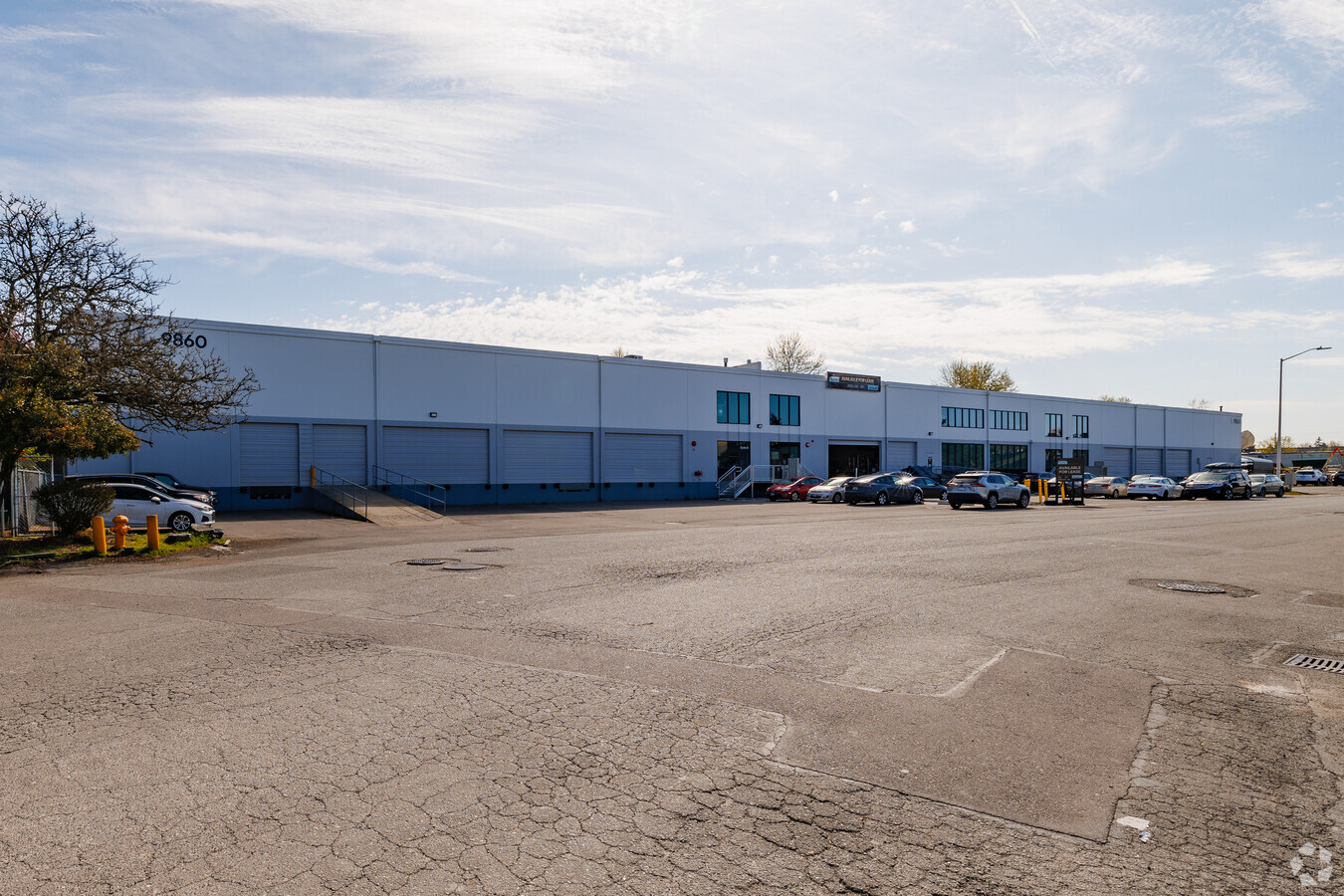
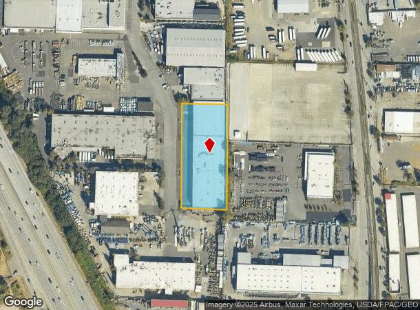
Property Record
9860 40Th Ave S, Seattle, WA 98118
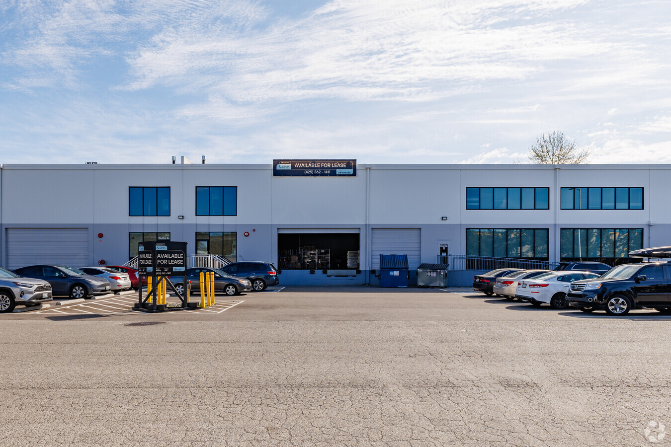
Current Lease Availabilities
NEARBY LISTINGS FOR SALE OR LEASE
Property Detail
9860 40Th Ave S
Seattle-Tacoma-Bellevue, WA
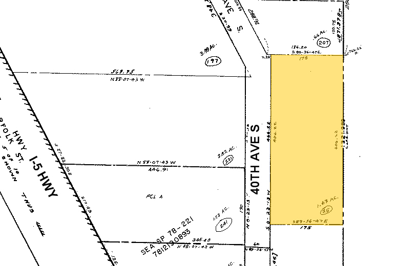
E Alg E Ln Of Subd
032304-9025
POR SE 1/4 OF NW 1/4 DAF BEG AT SE COR OF SD SE 1/4 TH N 0-23-13 E ALG E LN OF SUBD 360 FT TO TPOB TH CONTG N 0-23-13 E 406.22 FT TH N 89-36-47 W 175 FT TH S 0-23-13 W 406.22 FT TH S 89-36-47 E 175 FT TO TPOB
Warehouse
King
X
Washington
53033C0645G
32304
2025
1.63 AC
2024
Rainier/Beacon Hill
011700
Seattle/Puget Sound
48,100 SF
DEMOGRAPHICS near 9860 40Th Ave S
1 Mile
3 Mile
5 Mile
2024 Total Population
9,340
118,835
303,586
2029 Population
9,384
119,639
305,440
Pop Growth 2024-2029
+ 0.47%
+ 0.68%
+ 0.61%
Average Age
39
39
40
2024 Total Households
3,088
41,658
114,575
HH Growth 2024-2029
+ 0.26%
+ 0.55%
+ 0.45%
Median Household Inc
$84,205
$83,191
$92,652
Avg Household Size
2.80
2.70
2.50
2024 Avg HH Vehicles
2.00
2.00
2.00
Median Home Value
$655,956
$658,915
$712,746
Median Year Built
1964
1964
1969
Nearby Places
- Restaurants
- Banks
- Shops
- Fitness
- Groceries
PUBLIC TRANSPORTATION
TRANSIT/SUBWAY
Rainier Beach (Central Link - Central Puget Sound Regional Transit Authority Rail (Link Light Rail/Sounder), LINK to Sea-Tac - Central Puget Sound Regional Transit Authority Rail (Link Light Rail/Sounder))
DRIVE
WALK
Distance
Rainier Beach (Central Link - Central Puget Sound Regional Transit Authority Rail (Link Light Rail/Sounder), LINK to Sea-Tac - Central Puget Sound Regional Transit Authority Rail (Link Light Rail/Sounder))
3 min
17 min
0.9 mi
St Light Rail & Rainier Beach Station (Nb) (LINK to Sea-Tac - Central Puget Sound Regional Transit Authority Rail (Link Light Rail/Sounder))
DRIVE
WALK
Distance
St Light Rail & Rainier Beach Station (Nb) (LINK to Sea-Tac - Central Puget Sound Regional Transit Authority Rail (Link Light Rail/Sounder))
3 min
18 min
1.0 mi
COMMUTER RAIL
Tukwila Station (Sounder South Line - Central Puget Sound Regional Transit Authority Rail (Link Light Rail/Sounder))
DRIVE
WALK
Distance
Tukwila Station (Sounder South Line - Central Puget Sound Regional Transit Authority Rail (Link Light Rail/Sounder))
10 min
5.7 mi
King Street (Seattle) Station (Sounder South Line - Central Puget Sound Regional Transit Authority Rail (Link Light Rail/Sounder))
DRIVE
WALK
Distance
King Street (Seattle) Station (Sounder South Line - Central Puget Sound Regional Transit Authority Rail (Link Light Rail/Sounder))
13 min
8.2 mi
AIRPORT
Seattle-Tacoma International
DRIVE
WALK
Distance
Seattle-Tacoma International
14 min
7.2 mi
Seattle Paine Field International
DRIVE
WALK
Distance
Seattle Paine Field International
45 min
32.0 mi
Freight Ports
Port of Seattle
DRIVE
WALK
Distance
Port of Seattle
15 min
7.9 mi
Nearby Properties
Address
Land Use
TOTAL SIZE
Lot Size
Zoning
Address
Land Use
TOTAL SIZE
Lot Size
Zoning
30,290 SF
564.80 AC
MML U/85
Address
Land Use
TOTAL SIZE
Lot Size
Zoning
2,800 SF
210.85 AC
NR1
Address
Land Use
TOTAL SIZE
Lot Size
Zoning
1,134 SF
53.16 AC
MIC/H
Address
Land Use
TOTAL SIZE
Lot Size
Zoning
141,643 SF
11.44 AC
MIC/H
Address
Land Use
TOTAL SIZE
Lot Size
Zoning
704,186 SF
21.86 AC
I
Address
Land Use
TOTAL SIZE
Lot Size
Zoning
525,975 SF
37.44 AC
MML U/85
Address
Land Use
TOTAL SIZE
Lot Size
Zoning
230,950 SF
6.56 AC
CBP
Address
Land Use
TOTAL SIZE
Lot Size
Zoning
18,888 SF
85.89 AC
NR2
Address
Land Use
TOTAL SIZE
Lot Size
Zoning
34.25 AC
MIC/H
Address
Land Use
TOTAL SIZE
Lot Size
Zoning
169,110 SF
29.99 AC
MIC/H
Address
Land Use
TOTAL SIZE
Lot Size
Zoning
241,186 SF
25.51 AC
MIC/H
Address
Land Use
TOTAL SIZE
Lot Size
Zoning
555,036 SF
9.13 AC
MIC/L
Address
Land Use
TOTAL SIZE
Lot Size
Zoning
31,737 SF
9.55 AC
RSL (M)
Address
Land Use
TOTAL SIZE
Lot Size
Zoning
284,067 SF
14.36 AC
LI
Address
Land Use
TOTAL SIZE
Lot Size
Zoning
178,944 SF
7.79 AC
R24
Address
Land Use
TOTAL SIZE
Lot Size
Zoning
229,440 SF
14.87 AC
RM-F
Address
Land Use
TOTAL SIZE
Lot Size
Zoning
342,115 SF
14.12 AC
MIC/H
Address
Land Use
TOTAL SIZE
Lot Size
Zoning
17,694 SF
13.87 AC
LR2 (M)
Address
Land Use
TOTAL SIZE
Lot Size
Zoning
114,061 SF
19.92 AC
MML U/65
Address
Land Use
TOTAL SIZE
Lot Size
Zoning
180,775 SF
12.60 AC
MIC/H
Address
Land Use
TOTAL SIZE
Lot Size
Zoning
103,931 SF
28.65 AC
MIC/H
Address
Land Use
TOTAL SIZE
Lot Size
Zoning
460,477 SF
8.02 AC
MML U/85
Address
Land Use
TOTAL SIZE
Lot Size
Zoning
50,549 SF
24.17 AC
MIC/H
Address
Land Use
TOTAL SIZE
Lot Size
Zoning
31,360 SF
10.23 AC
MML U/85
Address
Land Use
TOTAL SIZE
Lot Size
Zoning
140,000 SF
19.42 AC
UL-7200
Address
Land Use
TOTAL SIZE
Lot Size
Zoning
144,640 SF
11.89 AC
NR2
Address
Land Use
TOTAL SIZE
Lot Size
Zoning
29,400 SF
8.48 AC
I
Address
Land Use
TOTAL SIZE
Lot Size
Zoning
21 AC
MML U/85
Address
Land Use
TOTAL SIZE
Lot Size
Zoning
314,268 SF
19.34 AC
MIC/H
Address
Land Use
TOTAL SIZE
Lot Size
Zoning
63,180 SF
27.36 AC
P
The World's #1 Commercial Real Estate Marketplace
Connect with us
© 2025 CoStar Group
The information above has been obtained from sources believed reliable. While we do not doubt its accuracy we have not verified it and make no guarantee, warranty or representation about it. It is your responsibility to independently confirm its accuracy and completeness. Any projections, opinions, assumptions, or estimates used are for example only and do not represent the current or future performance of the property. The value of this transaction to you depends on tax and other factors which should be evaluated by your tax, financial, and legal advisors. You and your advisors should conduct a careful, independent investigation of the property to determine to your satisfaction the suitability of the property for your needs.