Property Record
99 Ascension Dr, Asheville, NC 28806

NEARBY LISTINGS FOR SALE OR LEASE
Property Detail
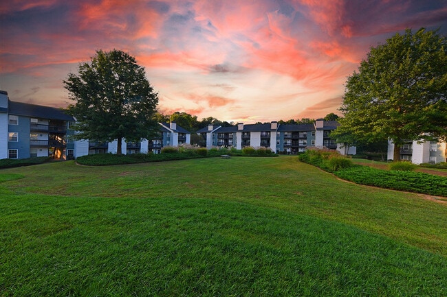
99 Ascension Dr
9629-71-1901-00000
The Meadows
Apartment
SUBDIV: THE MEADOWS BLOCK: LOT: SECTION: PLAT: 0074-0162
X
Buncombe
3700962900J
North Carolina
2024
13.39 AC
2025
West Asheville
001401
Asheville
52,591 SF
Asheville, NC
DEMOGRAPHICS near 99 Ascension Dr
1 Mile
3 Mile
5 Mile
2024 Total Population
5,689
47,410
94,835
2029 Population
5,804
49,164
98,413
Pop Growth 2024-2029
+ 2.02%
+ 3.70%
+ 3.77%
Average Age
37
39
41
2024 Total Households
2,422
20,065
41,291
HH Growth 2024-2029
+ 1.32%
+ 3.18%
+ 3.32%
Median Household Inc
$49,730
$57,141
$62,610
Avg Household Size
2.30
2.20
2.10
2024 Avg HH Vehicles
2.00
2.00
2.00
Median Home Value
$225,982
$319,960
$357,092
Median Year Built
1985
1978
1978
Nearby Places
Map Layers
Map Styles
 Street
 Aerial
- Restaurants
- Banks
- Shops
- Fitness
- Groceries
PUBLIC TRANSPORTATION
AIRPORT
Asheville Regional
DRIVE
WALK
Distance
Asheville Regional
22 min
14.4 mi
Freight Ports
North Charleston Terminal
DRIVE
WALK
Distance
North Charleston Terminal
294 min
258.1 mi
Nearby Properties
Address
Land Use
TOTAL SIZE
Lot Size
Zoning
Address
Land Use
TOTAL SIZE
Lot Size
Zoning
291,240 SF
86.10 AC
INST EXP
Address
Land Use
TOTAL SIZE
Lot Size
Zoning
251,071 SF
280.42 AC
INST
Address
Land Use
TOTAL SIZE
Lot Size
Zoning
109,294 SF
16.28 AC
RAD-IND
Address
Land Use
TOTAL SIZE
Lot Size
Zoning
285,416 SF
98.33 AC
PS
Address
Land Use
TOTAL SIZE
Lot Size
Zoning
311,958 SF
33.93 AC
OU
Address
Land Use
TOTAL SIZE
Lot Size
Zoning
78,563 SF
2.88 AC
UP
Address
Land Use
TOTAL SIZE
Lot Size
Zoning
100,612 SF
16.84 AC
NS
Address
Land Use
TOTAL SIZE
Lot Size
Zoning
88,817 SF
19.63 AC
R-2
Address
Land Use
TOTAL SIZE
Lot Size
Zoning
81,621 SF
19.62 AC
PS
Address
Land Use
TOTAL SIZE
Lot Size
Zoning
52,336 SF
2.05 AC
CBD
Address
Land Use
TOTAL SIZE
Lot Size
Zoning
106,436 SF
22.02 AC
PS
Address
Land Use
TOTAL SIZE
Lot Size
Zoning
97,263 SF
17.50 AC
INST
Address
Land Use
TOTAL SIZE
Lot Size
Zoning
76,459 SF
7.01 AC
RM8
Address
Land Use
TOTAL SIZE
Lot Size
Zoning
64,089 SF
0.72 AC
CBD
Address
Land Use
TOTAL SIZE
Lot Size
Zoning
131,755 SF
1.37 AC
CBD
Address
Land Use
TOTAL SIZE
Lot Size
Zoning
72,413 SF
18.25 AC
RM16
Address
Land Use
TOTAL SIZE
Lot Size
Zoning
70,237 SF
2.93 AC
CBD EXP
Address
Land Use
TOTAL SIZE
Lot Size
Zoning
44,566 SF
7.39 AC
RM8
Address
Land Use
TOTAL SIZE
Lot Size
Zoning
136,000 SF
25.97 AC
INST
Address
Land Use
TOTAL SIZE
Lot Size
Zoning
25,184 SF
1.54 AC
CBD
Address
Land Use
TOTAL SIZE
Lot Size
Zoning
56,042 SF
16.60 AC
INST
Address
Land Use
TOTAL SIZE
Lot Size
Zoning
107,268 SF
9.48 AC
RESORT
Address
Land Use
TOTAL SIZE
Lot Size
Zoning
316,821 SF
23.88 AC
CI
Address
Land Use
TOTAL SIZE
Lot Size
Zoning
43,824 SF
13.71 AC
R-3
Address
Land Use
TOTAL SIZE
Lot Size
Zoning
30,664 SF
3.26 AC
HR-3:CRDR
Address
Land Use
TOTAL SIZE
Lot Size
Zoning
145,519 SF
10.75 AC
R-2
Address
Land Use
TOTAL SIZE
Lot Size
Zoning
168,519 SF
53.11 AC
INST
Address
Land Use
TOTAL SIZE
Lot Size
Zoning
45,670 SF
11.20 AC
RM8
Address
Land Use
TOTAL SIZE
Lot Size
Zoning
145,468 SF
24.91 AC
COM EXP
The World's #1 Commercial Real Estate Marketplace
Connect with us
© 2026 CoStar Group
The information above has been obtained from sources believed reliable. While we do not doubt its accuracy we have not verified it and make no guarantee, warranty or representation about it. It is your responsibility to independently confirm its accuracy and completeness. Any projections, opinions, assumptions, or estimates used are for example only and do not represent the current or future performance of the property. The value of this transaction to you depends on tax and other factors which should be evaluated by your tax, financial, and legal advisors. You and your advisors should conduct a careful, independent investigation of the property to determine to your satisfaction the suitability of the property for your needs.