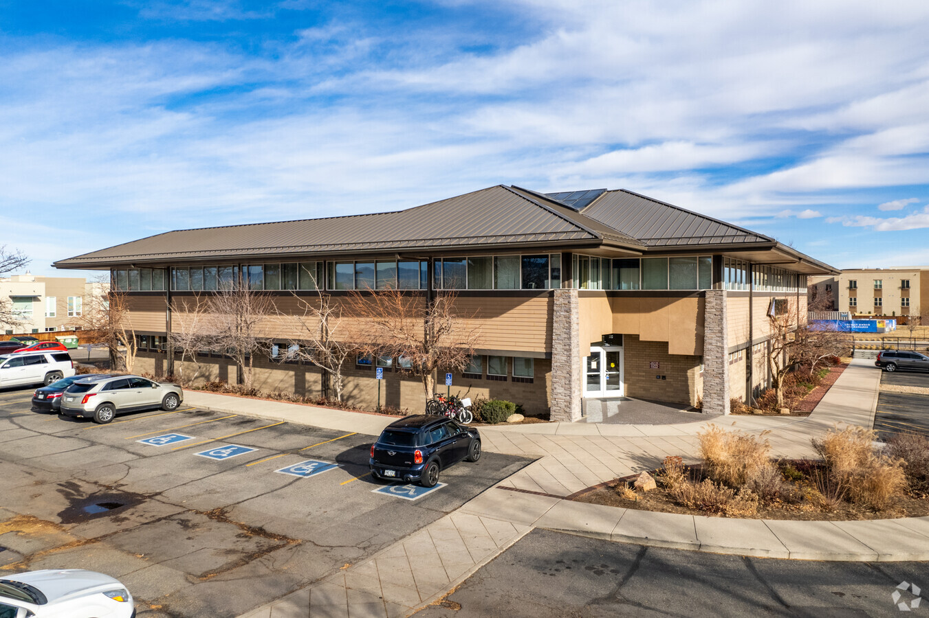
Property Record
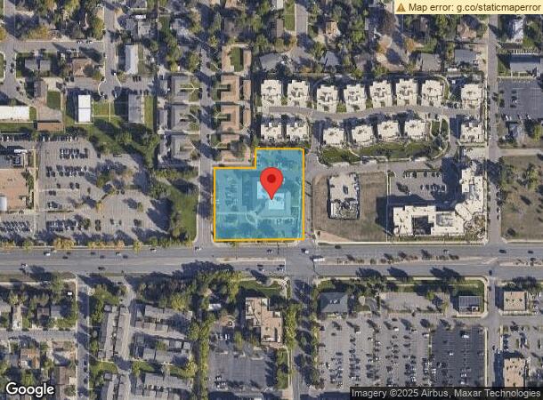
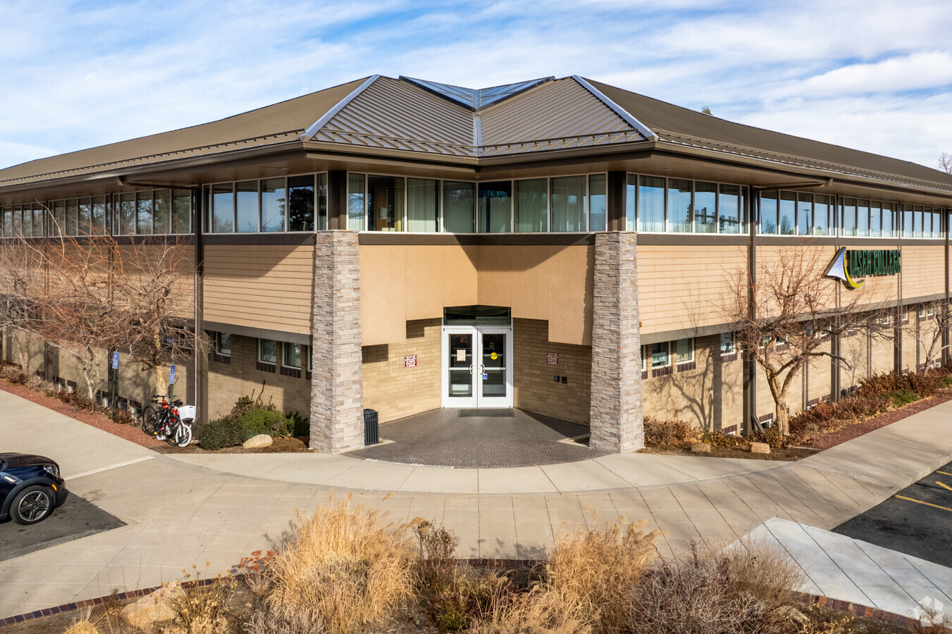
8015 W Alameda Ave, Lakewood, CO 80226

Current Lease Availabilities
NEARBY LISTINGS FOR SALE OR LEASE
Property Detail
8015 W Alameda Ave
Denver-Aurora-Lakewood, CO
West Alameda Heights
49-113-14-047
SECTION 11 TOWNSHIP 04 RANGE 69 QTR SW SUBDIVISIONCD 807600 SUBDIVISIONNAME WEST ALAMEDA HEIGHTS BLOCK 013 LOT 0011 SIZE: 30361 TRACT 00A VALUE: .697 SECTION 11 TOWNSHIP 04 RANGE 69 QTR SW SUBDIVISIONCD 807600 SUBDIVISIONNAME WEST ALAMEDA HEIGHTS BLO
Commercialnec
Jefferson
X
Colorado
08059C0304G
11-13
2023
1.90 AC
2024
West Denver
011202
Denver
33,130 SF
DEMOGRAPHICS near 8015 W Alameda Ave
1 Mile
3 Mile
5 Mile
2024 Total Population
16,855
146,615
355,895
2029 Population
16,742
145,859
355,087
Pop Growth 2024-2029
(0.67%)
(0.52%)
(0.23%)
Average Age
39
39
39
2024 Total Households
7,239
59,344
147,497
HH Growth 2024-2029
(0.70%)
(0.59%)
(0.25%)
Median Household Inc
$75,771
$68,111
$75,653
Avg Household Size
2.10
2.30
2.30
2024 Avg HH Vehicles
2.00
2.00
2.00
Median Home Value
$497,936
$453,038
$492,906
Median Year Built
1976
1969
1970
Nearby Places
- Restaurants
- Banks
- Shops
- Fitness
- Groceries
PUBLIC TRANSPORTATION
COMMUTER RAIL
Union Station: Lodo-Coors Field-16Th Street Mall (C Line - Denver Regional Transportation District Light Rail (TheRide), E Line - Denver Regional Transportation District Light Rail (TheRide), W Line - Denver Regional Transportation District Light Rail (TheRide))
DRIVE
WALK
Distance
Union Station: Lodo-Coors Field-16Th Street Mall (C Line - Denver Regional Transportation District Light Rail (TheRide), E Line - Denver Regional Transportation District Light Rail (TheRide), W Line - Denver Regional Transportation District Light Rail (TheRide))
13 min
7.3 mi
Denver (California Zephyr - Amtrak)
DRIVE
WALK
Distance
Denver (California Zephyr - Amtrak)
13 min
7.5 mi
AIRPORT
Denver International
DRIVE
WALK
Distance
Denver International
42 min
31.6 mi
Freight Ports
Tulsa Port Of Catoosa
DRIVE
WALK
Distance
Tulsa Port Of Catoosa
740 min
717.1 mi
Nearby Properties
Address
Land Use
TOTAL SIZE
Lot Size
Zoning
Address
Land Use
TOTAL SIZE
Lot Size
Zoning
943,179 SF
23.96 AC
Address
Land Use
TOTAL SIZE
Lot Size
Zoning
3,195,026 SF
562.97 AC
Address
Land Use
TOTAL SIZE
Lot Size
Zoning
198,081 SF
Address
Land Use
TOTAL SIZE
Lot Size
Zoning
232,678 SF
27.50 AC
Address
Land Use
TOTAL SIZE
Lot Size
Zoning
233,688 SF
22.37 AC
Address
Land Use
TOTAL SIZE
Lot Size
Zoning
199,685 SF
27.73 AC
Address
Land Use
TOTAL SIZE
Lot Size
Zoning
239,510 SF
6.63 AC
Address
Land Use
TOTAL SIZE
Lot Size
Zoning
238,452 SF
8.02 AC
Address
Land Use
TOTAL SIZE
Lot Size
Zoning
738 SF
3.68 AC
Address
Land Use
TOTAL SIZE
Lot Size
Zoning
298,767 SF
4.43 AC
Address
Land Use
TOTAL SIZE
Lot Size
Zoning
397,700 SF
14.45 AC
Address
Land Use
TOTAL SIZE
Lot Size
Zoning
135,372 SF
11.66 AC
Address
Land Use
TOTAL SIZE
Lot Size
Zoning
284,413 SF
3.82 AC
Address
Land Use
TOTAL SIZE
Lot Size
Zoning
167,420 SF
5.84 AC
Address
Land Use
TOTAL SIZE
Lot Size
Zoning
214,839 SF
8.17 AC
Address
Land Use
TOTAL SIZE
Lot Size
Zoning
100,615 SF
2.28 AC
Address
Land Use
TOTAL SIZE
Lot Size
Zoning
82,756 SF
14.95 AC
Address
Land Use
TOTAL SIZE
Lot Size
Zoning
147,609 SF
9.22 AC
Address
Land Use
TOTAL SIZE
Lot Size
Zoning
143,603 SF
4.71 AC
Address
Land Use
TOTAL SIZE
Lot Size
Zoning
319,365 SF
11.60 AC
Address
Land Use
TOTAL SIZE
Lot Size
Zoning
311,200 SF
0.85 AC
Address
Land Use
TOTAL SIZE
Lot Size
Zoning
138,204 SF
3.68 AC
Address
Land Use
TOTAL SIZE
Lot Size
Zoning
146,133 SF
3.75 AC
Address
Land Use
TOTAL SIZE
Lot Size
Zoning
230,285 SF
3.21 AC
Address
Land Use
TOTAL SIZE
Lot Size
Zoning
330,357 SF
15.16 AC
Address
Land Use
TOTAL SIZE
Lot Size
Zoning
241,243 SF
9.08 AC
Address
Land Use
TOTAL SIZE
Lot Size
Zoning
41,263 SF
7.94 AC
Address
Land Use
TOTAL SIZE
Lot Size
Zoning
221,088 SF
9.48 AC
Address
Land Use
TOTAL SIZE
Lot Size
Zoning
7,826 SF
0.48 AC
Address
Land Use
TOTAL SIZE
Lot Size
Zoning
159,279 SF
5.55 AC
The World's #1 Commercial Real Estate Marketplace
Connect with us
© 2025 CoStar Group
The information above has been obtained from sources believed reliable. While we do not doubt its accuracy we have not verified it and make no guarantee, warranty or representation about it. It is your responsibility to independently confirm its accuracy and completeness. Any projections, opinions, assumptions, or estimates used are for example only and do not represent the current or future performance of the property. The value of this transaction to you depends on tax and other factors which should be evaluated by your tax, financial, and legal advisors. You and your advisors should conduct a careful, independent investigation of the property to determine to your satisfaction the suitability of the property for your needs.