Property Record
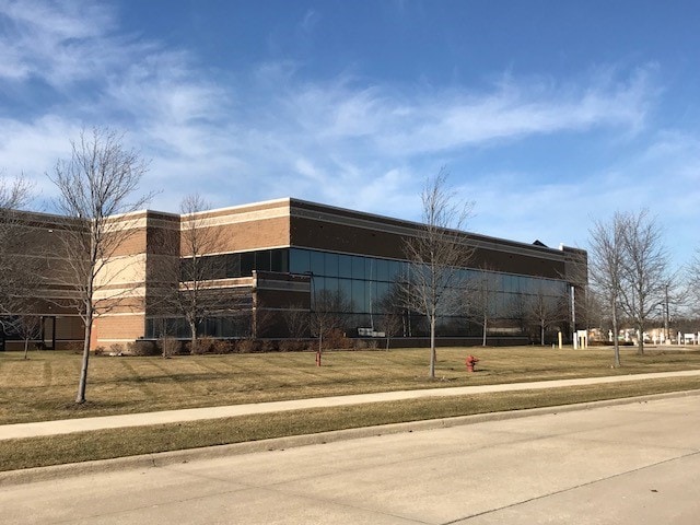
47050 5 Mile Rd, Northville, MI 48168


NEARBY LISTINGS FOR SALE OR LEASE
Property Detail
47050 5 Mile Rd
Detroit-Warren-Dearborn, MI
Wayne County Cond
77-063-99-0002-727
PT OF SW 1/4 SEC 16, T1S, R8E, DESC AS BEG N 8447'36" E 60.12 FT AND N 0139'44" W 60.12 FT AND N 8447'36" E 517.36 FT FROM SW COR SEC 16 TO POB. TH N 8447'36" E 434.37 FT; TH N 0512'24" W 71.80 FT; TH 90.22 FT ALONG A CURVE TO THE RT RAD 190.00 FT CH
Industrialgeneral
Wayne
X
Michigan
26163C0020E
0002
2025
13.99 AC
2025
Livonia
561302
Detroit
111,223 SF
DEMOGRAPHICS near 47050 5 Mile Rd
1 Mile
3 Mile
5 Mile
2024 Total Population
1,876
45,225
123,995
2029 Population
1,784
43,363
119,590
Pop Growth 2024-2029
(4.90%)
(4.12%)
(3.55%)
Average Age
43
43
43
2024 Total Households
643
18,085
49,193
HH Growth 2024-2029
(4.82%)
(4.03%)
(3.53%)
Median Household Inc
$233,247
$130,431
$118,038
Avg Household Size
2.90
2.50
2.50
2024 Avg HH Vehicles
2.00
2.00
2.00
Median Home Value
$570,809
$458,339
$377,107
Median Year Built
2004
1983
1979
Nearby Places
Map Layers
Map Styles
 Street
 Aerial
- Restaurants
- Banks
- Shops
- Fitness
- Groceries
PUBLIC TRANSPORTATION
AIRPORT
Detroit Metro Wayne County
DRIVE
WALK
Distance
Detroit Metro Wayne County
30 min
23.4 mi
Windsor International
DRIVE
WALK
Distance
Windsor International
55 min
37.9 mi
Freight Ports
Port of Toledo
DRIVE
WALK
Distance
Port of Toledo
79 min
65.1 mi
Nearby Properties
Address
Land Use
TOTAL SIZE
Lot Size
Zoning
Address
Land Use
TOTAL SIZE
Lot Size
Zoning
334,346 SF
55.65 AC
TAR
Address
Land Use
TOTAL SIZE
Lot Size
Zoning
306,061 SF
26.36 AC
TAR
Address
Land Use
TOTAL SIZE
Lot Size
Zoning
117.35 AC
Address
Land Use
TOTAL SIZE
Lot Size
Zoning
225,164 SF
25.66 AC
IND
Address
Land Use
TOTAL SIZE
Lot Size
Zoning
9,706 SF
40.41 AC
RM-1
Address
Land Use
TOTAL SIZE
Lot Size
Zoning
99,826 SF
ORT
Address
Land Use
TOTAL SIZE
Lot Size
Zoning
123,225 SF
9 AC
CJ/ARC
Address
Land Use
TOTAL SIZE
Lot Size
Zoning
110,220 SF
0.78 AC
CBD
Address
Land Use
TOTAL SIZE
Lot Size
Zoning
46.60 AC
R-3
Address
Land Use
TOTAL SIZE
Lot Size
Zoning
78,164 SF
5.51 AC
PUD
Address
Land Use
TOTAL SIZE
Lot Size
Zoning
510.78 AC
R-2
Address
Land Use
TOTAL SIZE
Lot Size
Zoning
103,075 SF
8.15 AC
PUD
Address
Land Use
TOTAL SIZE
Lot Size
Zoning
19.68 AC
RM-1
Address
Land Use
TOTAL SIZE
Lot Size
Zoning
135,586 SF
8.08 AC
IND
Address
Land Use
TOTAL SIZE
Lot Size
Zoning
191,759 SF
26.11 AC
ORT
Address
Land Use
TOTAL SIZE
Lot Size
Zoning
285,680 SF
IND
Address
Land Use
TOTAL SIZE
Lot Size
Zoning
5,000 SF
37.40 AC
RM-1
Address
Land Use
TOTAL SIZE
Lot Size
Zoning
122,116 SF
4.99 AC
PUD
Address
Land Use
TOTAL SIZE
Lot Size
Zoning
101,121 SF
17.52 AC
C-2
Address
Land Use
TOTAL SIZE
Lot Size
Zoning
233,568 SF
11.96 AC
IND
Address
Land Use
TOTAL SIZE
Lot Size
Zoning
307,495 SF
15.76 AC
IND
Address
Land Use
TOTAL SIZE
Lot Size
Zoning
37,528 SF
0.55 AC
B-2
Address
Land Use
TOTAL SIZE
Lot Size
Zoning
121,446 SF
11.17 AC
ORT
Address
Land Use
TOTAL SIZE
Lot Size
Zoning
949,993 SF
98.83 AC
IND
Address
Land Use
TOTAL SIZE
Lot Size
Zoning
245 SF
78.71 AC
RM
Address
Land Use
TOTAL SIZE
Lot Size
Zoning
37.43 AC
7MIPUD
Address
Land Use
TOTAL SIZE
Lot Size
Zoning
37.43 AC
7MIPUD
Address
Land Use
TOTAL SIZE
Lot Size
Zoning
87,513 SF
3.14 AC
MR
Address
Land Use
TOTAL SIZE
Lot Size
Zoning
14.75 AC
R-2-A
Address
Land Use
TOTAL SIZE
Lot Size
Zoning
68,687 SF
15 AC
TAR
The World's #1 Commercial Real Estate Marketplace
Connect with us
© 2025 CoStar Group
The information above has been obtained from sources believed reliable. While we do not doubt its accuracy we have not verified it and make no guarantee, warranty or representation about it. It is your responsibility to independently confirm its accuracy and completeness. Any projections, opinions, assumptions, or estimates used are for example only and do not represent the current or future performance of the property. The value of this transaction to you depends on tax and other factors which should be evaluated by your tax, financial, and legal advisors. You and your advisors should conduct a careful, independent investigation of the property to determine to your satisfaction the suitability of the property for your needs.