Property Record
Brown Rd, Covington, GA 30016

NEARBY LISTINGS FOR SALE OR LEASE
Property Detail
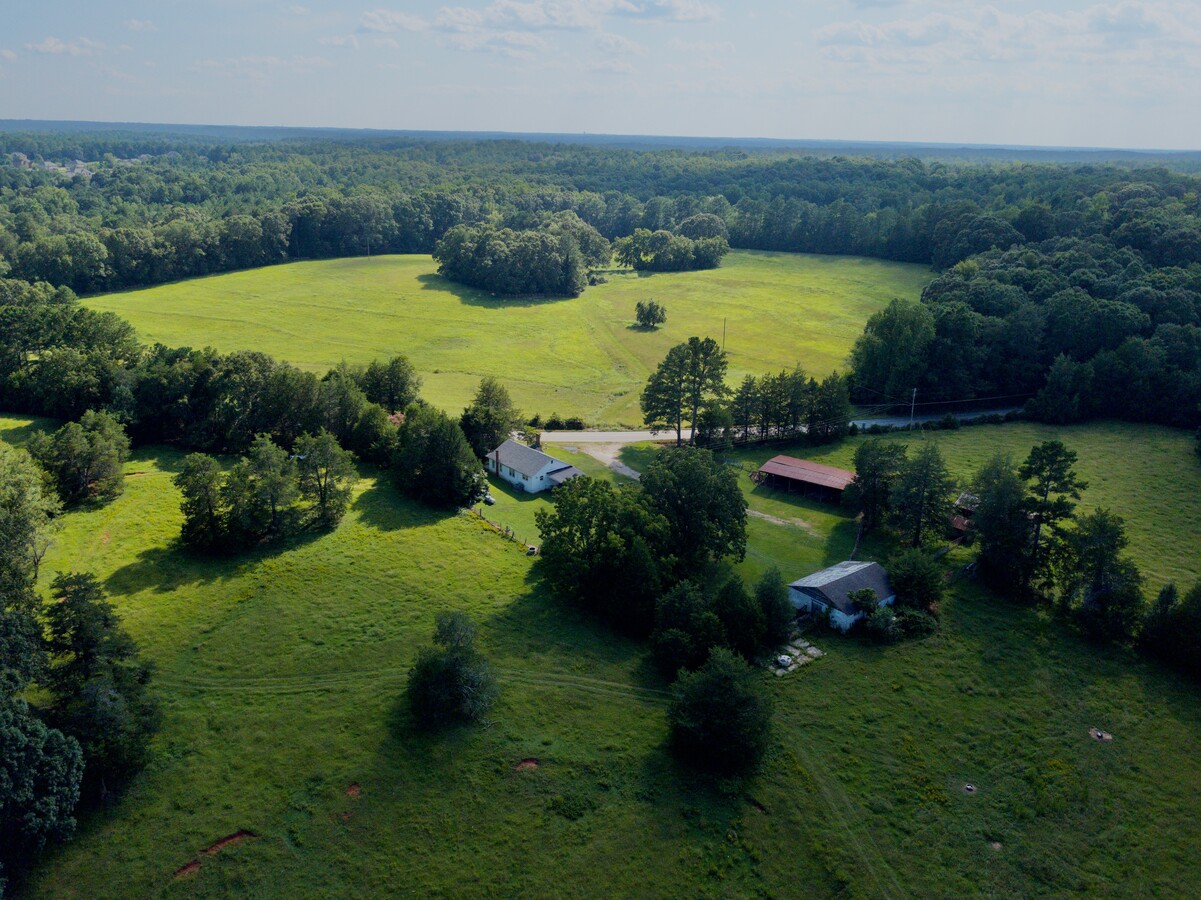
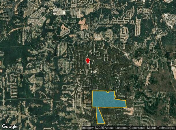
Brown Rd
Atlanta-Sandy Springs-Roswell, GA
R5 Misc Land - Area 10
0029000000068000
394.98AC OFF BROWN ROAD
Privatepreserveopenspacevacantlandforestlandconservation
Newton
A
Georgia
13217C0120D
394.98 AC
2024
Newton County
2024
Atlanta
100902
DEMOGRAPHICS near Brown Rd
1 Mile
3 Mile
5 Mile
2024 Total Population
1,767
16,733
48,861
2029 Population
2,000
18,618
54,102
Pop Growth 2024-2029
+ 13.19%
+ 11.27%
+ 10.73%
Average Age
39
37
37
2024 Total Households
603
5,638
16,457
HH Growth 2024-2029
+ 13.60%
+ 11.56%
+ 11.00%
Median Household Inc
$73,916
$74,284
$74,436
Avg Household Size
2.90
2.90
2.90
2024 Avg HH Vehicles
2.00
2.00
2.00
Median Home Value
$192,357
$168,903
$172,134
Median Year Built
2004
1999
2000
Nearby Places
- Restaurants
- Banks
- Shops
- Fitness
- Groceries
PUBLIC TRANSPORTATION
AIRPORT
Hartsfield - Jackson Atlanta International
DRIVE
WALK
Distance
Hartsfield - Jackson Atlanta International
57 min
39.8 mi
Freight Ports
Georgia Ports - Savannah
DRIVE
WALK
Distance
Georgia Ports - Savannah
271 min
237.8 mi
SALE & LEASE HISTORY
LISTING DATE
SALE/LEASE

Sep 18, 2020
For Sale
Nov 03, 2018
For Sale
Nearby Properties
Address
Land Use
TOTAL SIZE
Lot Size
Zoning
Address
Land Use
TOTAL SIZE
Lot Size
Zoning
1,158,095 SF
161.26 AC
Address
Land Use
TOTAL SIZE
Lot Size
Zoning
1,158,095 SF
0.01 AC
Address
Land Use
TOTAL SIZE
Lot Size
Zoning
5,160 SF
45.17 AC
C1
Address
Land Use
TOTAL SIZE
Lot Size
Zoning
82,716 SF
21.04 AC
R2
Address
Land Use
TOTAL SIZE
Lot Size
Zoning
65,360 SF
75.51 AC
E6
Address
Land Use
TOTAL SIZE
Lot Size
Zoning
151,955 SF
26.19 AC
R1
Address
Land Use
TOTAL SIZE
Lot Size
Zoning
64,799 SF
19.10 AC
E6
Address
Land Use
TOTAL SIZE
Lot Size
Zoning
66,660 SF
12.80 AC
C1
Address
Land Use
TOTAL SIZE
Lot Size
Zoning
58,892 SF
17.52 AC
E6
Address
Land Use
TOTAL SIZE
Lot Size
Zoning
1,392 SF
589.50 AC
A1
Address
Land Use
TOTAL SIZE
Lot Size
Zoning
30,000 SF
11.06 AC
E2
Address
Land Use
TOTAL SIZE
Lot Size
Zoning
1,790 SF
79.74 AC
E2
Address
Land Use
TOTAL SIZE
Lot Size
Zoning
14,328 SF
1.20 AC
C1
Address
Land Use
TOTAL SIZE
Lot Size
Zoning
331.12 AC
AR
Address
Land Use
TOTAL SIZE
Lot Size
Zoning
26.13 AC
R2
Address
Land Use
TOTAL SIZE
Lot Size
Zoning
4,576 SF
1.58 AC
Address
Land Use
TOTAL SIZE
Lot Size
Zoning
11,862 SF
1.76 AC
C1
Address
Land Use
TOTAL SIZE
Lot Size
Zoning
292.79 AC
AR
Address
Land Use
TOTAL SIZE
Lot Size
Zoning
467.65 AC
A
Address
Land Use
TOTAL SIZE
Lot Size
Zoning
2,858 SF
11 AC
R1
Address
Land Use
TOTAL SIZE
Lot Size
Zoning
406.15 AC
A
Address
Land Use
TOTAL SIZE
Lot Size
Zoning
264.49 AC
AR
Address
Land Use
TOTAL SIZE
Lot Size
Zoning
7,610 SF
2.28 AC
CG
Address
Land Use
TOTAL SIZE
Lot Size
Zoning
30,456 SF
6.99 AC
R2
Address
Land Use
TOTAL SIZE
Lot Size
Zoning
672 SF
5.13 AC
E1
Address
Land Use
TOTAL SIZE
Lot Size
Zoning
8,000 SF
2.38 AC
C1
Address
Land Use
TOTAL SIZE
Lot Size
Zoning
2,065 SF
15 AC
E2
Address
Land Use
TOTAL SIZE
Lot Size
Zoning
9,000 SF
1.70 AC
R1
Address
Land Use
TOTAL SIZE
Lot Size
Zoning
315.08 AC
A
The World's #1 Commercial Real Estate Marketplace
Connect with us
© 2025 CoStar Group
The information above has been obtained from sources believed reliable. While we do not doubt its accuracy we have not verified it and make no guarantee, warranty or representation about it. It is your responsibility to independently confirm its accuracy and completeness. Any projections, opinions, assumptions, or estimates used are for example only and do not represent the current or future performance of the property. The value of this transaction to you depends on tax and other factors which should be evaluated by your tax, financial, and legal advisors. You and your advisors should conduct a careful, independent investigation of the property to determine to your satisfaction the suitability of the property for your needs.