Property Record
Calera Xing, Calera, AL 35040
NEARBY LISTINGS FOR SALE OR LEASE
-
-
View all Calera listings for lease on LoopNet.com
Property Detail
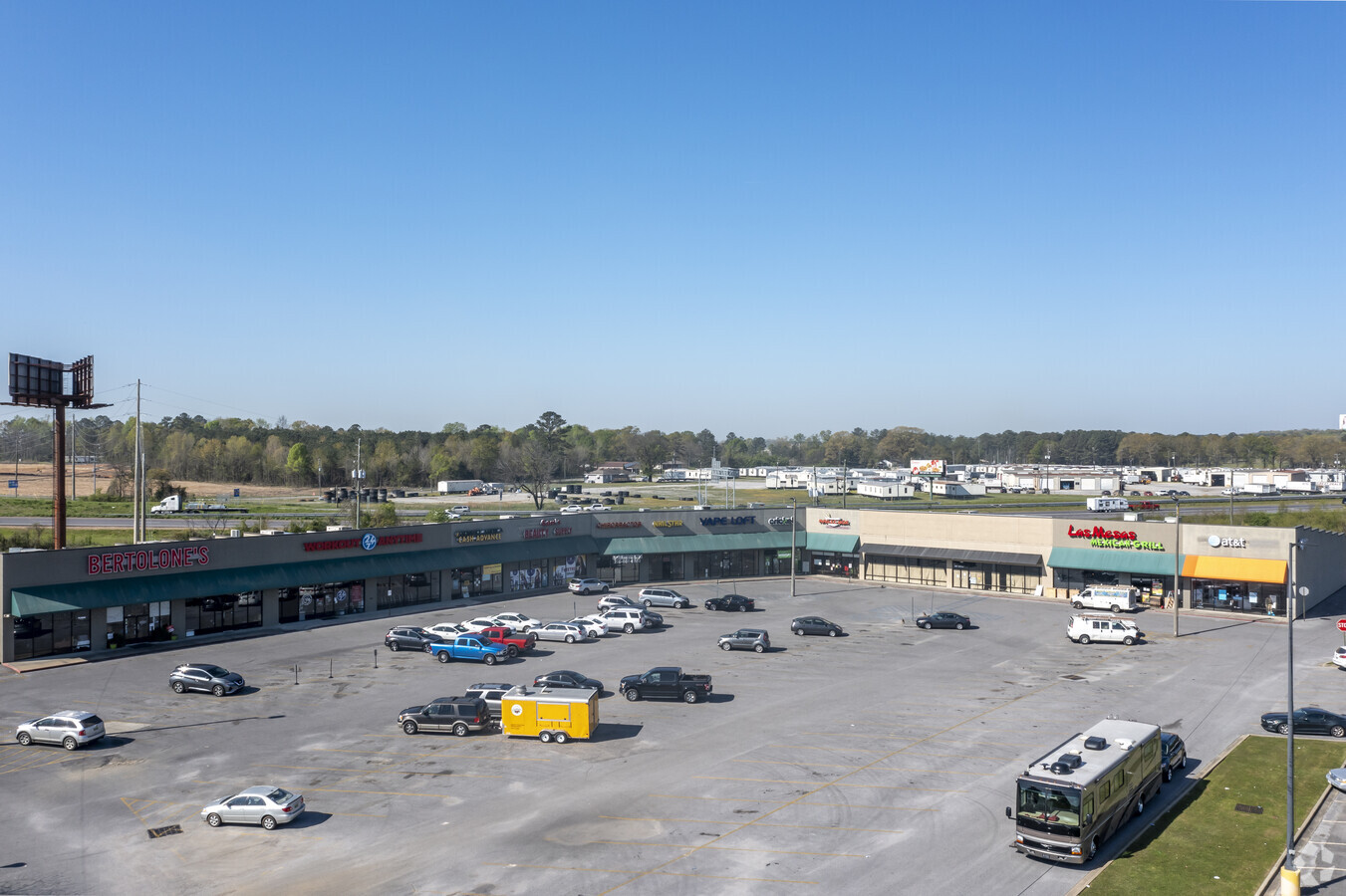
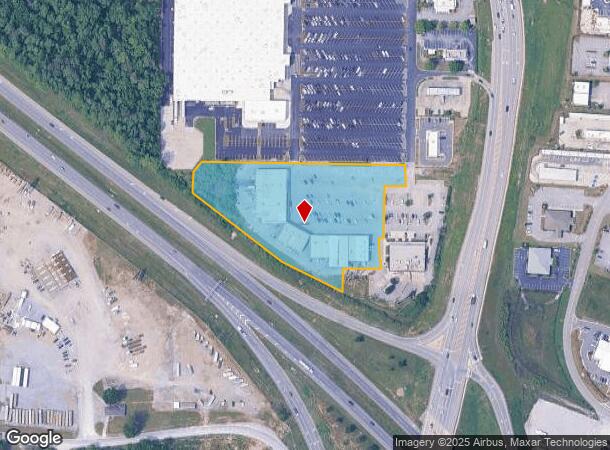
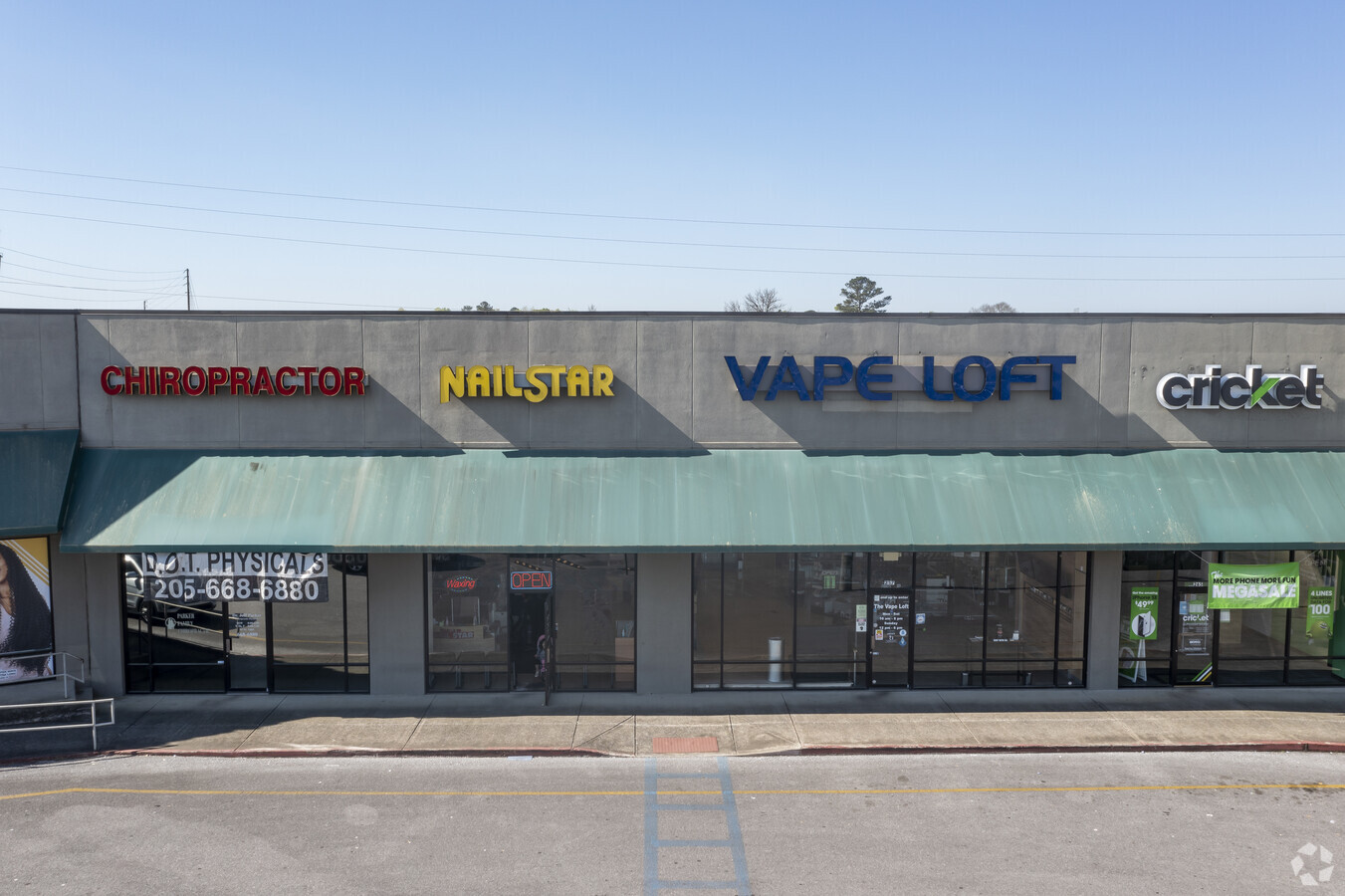
Calera Xing
Birmingham-Hoover, AL
Calera Crossings Wal-Mart Supercenter #3
28-2-04-0-001-012-002
SEC/TWNSHP/RAN 4 22S 02W NBRHD: 03 CALERA COMMERCIAL R-2
Stripcommercialcenter
Shelby
X
Alabama
01117C0395E
2b
2023
4.28 AC
2023
I-65 Corr/S Shelby County
030504
Birmingham
38,429 SF
DEMOGRAPHICS near Calera Xing
1 Mile
3 Mile
5 Mile
2024 Total Population
981
14,887
27,040
2029 Population
1,072
16,218
29,568
Pop Growth 2024-2029
+ 9.28%
+ 8.94%
+ 9.35%
Average Age
39
36
37
2024 Total Households
351
5,630
10,096
HH Growth 2024-2029
+ 9.40%
+ 9.08%
+ 9.48%
Median Household Inc
$71,249
$73,284
$73,421
Avg Household Size
2.70
2.60
2.60
2024 Avg HH Vehicles
2.00
2.00
2.00
Median Home Value
$248,701
$197,775
$213,336
Median Year Built
1994
2004
2003
Nearby Places
- Restaurants
- Banks
- Shops
- Fitness
- Groceries
PUBLIC TRANSPORTATION
AIRPORT
Birmingham-Shuttlesworth International
DRIVE
WALK
Distance
Birmingham-Shuttlesworth International
44 min
34.9 mi
Freight Ports
Port of Mobile
DRIVE
WALK
Distance
Port of Mobile
247 min
227.2 mi
SALE & LEASE HISTORY
LISTING DATE
SALE/LEASE

Jan 19, 2017
For Lease
Dec 16, 2020
For Lease
Nearby Properties
Address
Land Use
TOTAL SIZE
Lot Size
Zoning
Address
Land Use
TOTAL SIZE
Lot Size
Zoning
573,600 SF
19.96 AC
Address
Land Use
TOTAL SIZE
Lot Size
Zoning
1,456 SF
20.58 AC
Address
Land Use
TOTAL SIZE
Lot Size
Zoning
14,160 SF
6.75 AC
Address
Land Use
TOTAL SIZE
Lot Size
Zoning
139,905 SF
34.78 AC
Address
Land Use
TOTAL SIZE
Lot Size
Zoning
500,500 SF
17.45 AC
Address
Land Use
TOTAL SIZE
Lot Size
Zoning
205,546 SF
14.10 AC
Address
Land Use
TOTAL SIZE
Lot Size
Zoning
3,941 SF
5.60 AC
Address
Land Use
TOTAL SIZE
Lot Size
Zoning
368,066 SF
20.66 AC
Address
Land Use
TOTAL SIZE
Lot Size
Zoning
6,234 SF
33 AC
Address
Land Use
TOTAL SIZE
Lot Size
Zoning
270,600 SF
21.74 AC
Address
Land Use
TOTAL SIZE
Lot Size
Zoning
46,031 SF
11.09 AC
Address
Land Use
TOTAL SIZE
Lot Size
Zoning
208,000 SF
11.91 AC
Address
Land Use
TOTAL SIZE
Lot Size
Zoning
104,643 SF
5.39 AC
Address
Land Use
TOTAL SIZE
Lot Size
Zoning
85,144 SF
2.94 AC
Address
Land Use
TOTAL SIZE
Lot Size
Zoning
53,022 SF
2.20 AC
Address
Land Use
TOTAL SIZE
Lot Size
Zoning
241.36 AC
Address
Land Use
TOTAL SIZE
Lot Size
Zoning
6,275 SF
290 AC
Address
Land Use
TOTAL SIZE
Lot Size
Zoning
8,328 SF
6.89 AC
Address
Land Use
TOTAL SIZE
Lot Size
Zoning
73,825 SF
15 AC
Address
Land Use
TOTAL SIZE
Lot Size
Zoning
14,163 SF
12.78 AC
Address
Land Use
TOTAL SIZE
Lot Size
Zoning
38,816 SF
33.96 AC
Address
Land Use
TOTAL SIZE
Lot Size
Zoning
3.79 AC
Address
Land Use
TOTAL SIZE
Lot Size
Zoning
30,000 SF
10.06 AC
Address
Land Use
TOTAL SIZE
Lot Size
Zoning
33,440 SF
5.08 AC
Address
Land Use
TOTAL SIZE
Lot Size
Zoning
36,430 SF
4.10 AC
Address
Land Use
TOTAL SIZE
Lot Size
Zoning
40,295 SF
0.56 AC
Address
Land Use
TOTAL SIZE
Lot Size
Zoning
66,260 SF
3.84 AC
The World's #1 Commercial Real Estate Marketplace
Connect with us
© 2025 CoStar Group
The information above has been obtained from sources believed reliable. While we do not doubt its accuracy we have not verified it and make no guarantee, warranty or representation about it. It is your responsibility to independently confirm its accuracy and completeness. Any projections, opinions, assumptions, or estimates used are for example only and do not represent the current or future performance of the property. The value of this transaction to you depends on tax and other factors which should be evaluated by your tax, financial, and legal advisors. You and your advisors should conduct a careful, independent investigation of the property to determine to your satisfaction the suitability of the property for your needs.