Property Record
Carpenters Pit Rd, Milford, DE 19963
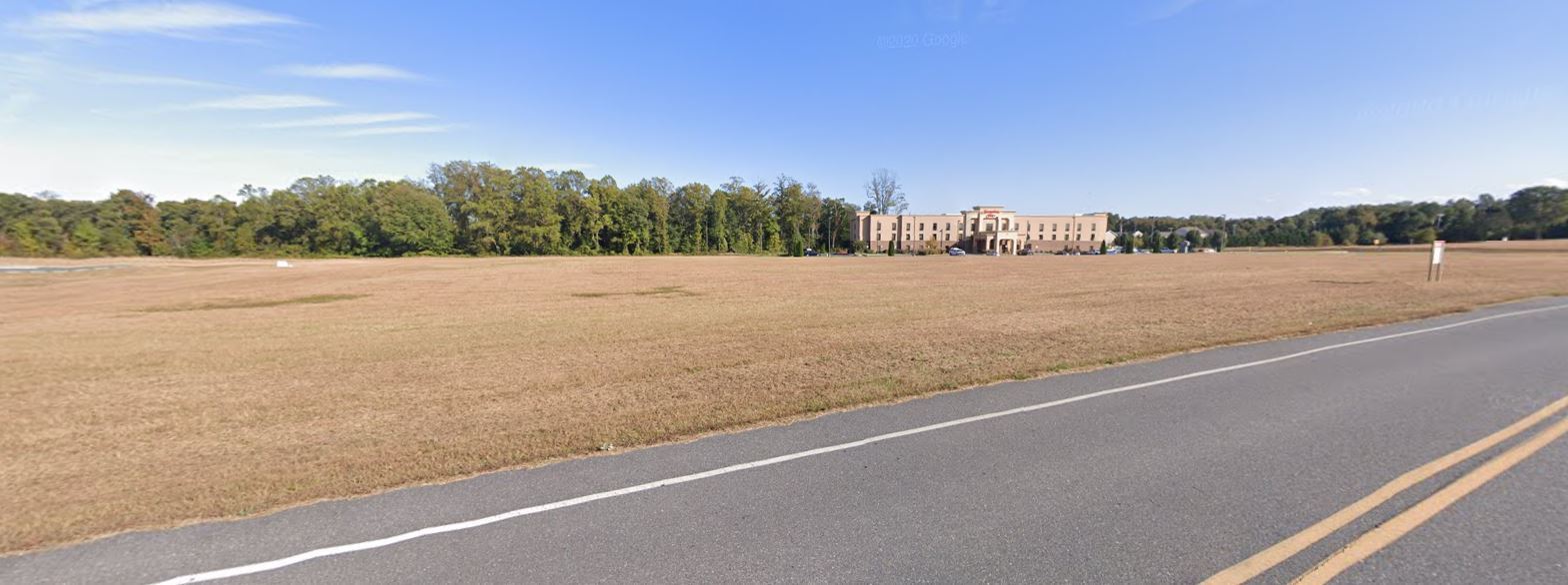
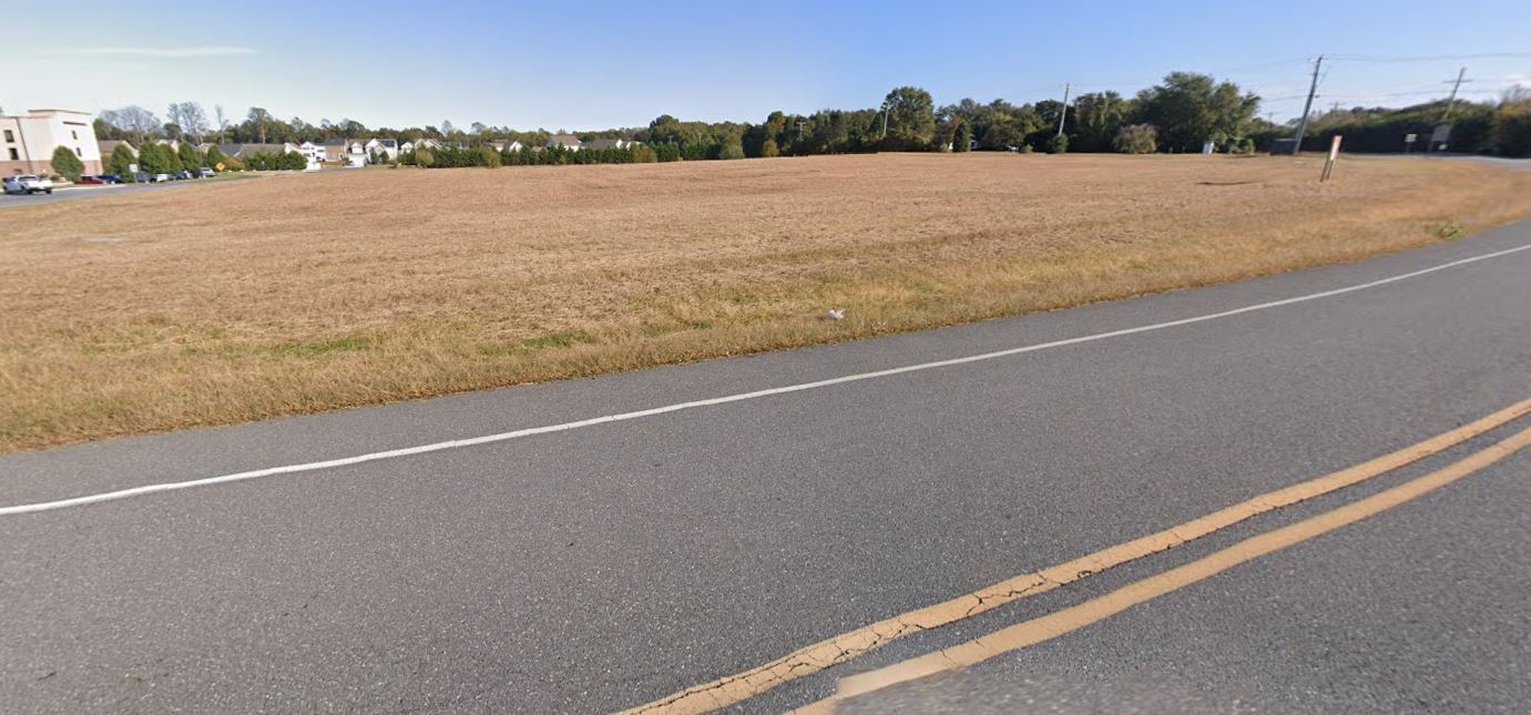
This Property Is For Sale
NEARBY LISTINGS FOR SALE OR LEASE
Property Detail
Carpenters Pit Rd
Dover, DE
Minor Sub Plan Of Lands Of First United
5-16-17400-03-0101-000
N. SD. CO. RD. 408A 4.88 AC.
Vacantlandexempt
Kent
X
Delaware
10005C0041K
4.90 AC
0
Kent County
2024
Philadelphia
042500
DEMOGRAPHICS near Carpenters Pit Rd
1 Mile
3 Mile
5 Mile
2024 Total Population
1,873
14,143
23,840
2029 Population
2,011
15,815
26,681
Pop Growth 2024-2029
+ 7.37%
+ 11.82%
+ 11.92%
Average Age
39
40
42
2024 Total Households
717
5,405
9,155
HH Growth 2024-2029
+ 7.53%
+ 11.42%
+ 11.56%
Median Household Inc
$53,295
$54,688
$59,054
Avg Household Size
2.60
2.50
2.50
2024 Avg HH Vehicles
2.00
2.00
2.00
Median Home Value
$245,637
$261,741
$269,542
Median Year Built
1981
1984
1991
Nearby Places
- Restaurants
- Banks
- Shops
- Fitness
- Groceries
Nearby Properties
Address
Land Use
TOTAL SIZE
Lot Size
Zoning
Address
Land Use
TOTAL SIZE
Lot Size
Zoning
170,788 SF
69.90 AC
R2
Address
Land Use
TOTAL SIZE
Lot Size
Zoning
180,878 SF
21.43 AC
C3
Address
Land Use
TOTAL SIZE
Lot Size
Zoning
551.10 AC
AC
Address
Land Use
TOTAL SIZE
Lot Size
Zoning
111,133 SF
22.99 AC
OC1
Address
Land Use
TOTAL SIZE
Lot Size
Zoning
68,127 SF
14.97 AC
H1
Address
Land Use
TOTAL SIZE
Lot Size
Zoning
130,101 SF
13.80 AC
C3
Address
Land Use
TOTAL SIZE
Lot Size
Zoning
398.20 AC
AP/10
Address
Land Use
TOTAL SIZE
Lot Size
Zoning
204,457 SF
18.50 AC
C3
Address
Land Use
TOTAL SIZE
Lot Size
Zoning
185,027 SF
24.54 AC
I2
Address
Land Use
TOTAL SIZE
Lot Size
Zoning
443.50 AC
AP/10
Address
Land Use
TOTAL SIZE
Lot Size
Zoning
44,037 SF
23.20 AC
BG
Address
Land Use
TOTAL SIZE
Lot Size
Zoning
99,488 SF
18.20 AC
R3
Address
Land Use
TOTAL SIZE
Lot Size
Zoning
61,585 SF
10.55 AC
R2
Address
Land Use
TOTAL SIZE
Lot Size
Zoning
72,706 SF
10.60 AC
C3
Address
Land Use
TOTAL SIZE
Lot Size
Zoning
88,015 SF
8 AC
C3
Address
Land Use
TOTAL SIZE
Lot Size
Zoning
191,470 SF
49.58 AC
IL
Address
Land Use
TOTAL SIZE
Lot Size
Zoning
72,084 SF
4.90 AC
R3
Address
Land Use
TOTAL SIZE
Lot Size
Zoning
23,312 SF
27.90 AC
C3
Address
Land Use
TOTAL SIZE
Lot Size
Zoning
180,174 SF
17.51 AC
I1
Address
Land Use
TOTAL SIZE
Lot Size
Zoning
46,784 SF
2.30 AC
C3
Address
Land Use
TOTAL SIZE
Lot Size
Zoning
1,043.70 AC
AC
Address
Land Use
TOTAL SIZE
Lot Size
Zoning
49,500 SF
7.40 AC
R3
Address
Land Use
TOTAL SIZE
Lot Size
Zoning
47,754 SF
25.50 AC
I1
Address
Land Use
TOTAL SIZE
Lot Size
Zoning
37,022 SF
11.80 AC
OC1
Address
Land Use
TOTAL SIZE
Lot Size
Zoning
42,400 SF
9 AC
R3
Address
Land Use
TOTAL SIZE
Lot Size
Zoning
72,084 SF
5.60 AC
R3
Address
Land Use
TOTAL SIZE
Lot Size
Zoning
150.80 AC
AP/10
Address
Land Use
TOTAL SIZE
Lot Size
Zoning
159.10 AC
AP/10
Address
Land Use
TOTAL SIZE
Lot Size
Zoning
150.10 AC
AC
Address
Land Use
TOTAL SIZE
Lot Size
Zoning
50,304 SF
8.90 AC
R3
The World's #1 Commercial Real Estate Marketplace
Connect with us
© 2025 CoStar Group
The information above has been obtained from sources believed reliable. While we do not doubt its accuracy we have not verified it and make no guarantee, warranty or representation about it. It is your responsibility to independently confirm its accuracy and completeness. Any projections, opinions, assumptions, or estimates used are for example only and do not represent the current or future performance of the property. The value of this transaction to you depends on tax and other factors which should be evaluated by your tax, financial, and legal advisors. You and your advisors should conduct a careful, independent investigation of the property to determine to your satisfaction the suitability of the property for your needs.