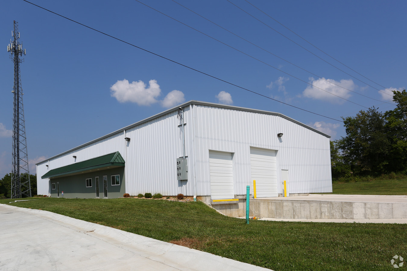
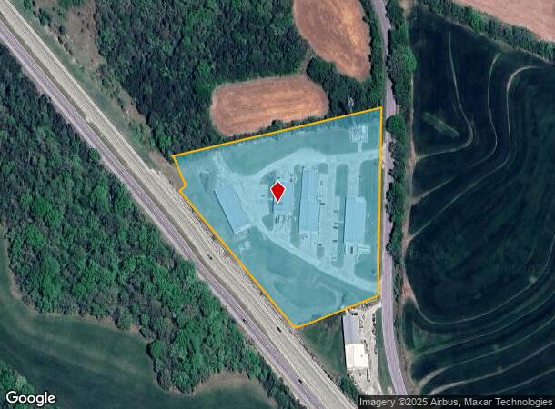
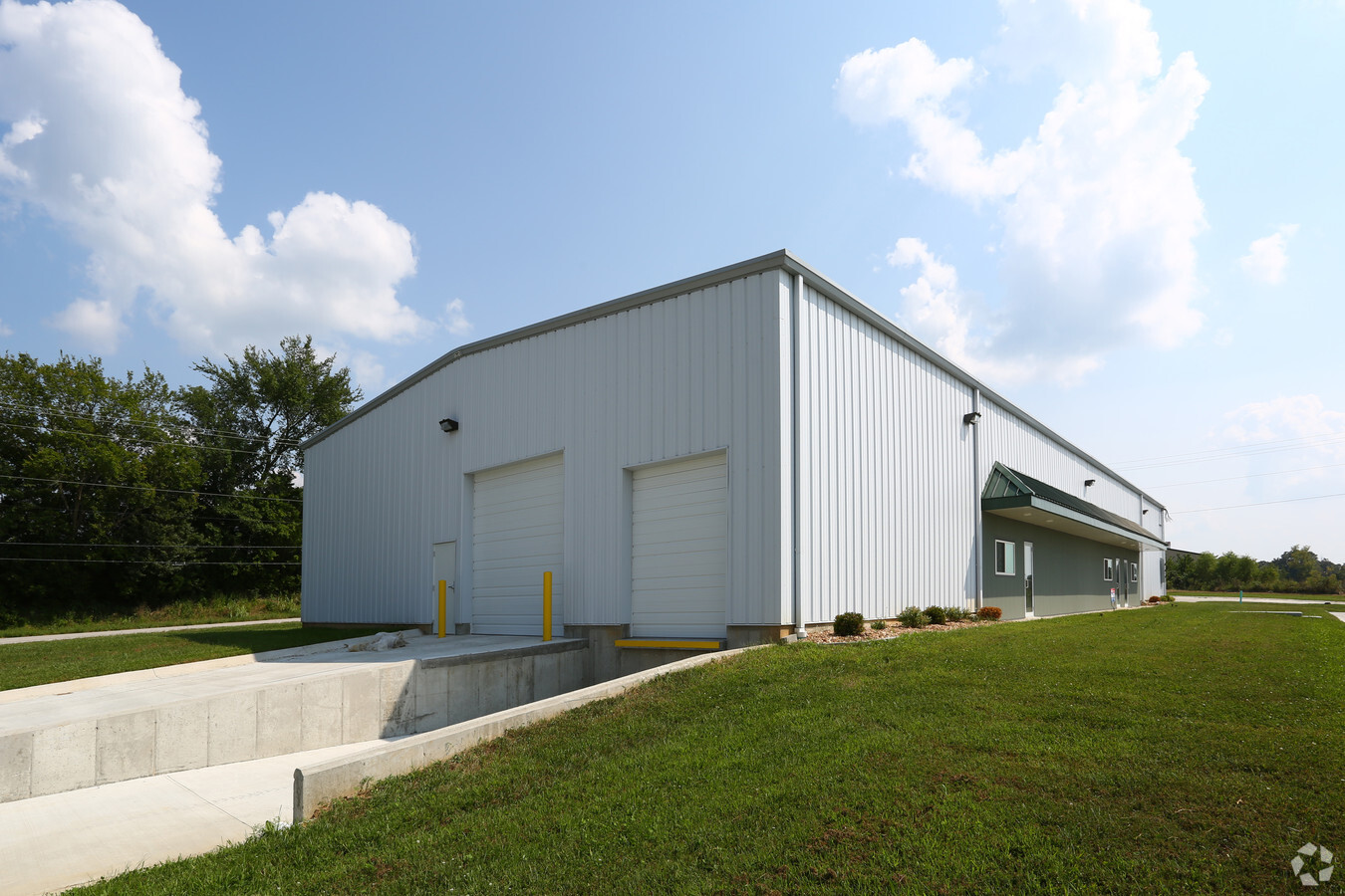
Property Record
Century Commerce Loop, Labadie, MO 63055
NEARBY LISTINGS FOR SALE OR LEASE
-
-
View all Labadie listings for lease on LoopNet.com
Property Detail
Century Commerce Loop
09-8-33.0-0-000-023.000
Carriage Courts Plat 2
Realpropertynec
LEASED WAREHOUSE SPACE PT SE SW, E OF NEW HWY 100 W OF OLD HWY 100
X
Franklin
29183C0500G
Missouri
2024
7.90 AC
2023
Franklin County
800101
St. Louis
11,088 SF
St. Louis, MO-IL
DEMOGRAPHICS near Century Commerce Loop
1 Mile
3 Mile
5 Mile
2024 Total Population
517
2,880
12,930
2029 Population
530
2,953
13,296
Pop Growth 2024-2029
+ 2.51%
+ 2.53%
+ 2.83%
Average Age
43
43
44
2024 Total Households
189
1,071
5,063
HH Growth 2024-2029
+ 2.12%
+ 2.52%
+ 2.80%
Median Household Inc
$107,143
$100,195
$88,627
Avg Household Size
2.70
2.70
2.50
2024 Avg HH Vehicles
3.00
3.00
2.00
Median Home Value
$423,077
$345,895
$257,142
Median Year Built
1995
1992
1988
Nearby Places
- Restaurants
- Banks
- Shops
- Fitness
- Groceries
PUBLIC TRANSPORTATION
COMMUTER RAIL
Washington Amtrak Station (Lincoln Service Missouri River Runner - Amtrak, Missouri River Runner - Amtrak)
DRIVE
WALK
Distance
Washington Amtrak Station (Lincoln Service Missouri River Runner - Amtrak, Missouri River Runner - Amtrak)
14 min
7.5 mi
Freight Ports
Tulsa Port of Inola
DRIVE
WALK
Distance
Tulsa Port of Inola
383 min
347.3 mi
SALE & LEASE HISTORY
LISTING DATE
SALE/LEASE

Sep 25, 2016
For Lease
Jun 18, 2019
For Lease
Dec 07, 2018
For Lease
Nearby Properties
Address
Land Use
TOTAL SIZE
Lot Size
Zoning
Address
Land Use
TOTAL SIZE
Lot Size
Zoning
Address
Land Use
TOTAL SIZE
Lot Size
Zoning
3,412 SF
32 AC
ANU
Address
Land Use
TOTAL SIZE
Lot Size
Zoning
10,650 SF
9.50 AC
SD
Address
Land Use
TOTAL SIZE
Lot Size
Zoning
4,605 SF
6.10 AC
ANU
Address
Land Use
TOTAL SIZE
Lot Size
Zoning
63,700 SF
16.30 AC
Address
Land Use
TOTAL SIZE
Lot Size
Zoning
23,702 SF
15 AC
Address
Land Use
TOTAL SIZE
Lot Size
Zoning
Address
Land Use
TOTAL SIZE
Lot Size
Zoning
19,200 SF
7.20 AC
CA
Address
Land Use
TOTAL SIZE
Lot Size
Zoning
4,405 SF
4 AC
ANU
Address
Land Use
TOTAL SIZE
Lot Size
Zoning
6,386 SF
50.50 AC
ANU
Address
Land Use
TOTAL SIZE
Lot Size
Zoning
21,280 SF
11.60 AC
Address
Land Use
TOTAL SIZE
Lot Size
Zoning
12,194 SF
6.60 AC
CA
Address
Land Use
TOTAL SIZE
Lot Size
Zoning
12,000 SF
2.10 AC
Address
Land Use
TOTAL SIZE
Lot Size
Zoning
8,400 SF
1.10 AC
Address
Land Use
TOTAL SIZE
Lot Size
Zoning
2,242 SF
1.20 AC
ANU
Address
Land Use
TOTAL SIZE
Lot Size
Zoning
13.40 AC
ANU
Address
Land Use
TOTAL SIZE
Lot Size
Zoning
71 AC
ANU
Address
Land Use
TOTAL SIZE
Lot Size
Zoning
2.20 AC
ANU
Address
Land Use
TOTAL SIZE
Lot Size
Zoning
3,036 SF
52.90 AC
SD
Address
Land Use
TOTAL SIZE
Lot Size
Zoning
8.10 AC
SD
Address
Land Use
TOTAL SIZE
Lot Size
Zoning
31.10 AC
ANU
Address
Land Use
TOTAL SIZE
Lot Size
Zoning
9.40 AC
ANU
Address
Land Use
TOTAL SIZE
Lot Size
Zoning
10,571 SF
1.30 AC
ANU
Address
Land Use
TOTAL SIZE
Lot Size
Zoning
0.50 AC
Address
Land Use
TOTAL SIZE
Lot Size
Zoning
3,116 SF
10.90 AC
ANU
Address
Land Use
TOTAL SIZE
Lot Size
Zoning
672 SF
2.70 AC
ANU
Address
Land Use
TOTAL SIZE
Lot Size
Zoning
6,083 SF
1.30 AC
Address
Land Use
TOTAL SIZE
Lot Size
Zoning
Address
Land Use
TOTAL SIZE
Lot Size
Zoning
1,512 SF
6.30 AC
The World's #1 Commercial Real Estate Marketplace
Connect with us
© 2025 CoStar Group
The information above has been obtained from sources believed reliable. While we do not doubt its accuracy we have not verified it and make no guarantee, warranty or representation about it. It is your responsibility to independently confirm its accuracy and completeness. Any projections, opinions, assumptions, or estimates used are for example only and do not represent the current or future performance of the property. The value of this transaction to you depends on tax and other factors which should be evaluated by your tax, financial, and legal advisors. You and your advisors should conduct a careful, independent investigation of the property to determine to your satisfaction the suitability of the property for your needs.