Property Record
Clove Rd, Little Falls, NJ 07424


NEARBY LISTINGS FOR SALE OR LEASE
-
-
View all Little Falls listings for sale on LoopNet.com
Property Detail
Clove Rd
New York-Jersey City-White Plains, NY-NJ
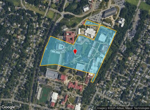
Parcel Map Center For Environmental And
05-00250-0000-00005
FACILITY NAME: FINLEY HALL
Governmentalpublicusegeneral
Passaic
X
New Jersey
34031C0252G
5
0
28.33 AC
2024
Passaic Rt 46/23
264102
Northern New Jersey
DEMOGRAPHICS near Clove Rd
1 Mile
3 Mile
5 Mile
2024 Total Population
14,908
153,824
578,121
2029 Population
14,739
151,350
563,729
Pop Growth 2024-2029
(1.13%)
(1.61%)
(2.49%)
Average Age
38
41
39
2024 Total Households
4,350
55,490
201,893
HH Growth 2024-2029
(0.74%)
(1.71%)
(2.56%)
Median Household Inc
$136,809
$109,966
$80,795
Avg Household Size
2.50
2.60
2.70
2024 Avg HH Vehicles
2.00
2.00
2.00
Median Home Value
$636,197
$474,112
$446,895
Median Year Built
1959
1955
1953
Nearby Places
- Restaurants
- Banks
- Shops
- Fitness
- Groceries
PUBLIC TRANSPORTATION
COMMUTER RAIL
Montclair Heights (Montclair-Boonton Line - NJ Transit Commuter Rail (NJ Transit))
DRIVE
WALK
Distance
Montclair Heights (Montclair-Boonton Line - NJ Transit Commuter Rail (NJ Transit))
2 min
7 min
0.4 mi
Montclair State University (Montclair-Boonton Line - NJ Transit Commuter Rail (NJ Transit))
DRIVE
WALK
Distance
Montclair State University (Montclair-Boonton Line - NJ Transit Commuter Rail (NJ Transit))
3 min
18 min
0.8 mi
AIRPORT
Newark Liberty International
DRIVE
WALK
Distance
Newark Liberty International
24 min
18.9 mi
Laguardia
DRIVE
WALK
Distance
Laguardia
43 min
28.4 mi
John F Kennedy International
DRIVE
WALK
Distance
John F Kennedy International
52 min
33.4 mi
Freight Ports
Port Newark Container Terminal
DRIVE
WALK
Distance
Port Newark Container Terminal
29 min
18.2 mi
Nearby Properties
Address
Land Use
TOTAL SIZE
Lot Size
Zoning
Address
Land Use
TOTAL SIZE
Lot Size
Zoning
1.12 AC
M-O
Address
Land Use
TOTAL SIZE
Lot Size
Zoning
260,609 SF
35.39 AC
Address
Land Use
TOTAL SIZE
Lot Size
Zoning
20.43 AC
Address
Land Use
TOTAL SIZE
Lot Size
Zoning
Address
Land Use
TOTAL SIZE
Lot Size
Zoning
24,200 SF
19.33 AC
Address
Land Use
TOTAL SIZE
Lot Size
Zoning
315,332 SF
19.60 AC
Address
Land Use
TOTAL SIZE
Lot Size
Zoning
3.55 AC
Address
Land Use
TOTAL SIZE
Lot Size
Zoning
7.22 AC
Address
Land Use
TOTAL SIZE
Lot Size
Zoning
25.88 AC
Address
Land Use
TOTAL SIZE
Lot Size
Zoning
25.80 AC
P
Address
Land Use
TOTAL SIZE
Lot Size
Zoning
1,512 SF
90 AC
Address
Land Use
TOTAL SIZE
Lot Size
Zoning
21.80 AC
R-A3
Address
Land Use
TOTAL SIZE
Lot Size
Zoning
49.03 AC
Address
Land Use
TOTAL SIZE
Lot Size
Zoning
14,152 SF
23.87 AC
Address
Land Use
TOTAL SIZE
Lot Size
Zoning
15.80 AC
IND
Address
Land Use
TOTAL SIZE
Lot Size
Zoning
14.27 AC
RO
Address
Land Use
TOTAL SIZE
Lot Size
Zoning
4.13 AC
M-O
Address
Land Use
TOTAL SIZE
Lot Size
Zoning
17.48 AC
M-2
Address
Land Use
TOTAL SIZE
Lot Size
Zoning
1,063 SF
14.08 AC
C-1
Address
Land Use
TOTAL SIZE
Lot Size
Zoning
130,000 SF
11 AC
Address
Land Use
TOTAL SIZE
Lot Size
Zoning
186,856 SF
10.47 AC
Address
Land Use
TOTAL SIZE
Lot Size
Zoning
4,969 SF
129 AC
Address
Land Use
TOTAL SIZE
Lot Size
Zoning
173,000 SF
14.70 AC
Address
Land Use
TOTAL SIZE
Lot Size
Zoning
8.52 AC
PDHC
Address
Land Use
TOTAL SIZE
Lot Size
Zoning
Address
Land Use
TOTAL SIZE
Lot Size
Zoning
103.46 AC
R-40
Address
Land Use
TOTAL SIZE
Lot Size
Zoning
7,647 SF
8.60 AC
Address
Land Use
TOTAL SIZE
Lot Size
Zoning
14 AC
B-D
Address
Land Use
TOTAL SIZE
Lot Size
Zoning
5.88 AC
P
The World's #1 Commercial Real Estate Marketplace
Connect with us
© 2025 CoStar Group
The information above has been obtained from sources believed reliable. While we do not doubt its accuracy we have not verified it and make no guarantee, warranty or representation about it. It is your responsibility to independently confirm its accuracy and completeness. Any projections, opinions, assumptions, or estimates used are for example only and do not represent the current or future performance of the property. The value of this transaction to you depends on tax and other factors which should be evaluated by your tax, financial, and legal advisors. You and your advisors should conduct a careful, independent investigation of the property to determine to your satisfaction the suitability of the property for your needs.