Property Record
County Road 19A, Eustis, FL 32726
This Property Is For Sale
NEARBY LISTINGS FOR SALE OR LEASE
Property Detail
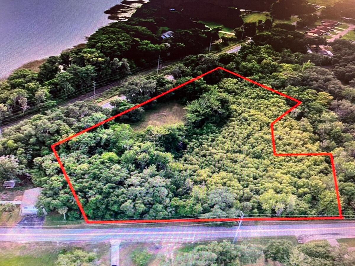
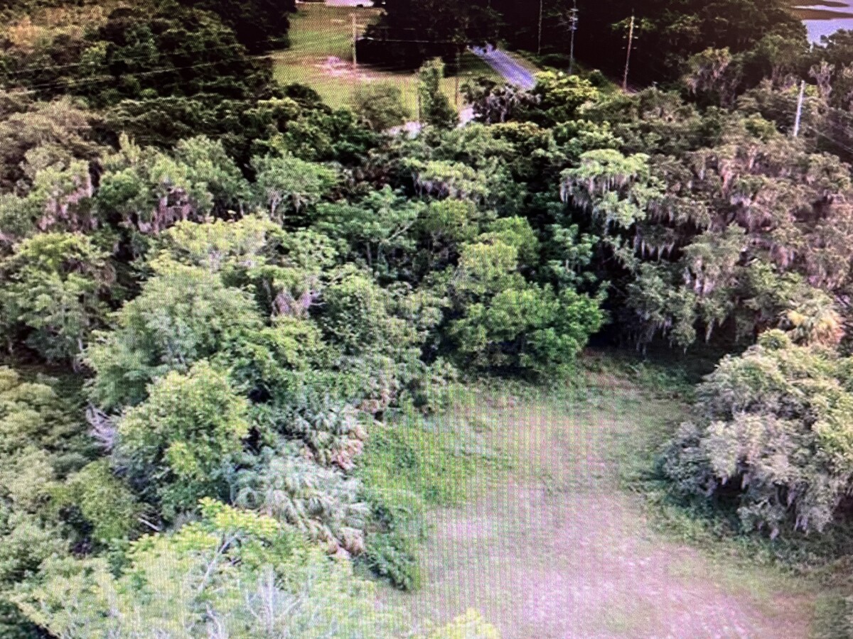
County Road 19A
Orlando-Kissimmee-Sanford, FL
Century Oaks Estates
03-19-26-0001-000-00103
FROM SE COR OF LOT 18 CENTURY OAKS ESTATES RUN S 0-01-35 E ALONG W R/W LINE OF CR 19-A A DIST OF 200 FT FOR POB CONT S 0-01-35 E 304.12 FT S 66-39-25 W 159 FT TO NELY R/W LINE OF SR 44 & PT A RETURN TO POB RUN S 89-58-25 W 145 FT S 0-01-35 E 91 FT S
Commercialacreage
Lake
X
Florida
12069C0355E
18
2023
2.08 AC
2024
Lake County
030204
Orlando
DEMOGRAPHICS near County Road 19A
1 Mile
3 Mile
5 Mile
2024 Total Population
2,885
28,055
67,973
2029 Population
3,320
32,593
79,301
Pop Growth 2024-2029
+ 15.08%
+ 16.18%
+ 16.67%
Average Age
46
43
45
2024 Total Households
1,375
11,552
28,952
HH Growth 2024-2029
+ 14.84%
+ 15.94%
+ 16.52%
Median Household Inc
$39,426
$57,028
$59,000
Avg Household Size
2.10
2.40
2.30
2024 Avg HH Vehicles
2.00
2.00
2.00
Median Home Value
$149,289
$230,718
$235,510
Median Year Built
1982
1982
1984
Nearby Places
- Restaurants
- Banks
- Shops
- Fitness
- Groceries
PUBLIC TRANSPORTATION
AIRPORT
Orlando Sanford International
DRIVE
WALK
Distance
Orlando Sanford International
56 min
35.1 mi
Freight Ports
Port Canaveral
DRIVE
WALK
Distance
Port Canaveral
115 min
91.4 mi
Nearby Properties
Address
Land Use
TOTAL SIZE
Lot Size
Zoning
Address
Land Use
TOTAL SIZE
Lot Size
Zoning
730,215 SF
151.42 AC
PD
Address
Land Use
TOTAL SIZE
Lot Size
Zoning
302,511 SF
23.16 AC
Address
Land Use
TOTAL SIZE
Lot Size
Zoning
278,266 SF
23.85 AC
PD
Address
Land Use
TOTAL SIZE
Lot Size
Zoning
311,431 SF
37.14 AC
PUD
Address
Land Use
TOTAL SIZE
Lot Size
Zoning
226,508 SF
19.15 AC
Address
Land Use
TOTAL SIZE
Lot Size
Zoning
158,442 SF
17.50 AC
MCI
Address
Land Use
TOTAL SIZE
Lot Size
Zoning
267,107 SF
20.40 AC
R1
Address
Land Use
TOTAL SIZE
Lot Size
Zoning
85,539 SF
9.39 AC
Address
Land Use
TOTAL SIZE
Lot Size
Zoning
45,732 SF
5.68 AC
PD
Address
Land Use
TOTAL SIZE
Lot Size
Zoning
204,433 SF
28.43 AC
R1
Address
Land Use
TOTAL SIZE
Lot Size
Zoning
135,298 SF
9.22 AC
SR
Address
Land Use
TOTAL SIZE
Lot Size
Zoning
72,852 SF
10.91 AC
Address
Land Use
TOTAL SIZE
Lot Size
Zoning
190,551 SF
20.31 AC
GC
Address
Land Use
TOTAL SIZE
Lot Size
Zoning
157,511 SF
15.28 AC
Address
Land Use
TOTAL SIZE
Lot Size
Zoning
36,261 SF
6.27 AC
PD
Address
Land Use
TOTAL SIZE
Lot Size
Zoning
95,803 SF
6.13 AC
CP
Address
Land Use
TOTAL SIZE
Lot Size
Zoning
129,512 SF
15 AC
Address
Land Use
TOTAL SIZE
Lot Size
Zoning
174,744 SF
38.45 AC
GI
Address
Land Use
TOTAL SIZE
Lot Size
Zoning
71,076 SF
1.42 AC
Address
Land Use
TOTAL SIZE
Lot Size
Zoning
50,754 SF
17.30 AC
R1
Address
Land Use
TOTAL SIZE
Lot Size
Zoning
79,296 SF
8.54 AC
R3
Address
Land Use
TOTAL SIZE
Lot Size
Zoning
54,035 SF
1.65 AC
PD
Address
Land Use
TOTAL SIZE
Lot Size
Zoning
94,435 SF
8.16 AC
GC
Address
Land Use
TOTAL SIZE
Lot Size
Zoning
146,690 SF
15.19 AC
RMF2
Address
Land Use
TOTAL SIZE
Lot Size
Zoning
115,293 SF
8.45 AC
Address
Land Use
TOTAL SIZE
Lot Size
Zoning
64,730 SF
6.38 AC
C3
Address
Land Use
TOTAL SIZE
Lot Size
Zoning
106,175 SF
8.10 AC
UR
Address
Land Use
TOTAL SIZE
Lot Size
Zoning
100,117 SF
7.44 AC
GC
Address
Land Use
TOTAL SIZE
Lot Size
Zoning
70,525 SF
37.62 AC
R2
Address
Land Use
TOTAL SIZE
Lot Size
Zoning
116,261 SF
5.66 AC
The World's #1 Commercial Real Estate Marketplace
Connect with us
© 2025 CoStar Group
The information above has been obtained from sources believed reliable. While we do not doubt its accuracy we have not verified it and make no guarantee, warranty or representation about it. It is your responsibility to independently confirm its accuracy and completeness. Any projections, opinions, assumptions, or estimates used are for example only and do not represent the current or future performance of the property. The value of this transaction to you depends on tax and other factors which should be evaluated by your tax, financial, and legal advisors. You and your advisors should conduct a careful, independent investigation of the property to determine to your satisfaction the suitability of the property for your needs.