Property Record
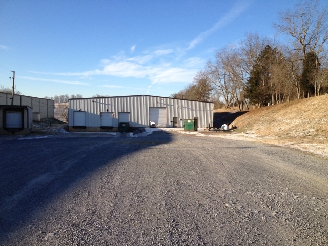
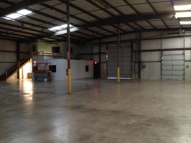
Dennison Dr, Abingdon, VA 24211
NEARBY LISTINGS FOR SALE OR LEASE
-
-
View all Abingdon listings for sale on LoopNet.com
Property Detail
Dennison Dr
124-1-13
PLAT OF DIVISION OF THE FARMERS WAREHOUSE INC PROP ACR 8.5920
Commercialnec
Washington
X
Virginia
51191C0270C
8.59 AC
2024
Washington County
2024
Kingsport/Bristol/Bristol
011000
Kingsport-Bristol-Bristol, TN-VA
126,000 SF
DEMOGRAPHICS near Dennison Dr
1 Mile
3 Mile
5 Mile
2024 Total Population
960
8,160
18,708
2029 Population
955
8,115
18,661
Pop Growth 2024-2029
(0.52%)
(0.55%)
(0.25%)
Average Age
47
45
45
2024 Total Households
418
3,680
8,408
HH Growth 2024-2029
(0.48%)
(0.49%)
(0.24%)
Median Household Inc
$91,558
$63,871
$56,921
Avg Household Size
2.30
2.20
2.20
2024 Avg HH Vehicles
2.00
2.00
2.00
Median Home Value
$269,196
$218,583
$219,376
Median Year Built
1987
1984
1983
Nearby Places
- Restaurants
- Banks
- Shops
- Fitness
- Groceries
PUBLIC TRANSPORTATION
AIRPORT
Tri-Cities
DRIVE
WALK
Distance
Tri-Cities
39 min
31.0 mi
Freight Ports
Virginia Port Authority - Richmond
DRIVE
WALK
Distance
Virginia Port Authority - Richmond
354 min
318.6 mi
Nearby Properties
Address
Land Use
TOTAL SIZE
Lot Size
Zoning
Address
Land Use
TOTAL SIZE
Lot Size
Zoning
53,625 SF
96.46 AC
ABINGDON
Address
Land Use
TOTAL SIZE
Lot Size
Zoning
130,142 SF
17.16 AC
M1 INDUSTR
Address
Land Use
TOTAL SIZE
Lot Size
Zoning
80,896 SF
3.54 AC
ABINGDON
Address
Land Use
TOTAL SIZE
Lot Size
Zoning
46,412 SF
10.30 AC
ABINGDON
Address
Land Use
TOTAL SIZE
Lot Size
Zoning
336,768 SF
43.21 AC
M1 INDUSTR
Address
Land Use
TOTAL SIZE
Lot Size
Zoning
8,154 SF
73.47 AC
AD AIRPORT
Address
Land Use
TOTAL SIZE
Lot Size
Zoning
35,952 SF
7.42 AC
A2 AGRICUL
Address
Land Use
TOTAL SIZE
Lot Size
Zoning
25,092 SF
1.21 AC
ABINGDON
Address
Land Use
TOTAL SIZE
Lot Size
Zoning
1,320 SF
12.23 AC
B2 BUSINES
Address
Land Use
TOTAL SIZE
Lot Size
Zoning
39,595 SF
2.64 AC
ABINGDON
Address
Land Use
TOTAL SIZE
Lot Size
Zoning
27,612 SF
6.50 AC
R1 RESIDEN
Address
Land Use
TOTAL SIZE
Lot Size
Zoning
31,230 SF
7.92 AC
B2 BUSINES
Address
Land Use
TOTAL SIZE
Lot Size
Zoning
58,568 SF
15.09 AC
M1 INDUSTR
Address
Land Use
TOTAL SIZE
Lot Size
Zoning
30,120 SF
6.33 AC
ABINGDON
Address
Land Use
TOTAL SIZE
Lot Size
Zoning
42,896 SF
2 AC
ABINGDON
Address
Land Use
TOTAL SIZE
Lot Size
Zoning
29,920 SF
3.18 AC
ABINGDON
Address
Land Use
TOTAL SIZE
Lot Size
Zoning
39,846 SF
3.55 AC
ABINGDON
Address
Land Use
TOTAL SIZE
Lot Size
Zoning
69,100 SF
13.83 AC
M1 INDUSTR
Address
Land Use
TOTAL SIZE
Lot Size
Zoning
14,965 SF
1.47 AC
ABINGDON
Address
Land Use
TOTAL SIZE
Lot Size
Zoning
12,909 SF
6.42 AC
B2 BUSINES
Address
Land Use
TOTAL SIZE
Lot Size
Zoning
6,842 SF
75.05 AC
B2 BUSINES
Address
Land Use
TOTAL SIZE
Lot Size
Zoning
20,906 SF
4.78 AC
B2 BUSINES
Address
Land Use
TOTAL SIZE
Lot Size
Zoning
16,192 SF
3.73 AC
ABINGDON
Address
Land Use
TOTAL SIZE
Lot Size
Zoning
143.30 AC
A2 AGRICUL
Address
Land Use
TOTAL SIZE
Lot Size
Zoning
17,760 SF
5.57 AC
B2 BUSINES
Address
Land Use
TOTAL SIZE
Lot Size
Zoning
18,156 SF
1.39 AC
ABINGDON
Address
Land Use
TOTAL SIZE
Lot Size
Zoning
35,248 SF
1.82 AC
ABINGDON
Address
Land Use
TOTAL SIZE
Lot Size
Zoning
22,256 SF
2.14 AC
ABINGDON
Address
Land Use
TOTAL SIZE
Lot Size
Zoning
32,948 SF
4.52 AC
ABINGDON
The World's #1 Commercial Real Estate Marketplace
Connect with us
© 2025 CoStar Group
The information above has been obtained from sources believed reliable. While we do not doubt its accuracy we have not verified it and make no guarantee, warranty or representation about it. It is your responsibility to independently confirm its accuracy and completeness. Any projections, opinions, assumptions, or estimates used are for example only and do not represent the current or future performance of the property. The value of this transaction to you depends on tax and other factors which should be evaluated by your tax, financial, and legal advisors. You and your advisors should conduct a careful, independent investigation of the property to determine to your satisfaction the suitability of the property for your needs.