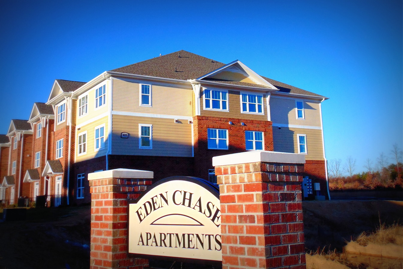
Property Record
E Harris Pl, Eden, NC 27288
NEARBY LISTINGS FOR SALE OR LEASE
-
-
View all Eden listings for sale on LoopNet.com
Property Detail
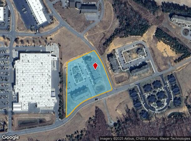
E Harris Pl
Greensboro-High Point, NC
Minor Subdivision Plat Of Osborne Invest
178256
4.20 AC LOT 1 E HARRIS PL
Apartment
Rockingham
X
North Carolina
3710798900J
1
2024
4.20 AC
2024
Rockingham County
040300
Greensboro/Winston-Salem
39,876 SF
DEMOGRAPHICS near E Harris Pl
1 Mile
3 Mile
5 Mile
2024 Total Population
1,548
16,661
24,677
2029 Population
1,570
17,204
25,416
Pop Growth 2024-2029
+ 1.42%
+ 3.26%
+ 2.99%
Average Age
46
42
43
2024 Total Households
773
7,291
10,682
HH Growth 2024-2029
+ 1.42%
+ 3.17%
+ 2.91%
Median Household Inc
$30,700
$37,666
$41,358
Avg Household Size
2.00
2.20
2.30
2024 Avg HH Vehicles
2.00
2.00
2.00
Median Home Value
$180,991
$116,927
$118,910
Median Year Built
1977
1966
1969
Nearby Places
- Restaurants
- Banks
- Shops
- Fitness
- Groceries
PUBLIC TRANSPORTATION
AIRPORT
Piedmont Triad International
DRIVE
WALK
Distance
Piedmont Triad International
57 min
42.6 mi
Freight Ports
Virginia Port Authority - Richmond
DRIVE
WALK
Distance
Virginia Port Authority - Richmond
222 min
169.8 mi
Nearby Properties
Address
Land Use
TOTAL SIZE
Lot Size
Zoning
Address
Land Use
TOTAL SIZE
Lot Size
Zoning
1,094,878 SF
61.89 AC
LIGHT INDU
Address
Land Use
TOTAL SIZE
Lot Size
Zoning
51,491 SF
22.80 AC
NEIGHBORHO
Address
Land Use
TOTAL SIZE
Lot Size
Zoning
73,711 SF
42.90 AC
RES 20 EDE
Address
Land Use
TOTAL SIZE
Lot Size
Zoning
192,057 SF
21.83 AC
HWY BUS ED
Address
Land Use
TOTAL SIZE
Lot Size
Zoning
161,928 SF
22.72 AC
LIGHT INDU
Address
Land Use
TOTAL SIZE
Lot Size
Zoning
76,404 SF
4.24 AC
RES 12 EDE
Address
Land Use
TOTAL SIZE
Lot Size
Zoning
27,040 SF
605.77 AC
HEAVY INDU
Address
Land Use
TOTAL SIZE
Lot Size
Zoning
348,265 SF
35.79 AC
HEAVY INDU
Address
Land Use
TOTAL SIZE
Lot Size
Zoning
71,755 SF
10 AC
NEIGHBORHO
Address
Land Use
TOTAL SIZE
Lot Size
Zoning
9,008 SF
7.40 AC
NEIGHBORHO
Address
Land Use
TOTAL SIZE
Lot Size
Zoning
57,000 SF
1.58 AC
HWY BUS ED
Address
Land Use
TOTAL SIZE
Lot Size
Zoning
37,634 SF
10.21 AC
RES 20 EDE
Address
Land Use
TOTAL SIZE
Lot Size
Zoning
36,266 SF
4.18 AC
HWY BUS ED
Address
Land Use
TOTAL SIZE
Lot Size
Zoning
77,910 SF
23.77 AC
NEIGHBORHO
Address
Land Use
TOTAL SIZE
Lot Size
Zoning
25,844 SF
11.81 AC
NEIGHBORHO
Address
Land Use
TOTAL SIZE
Lot Size
Zoning
143,646 SF
12.47 AC
HWY BUS ED
Address
Land Use
TOTAL SIZE
Lot Size
Zoning
10,100 SF
10.19 AC
RES 12 EDE
Address
Land Use
TOTAL SIZE
Lot Size
Zoning
59,165 SF
6.56 AC
HWY BUS ED
Address
Land Use
TOTAL SIZE
Lot Size
Zoning
95,156 SF
16.50 AC
HWY BUS ED
Address
Land Use
TOTAL SIZE
Lot Size
Zoning
52,332 SF
14.20 AC
RES 20 EDE
Address
Land Use
TOTAL SIZE
Lot Size
Zoning
31,464 SF
4.42 AC
HWY BUS ED
Address
Land Use
TOTAL SIZE
Lot Size
Zoning
88,170 SF
15.39 AC
RES 12 EDE
Address
Land Use
TOTAL SIZE
Lot Size
Zoning
46,226 SF
44.93 AC
RES 20 EDE
Address
Land Use
TOTAL SIZE
Lot Size
Zoning
172,252 SF
17 AC
LIGHT INDU
Address
Land Use
TOTAL SIZE
Lot Size
Zoning
6,370 SF
8.60 AC
NEIGHBORHO
Address
Land Use
TOTAL SIZE
Lot Size
Zoning
85,306 SF
14.78 AC
LIGHT INDU
Address
Land Use
TOTAL SIZE
Lot Size
Zoning
552,147 SF
25.12 AC
LIGHT INDU
Address
Land Use
TOTAL SIZE
Lot Size
Zoning
19,966 SF
2 AC
NEIGHBORHO
Address
Land Use
TOTAL SIZE
Lot Size
Zoning
1,009.82 AC
RES AG/RES
The World's #1 Commercial Real Estate Marketplace
Connect with us
© 2025 CoStar Group
The information above has been obtained from sources believed reliable. While we do not doubt its accuracy we have not verified it and make no guarantee, warranty or representation about it. It is your responsibility to independently confirm its accuracy and completeness. Any projections, opinions, assumptions, or estimates used are for example only and do not represent the current or future performance of the property. The value of this transaction to you depends on tax and other factors which should be evaluated by your tax, financial, and legal advisors. You and your advisors should conduct a careful, independent investigation of the property to determine to your satisfaction the suitability of the property for your needs.