Property Record
Oak Ridge Tpke, Oak Ridge, TN 37830

NEARBY LISTINGS FOR SALE OR LEASE
-
-
View all Oak Ridge listings for sale on LoopNet.com
Property Detail
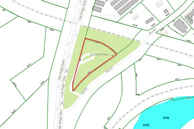
Oak Ridge Tpke
Knoxville, TN
Block 0E24 Lot 216A
087M-B-001.00
LOT: 216A
Commercialnec
Anderson
X
Tennessee
47001C0237G
216a
2024
1.42 AC
2025
Anderson County
020400
Knoxville
DEMOGRAPHICS near Oak Ridge Tpke
1 Mile
3 Mile
5 Mile
2024 Total Population
1,935
16,710
40,074
2029 Population
2,043
17,725
42,605
Pop Growth 2024-2029
+ 5.58%
+ 6.07%
+ 6.32%
Average Age
42
43
42
2024 Total Households
785
7,009
16,961
HH Growth 2024-2029
+ 5.61%
+ 6.22%
+ 6.45%
Median Household Inc
$80,000
$79,124
$66,074
Avg Household Size
2.40
2.30
2.30
2024 Avg HH Vehicles
2.00
2.00
2.00
Median Home Value
$181,578
$215,403
$199,894
Median Year Built
1961
1972
1973
Nearby Places
Map Layers
Map Styles
 Street
 Aerial
- Restaurants
- Banks
- Shops
- Fitness
- Groceries
PUBLIC TRANSPORTATION
AIRPORT
McGhee Tyson
DRIVE
WALK
Distance
McGhee Tyson
39 min
28.5 mi
Freight Ports
Georgia Ports - Savannah
DRIVE
WALK
Distance
Georgia Ports - Savannah
501 min
433.6 mi
SALE & LEASE HISTORY
LISTING DATE
SALE/LEASE

Sep 12, 2022
For Sale
Nearby Properties
Address
Land Use
TOTAL SIZE
Lot Size
Zoning
Address
Land Use
TOTAL SIZE
Lot Size
Zoning
4,482 SF
177.65 AC
Address
Land Use
TOTAL SIZE
Lot Size
Zoning
120,400 SF
4.57 AC
B2
Address
Land Use
TOTAL SIZE
Lot Size
Zoning
105,513 SF
4.23 AC
Address
Land Use
TOTAL SIZE
Lot Size
Zoning
147,110 SF
11.17 AC
Address
Land Use
TOTAL SIZE
Lot Size
Zoning
49,574 SF
31.25 AC
Address
Land Use
TOTAL SIZE
Lot Size
Zoning
162,874 SF
12.98 AC
Address
Land Use
TOTAL SIZE
Lot Size
Zoning
190,966 SF
12.70 AC
R3
Address
Land Use
TOTAL SIZE
Lot Size
Zoning
67,780 SF
4.40 AC
IND1
Address
Land Use
TOTAL SIZE
Lot Size
Zoning
34,905 SF
1.59 AC
OF
Address
Land Use
TOTAL SIZE
Lot Size
Zoning
139,118 SF
10 AC
Address
Land Use
TOTAL SIZE
Lot Size
Zoning
57,174 SF
6.09 AC
Address
Land Use
TOTAL SIZE
Lot Size
Zoning
74,948 SF
5.07 AC
R7
Address
Land Use
TOTAL SIZE
Lot Size
Zoning
76,032 SF
2.38 AC
R3
Address
Land Use
TOTAL SIZE
Lot Size
Zoning
109,185 SF
19.51 AC
Address
Land Use
TOTAL SIZE
Lot Size
Zoning
66,070 SF
4.68 AC
Address
Land Use
TOTAL SIZE
Lot Size
Zoning
80,855 SF
8.42 AC
Address
Land Use
TOTAL SIZE
Lot Size
Zoning
66,080 SF
0.41 AC
Address
Land Use
TOTAL SIZE
Lot Size
Zoning
65,779 SF
6.20 AC
Address
Land Use
TOTAL SIZE
Lot Size
Zoning
53,284 SF
3.80 AC
Address
Land Use
TOTAL SIZE
Lot Size
Zoning
25,408 SF
5.25 AC
Address
Land Use
TOTAL SIZE
Lot Size
Zoning
15,162 SF
1.74 AC
B2
Address
Land Use
TOTAL SIZE
Lot Size
Zoning
52,247 SF
4.40 AC
Address
Land Use
TOTAL SIZE
Lot Size
Zoning
53,566 SF
3.13 AC
R3
Address
Land Use
TOTAL SIZE
Lot Size
Zoning
44,751 SF
3.28 AC
B2
Address
Land Use
TOTAL SIZE
Lot Size
Zoning
33,911 SF
3.23 AC
Address
Land Use
TOTAL SIZE
Lot Size
Zoning
37,978 SF
1.84 AC
Address
Land Use
TOTAL SIZE
Lot Size
Zoning
35,548 SF
2.52 AC
Address
Land Use
TOTAL SIZE
Lot Size
Zoning
32,632 SF
4.01 AC
Address
Land Use
TOTAL SIZE
Lot Size
Zoning
40,752 SF
8.89 AC
B2
Address
Land Use
TOTAL SIZE
Lot Size
Zoning
8,938 SF
3.50 AC
The World's #1 Commercial Real Estate Marketplace
Connect with us
© 2026 CoStar Group
The information above has been obtained from sources believed reliable. While we do not doubt its accuracy we have not verified it and make no guarantee, warranty or representation about it. It is your responsibility to independently confirm its accuracy and completeness. Any projections, opinions, assumptions, or estimates used are for example only and do not represent the current or future performance of the property. The value of this transaction to you depends on tax and other factors which should be evaluated by your tax, financial, and legal advisors. You and your advisors should conduct a careful, independent investigation of the property to determine to your satisfaction the suitability of the property for your needs.