No Photo
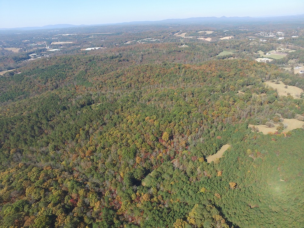
Property Record
299 Flatbottom Rd, Ball Ground, GA 30107
NEARBY LISTINGS FOR SALE OR LEASE
-
-
No Photo
-
-
-
-
-
-
View all Ball Ground listings for sale on LoopNet.com
Property Detail
299 Flatbottom Rd
Atlanta-Sandy Springs-Roswell, GA
Oscar Paul Holcombe Estate
003N02-00000-051-000-0000
Cherokee
Ruralagriculturalresidence
Georgia
X
36.05 AC
13057C0159E
Cherokee County
920 SF
Atlanta
DEMOGRAPHICS near 299 Flatbottom Rd
1 Mile
3 Mile
5 Mile
2024 Total Population
1,238
5,546
13,158
2029 Population
1,435
6,367
14,985
Pop Growth 2024-2029
+ 15.91%
+ 14.80%
+ 13.89%
Average Age
40
41
41
2024 Total Households
443
1,981
4,711
HH Growth 2024-2029
+ 16.03%
+ 14.94%
+ 14.03%
Median Household Inc
$96,614
$94,683
$89,754
Avg Household Size
2.80
2.80
2.80
2024 Avg HH Vehicles
2.00
2.00
2.00
Median Home Value
$345,000
$349,096
$355,793
Median Year Built
1999
1999
1999
Nearby Places
- Restaurants
- Banks
- Shops
- Fitness
- Groceries
SALE & LEASE HISTORY
LISTING DATE
SALE/LEASE

Feb 28, 2023
For Sale
Nearby Properties
Address
Land Use
TOTAL SIZE
Lot Size
Zoning
Address
Land Use
TOTAL SIZE
Lot Size
Zoning
2,752 SF
959.77 AC
AG
Address
Land Use
TOTAL SIZE
Lot Size
Zoning
166,581 SF
46.53 AC
LI
Address
Land Use
TOTAL SIZE
Lot Size
Zoning
142,837 SF
15.16 AC
TND
Address
Land Use
TOTAL SIZE
Lot Size
Zoning
371,338 SF
24.31 AC
LI
Address
Land Use
TOTAL SIZE
Lot Size
Zoning
119,086 SF
13.77 AC
TND
Address
Land Use
TOTAL SIZE
Lot Size
Zoning
9,142 SF
89.03 AC
LI
Address
Land Use
TOTAL SIZE
Lot Size
Zoning
89,900 SF
18.65 AC
HI
Address
Land Use
TOTAL SIZE
Lot Size
Zoning
28,106 SF
63.71 AC
LI
Address
Land Use
TOTAL SIZE
Lot Size
Zoning
1,663.77 AC
AG
Address
Land Use
TOTAL SIZE
Lot Size
Zoning
104,392 SF
16.53 AC
LI
Address
Land Use
TOTAL SIZE
Lot Size
Zoning
83.99 AC
LI
Address
Land Use
TOTAL SIZE
Lot Size
Zoning
54.80 AC
AG
Address
Land Use
TOTAL SIZE
Lot Size
Zoning
3,996 SF
10.93 AC
LI
Address
Land Use
TOTAL SIZE
Lot Size
Zoning
32,478 SF
5.75 AC
LI
Address
Land Use
TOTAL SIZE
Lot Size
Zoning
24,800 SF
100.45 AC
HI
Address
Land Use
TOTAL SIZE
Lot Size
Zoning
123.28 AC
LI
Address
Land Use
TOTAL SIZE
Lot Size
Zoning
62,210 SF
19.86 AC
LI
Address
Land Use
TOTAL SIZE
Lot Size
Zoning
16,300 SF
15.18 AC
TND
Address
Land Use
TOTAL SIZE
Lot Size
Zoning
12,354 SF
35.85 AC
HI
Address
Land Use
TOTAL SIZE
Lot Size
Zoning
13,754 SF
14.08 AC
TND
Address
Land Use
TOTAL SIZE
Lot Size
Zoning
51.33 AC
LI
Address
Land Use
TOTAL SIZE
Lot Size
Zoning
58,322 SF
12.42 AC
LI
Address
Land Use
TOTAL SIZE
Lot Size
Zoning
56,448 SF
2.15 AC
LI
Address
Land Use
TOTAL SIZE
Lot Size
Zoning
35,090 SF
15.42 AC
GC
Address
Land Use
TOTAL SIZE
Lot Size
Zoning
45,816 SF
3.96 AC
LI
Address
Land Use
TOTAL SIZE
Lot Size
Zoning
254.28 AC
AG
Address
Land Use
TOTAL SIZE
Lot Size
Zoning
538.36 AC
AG
Address
Land Use
TOTAL SIZE
Lot Size
Zoning
143,429 SF
4.32 AC
LI
Address
Land Use
TOTAL SIZE
Lot Size
Zoning
45,849 SF
4 AC
LI
Address
Land Use
TOTAL SIZE
Lot Size
Zoning
69.15 AC
LI
The World's #1 Commercial Real Estate Marketplace
Connect with us
© 2025 CoStar Group
The information above has been obtained from sources believed reliable. While we do not doubt its accuracy we have not verified it and make no guarantee, warranty or representation about it. It is your responsibility to independently confirm its accuracy and completeness. Any projections, opinions, assumptions, or estimates used are for example only and do not represent the current or future performance of the property. The value of this transaction to you depends on tax and other factors which should be evaluated by your tax, financial, and legal advisors. You and your advisors should conduct a careful, independent investigation of the property to determine to your satisfaction the suitability of the property for your needs.