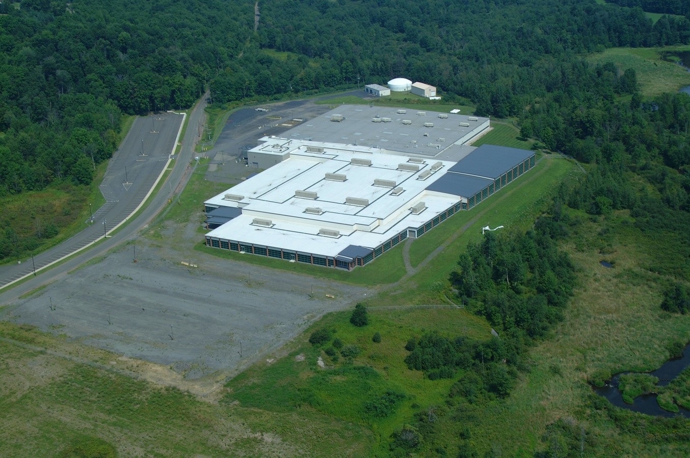
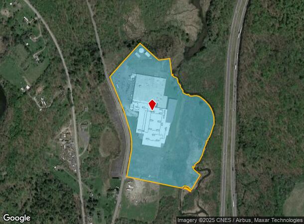
Property Record
Franklin Valley Rd, Dalton, PA 18414
NEARBY LISTINGS FOR SALE OR LEASE
Property Detail
Franklin Valley Rd
0400202000501
29.59A W-01
Redevelopmentagencyorzone
Lackawanna
A
Pennsylvania
42069C0110D
29.59 AC
2024
I-81 Corridor
2024
Philadelphia
110300
Scranton--Wilkes-Barre--Hazelton, PA
DEMOGRAPHICS near Franklin Valley Rd
1 Mile
3 Mile
5 Mile
2024 Total Population
355
2,502
9,497
2029 Population
375
2,563
9,624
Pop Growth 2024-2029
+ 5.63%
+ 2.44%
+ 1.34%
Average Age
45
45
44
2024 Total Households
145
1,002
3,839
HH Growth 2024-2029
+ 5.52%
+ 2.50%
+ 1.43%
Median Household Inc
$78,646
$84,129
$85,181
Avg Household Size
2.40
2.50
2.50
2024 Avg HH Vehicles
2.00
2.00
2.00
Median Home Value
$210,227
$228,289
$243,789
Median Year Built
1980
1979
1979
Nearby Places
- Restaurants
- Banks
- Shops
- Fitness
- Groceries
PUBLIC TRANSPORTATION
AIRPORT
Wilkes-Barre/Scranton International
DRIVE
WALK
Distance
Wilkes-Barre/Scranton International
35 min
24.7 mi
Freight Ports
Maher Terminal
DRIVE
WALK
Distance
Maher Terminal
157 min
125.7 mi
Nearby Properties
Address
Land Use
TOTAL SIZE
Lot Size
Zoning
Address
Land Use
TOTAL SIZE
Lot Size
Zoning
26.57 AC
Address
Land Use
TOTAL SIZE
Lot Size
Zoning
3.90 AC
Address
Land Use
TOTAL SIZE
Lot Size
Zoning
30 AC
Address
Land Use
TOTAL SIZE
Lot Size
Zoning
52 AC
Address
Land Use
TOTAL SIZE
Lot Size
Zoning
Address
Land Use
TOTAL SIZE
Lot Size
Zoning
2,226 SF
247 AC
Address
Land Use
TOTAL SIZE
Lot Size
Zoning
240.14 AC
Address
Land Use
TOTAL SIZE
Lot Size
Zoning
66.41 AC
Address
Land Use
TOTAL SIZE
Lot Size
Zoning
Address
Land Use
TOTAL SIZE
Lot Size
Zoning
368.07 AC
Address
Land Use
TOTAL SIZE
Lot Size
Zoning
Address
Land Use
TOTAL SIZE
Lot Size
Zoning
Address
Land Use
TOTAL SIZE
Lot Size
Zoning
2.60 AC
Address
Land Use
TOTAL SIZE
Lot Size
Zoning
38.15 AC
Address
Land Use
TOTAL SIZE
Lot Size
Zoning
Address
Land Use
TOTAL SIZE
Lot Size
Zoning
10.61 AC
Address
Land Use
TOTAL SIZE
Lot Size
Zoning
37.60 AC
Address
Land Use
TOTAL SIZE
Lot Size
Zoning
54.69 AC
Address
Land Use
TOTAL SIZE
Lot Size
Zoning
49.52 AC
Address
Land Use
TOTAL SIZE
Lot Size
Zoning
5,803 SF
16.75 AC
Address
Land Use
TOTAL SIZE
Lot Size
Zoning
98.70 AC
Address
Land Use
TOTAL SIZE
Lot Size
Zoning
256.16 AC
Address
Land Use
TOTAL SIZE
Lot Size
Zoning
66.19 AC
Address
Land Use
TOTAL SIZE
Lot Size
Zoning
Address
Land Use
TOTAL SIZE
Lot Size
Zoning
73.96 AC
Address
Land Use
TOTAL SIZE
Lot Size
Zoning
0.77 AC
Address
Land Use
TOTAL SIZE
Lot Size
Zoning
30.49 AC
Address
Land Use
TOTAL SIZE
Lot Size
Zoning
2.50 AC
Address
Land Use
TOTAL SIZE
Lot Size
Zoning
145 AC
The World's #1 Commercial Real Estate Marketplace
Connect with us
© 2025 CoStar Group
The information above has been obtained from sources believed reliable. While we do not doubt its accuracy we have not verified it and make no guarantee, warranty or representation about it. It is your responsibility to independently confirm its accuracy and completeness. Any projections, opinions, assumptions, or estimates used are for example only and do not represent the current or future performance of the property. The value of this transaction to you depends on tax and other factors which should be evaluated by your tax, financial, and legal advisors. You and your advisors should conduct a careful, independent investigation of the property to determine to your satisfaction the suitability of the property for your needs.