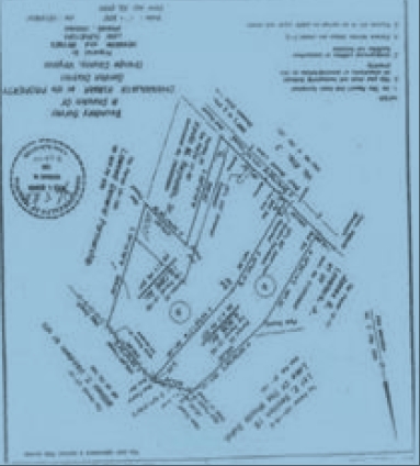
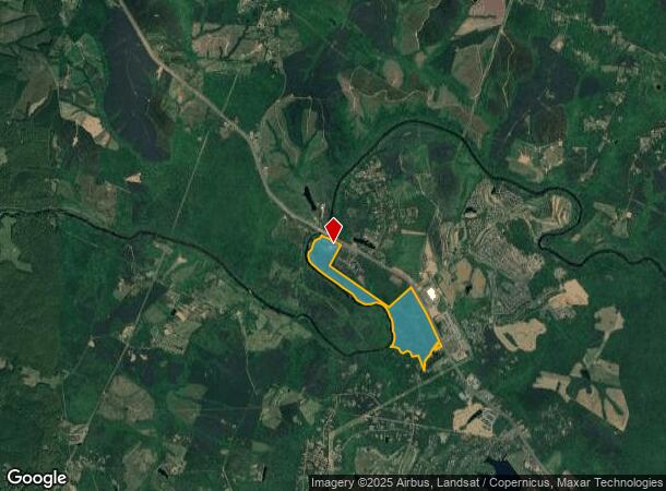
Property Record
2062 Germanna Hwy, Locust Grove, VA 22508
NEARBY LISTINGS FOR SALE OR LEASE
Property Detail
2062 Germanna Hwy
012-00-00-00-0040-0
12-40
Taxexempt
Orange
A
Virginia
51137C0200E
40
2024
178.60 AC
2024
Virginia Regional
110108
Other Market Areas
2,941 SF
DEMOGRAPHICS near 2062 Germanna Hwy
1 Mile
3 Mile
5 Mile
2024 Total Population
2,584
10,313
17,425
2029 Population
2,963
11,836
19,870
Pop Growth 2024-2029
+ 14.67%
+ 14.77%
+ 14.03%
Average Age
36
42
43
2024 Total Households
875
3,929
6,670
HH Growth 2024-2029
+ 14.74%
+ 14.91%
+ 14.20%
Median Household Inc
$138,897
$112,023
$102,168
Avg Household Size
2.90
2.60
2.60
2024 Avg HH Vehicles
3.00
2.00
2.00
Median Home Value
$327,128
$323,935
$332,346
Median Year Built
2007
2003
2001
Nearby Places
- Restaurants
- Banks
- Shops
- Fitness
- Groceries
SALE & LEASE HISTORY
LISTING DATE
SALE/LEASE

Sep 24, 2016
For Sale
Apr 11, 2017
For Sale
Nearby Properties
Address
Land Use
TOTAL SIZE
Lot Size
Zoning
Address
Land Use
TOTAL SIZE
Lot Size
Zoning
64,053 SF
100 AC
A AGRICULT
Address
Land Use
TOTAL SIZE
Lot Size
Zoning
129,762 SF
13.52 AC
C2 GENERAL
Address
Land Use
TOTAL SIZE
Lot Size
Zoning
1,972 SF
7 AC
RAA1
Address
Land Use
TOTAL SIZE
Lot Size
Zoning
62,364 SF
7.09 AC
C2 GENERAL
Address
Land Use
TOTAL SIZE
Lot Size
Zoning
13,139 SF
6.79 AC
R4 MULTI F
Address
Land Use
TOTAL SIZE
Lot Size
Zoning
42,897 SF
7.60 AC
R4 MULTI F
Address
Land Use
TOTAL SIZE
Lot Size
Zoning
10,508 SF
2.19 AC
R3 PLANNED
Address
Land Use
TOTAL SIZE
Lot Size
Zoning
13,200 SF
7.16 AC
C2 GENERAL
Address
Land Use
TOTAL SIZE
Lot Size
Zoning
77.67 AC
PDM MIXED
Address
Land Use
TOTAL SIZE
Lot Size
Zoning
9,480 SF
1.20 AC
C2 GENERAL
Address
Land Use
TOTAL SIZE
Lot Size
Zoning
672.90 AC
A AGRICULT
Address
Land Use
TOTAL SIZE
Lot Size
Zoning
8,964 SF
1.15 AC
C2 GENERAL
Address
Land Use
TOTAL SIZE
Lot Size
Zoning
6,768 SF
1 AC
C2 GENERAL
Address
Land Use
TOTAL SIZE
Lot Size
Zoning
12,000 SF
3 AC
C2 GENERAL
Address
Land Use
TOTAL SIZE
Lot Size
Zoning
9,456 SF
0.88 AC
C2 GENERAL
Address
Land Use
TOTAL SIZE
Lot Size
Zoning
7,600 SF
1.92 AC
A AGRICULT
Address
Land Use
TOTAL SIZE
Lot Size
Zoning
258.69 AC
RAA1
Address
Land Use
TOTAL SIZE
Lot Size
Zoning
10,232 SF
9.43 AC
R3 PLANNED
Address
Land Use
TOTAL SIZE
Lot Size
Zoning
356.90 AC
A1VC
Address
Land Use
TOTAL SIZE
Lot Size
Zoning
9,434 SF
0.93 AC
C2 GENERAL
Address
Land Use
TOTAL SIZE
Lot Size
Zoning
5,439 SF
1.58 AC
C2 GENERAL
Address
Land Use
TOTAL SIZE
Lot Size
Zoning
4,040 SF
0.87 AC
C2 GENERAL
Address
Land Use
TOTAL SIZE
Lot Size
Zoning
11,376 SF
1.39 AC
C2 GENERAL
Address
Land Use
TOTAL SIZE
Lot Size
Zoning
4,129 SF
0.88 AC
C2 GENERAL
Address
Land Use
TOTAL SIZE
Lot Size
Zoning
140.37 AC
A AGRICULT
Address
Land Use
TOTAL SIZE
Lot Size
Zoning
7,020 SF
4.04 AC
CS
Address
Land Use
TOTAL SIZE
Lot Size
Zoning
4,104 SF
4.56 AC
C2 GENERAL
Address
Land Use
TOTAL SIZE
Lot Size
Zoning
6,957 SF
0.74 AC
C2 GENERAL
Address
Land Use
TOTAL SIZE
Lot Size
Zoning
1,352 SF
2.93 AC
C2 GENERAL
The World's #1 Commercial Real Estate Marketplace
Connect with us
© 2025 CoStar Group
The information above has been obtained from sources believed reliable. While we do not doubt its accuracy we have not verified it and make no guarantee, warranty or representation about it. It is your responsibility to independently confirm its accuracy and completeness. Any projections, opinions, assumptions, or estimates used are for example only and do not represent the current or future performance of the property. The value of this transaction to you depends on tax and other factors which should be evaluated by your tax, financial, and legal advisors. You and your advisors should conduct a careful, independent investigation of the property to determine to your satisfaction the suitability of the property for your needs.