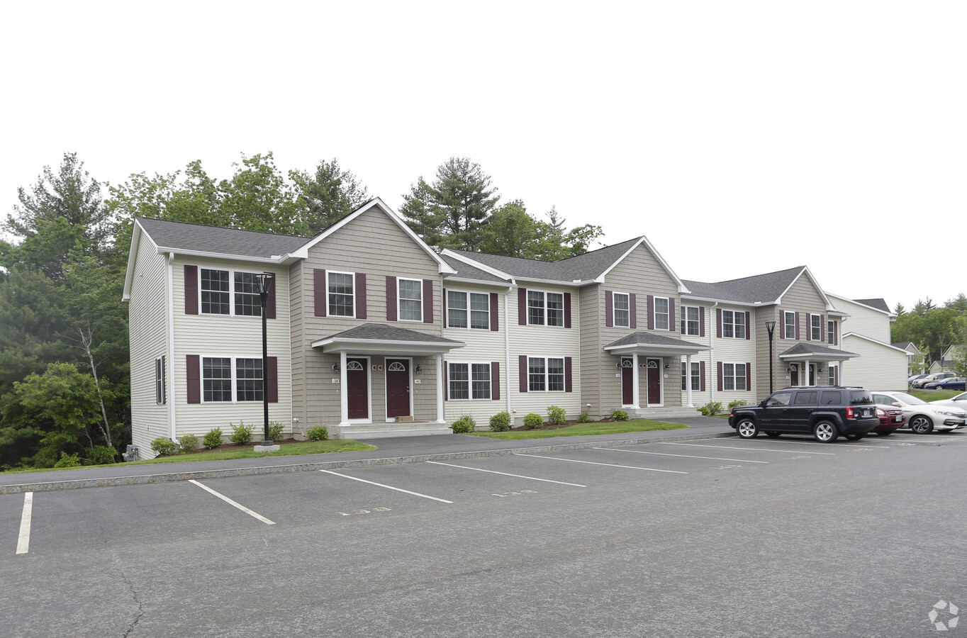
Property Record
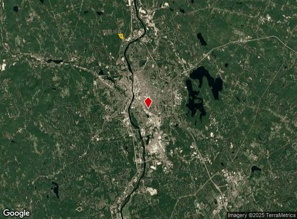
Hackett Hill Rd, Manchester, NH 03103

NEARBY LISTINGS FOR SALE OR LEASE
Property Detail
Hackett Hill Rd
MNCH-000766-000000-000015L
Hillsborough
Commercialofficeresidentialmixeduse
New Hampshire
X
15j
33013C0686E
33.49 AC
2023
Northwest Manchester
2023
Boston
002500
Manchester-Nashua, NH
8,064 SF
DEMOGRAPHICS near Hackett Hill Rd
1 Mile
3 Mile
5 Mile
2024 Total Population
4,521
31,280
109,484
2029 Population
4,655
32,267
111,716
Pop Growth 2024-2029
+ 2.96%
+ 3.16%
+ 2.04%
Average Age
43
42
40
2024 Total Households
2,209
13,345
45,530
HH Growth 2024-2029
+ 3.12%
+ 3.25%
+ 2.09%
Median Household Inc
$76,033
$87,095
$73,180
Avg Household Size
2.00
2.20
2.20
2024 Avg HH Vehicles
2.00
2.00
2.00
Median Home Value
$351,608
$346,404
$326,766
Median Year Built
1992
1982
1970
Nearby Places
- Restaurants
- Banks
- Shops
- Fitness
- Groceries
PUBLIC TRANSPORTATION
AIRPORT
Manchester Boston Regional
DRIVE
WALK
Distance
Manchester Boston Regional
14 min
4.7 mi
Freight Ports
Port of Boston
DRIVE
WALK
Distance
Port of Boston
83 min
55.5 mi
Nearby Properties
Address
Land Use
TOTAL SIZE
Lot Size
Zoning
Address
Land Use
TOTAL SIZE
Lot Size
Zoning
446,957 SF
24.16 AC
Address
Land Use
TOTAL SIZE
Lot Size
Zoning
376,493 SF
1.68 AC
Address
Land Use
TOTAL SIZE
Lot Size
Zoning
26,232 SF
39.97 AC
Address
Land Use
TOTAL SIZE
Lot Size
Zoning
6,830 SF
17.24 AC
Address
Land Use
TOTAL SIZE
Lot Size
Zoning
256,041 SF
6.69 AC
Address
Land Use
TOTAL SIZE
Lot Size
Zoning
8,064 SF
34.29 AC
Address
Land Use
TOTAL SIZE
Lot Size
Zoning
46,906 SF
552.35 AC
Address
Land Use
TOTAL SIZE
Lot Size
Zoning
3,748 SF
14.69 AC
Address
Land Use
TOTAL SIZE
Lot Size
Zoning
250,905 SF
1.16 AC
Address
Land Use
TOTAL SIZE
Lot Size
Zoning
217,697 SF
43.25 AC
Address
Land Use
TOTAL SIZE
Lot Size
Zoning
29,803 SF
31.46 AC
PZ
Address
Land Use
TOTAL SIZE
Lot Size
Zoning
135,879 SF
2.36 AC
Address
Land Use
TOTAL SIZE
Lot Size
Zoning
22,101 SF
8.33 AC
Address
Land Use
TOTAL SIZE
Lot Size
Zoning
723,875 SF
38.08 AC
Address
Land Use
TOTAL SIZE
Lot Size
Zoning
49,788 SF
34.73 AC
Address
Land Use
TOTAL SIZE
Lot Size
Zoning
221,144 SF
3.77 AC
Address
Land Use
TOTAL SIZE
Lot Size
Zoning
237,634 SF
5.39 AC
Address
Land Use
TOTAL SIZE
Lot Size
Zoning
229,089 SF
3.58 AC
Address
Land Use
TOTAL SIZE
Lot Size
Zoning
24,064 SF
19.44 AC
Address
Land Use
TOTAL SIZE
Lot Size
Zoning
116,763 SF
7 AC
PZ
Address
Land Use
TOTAL SIZE
Lot Size
Zoning
180,474 SF
18.60 AC
Address
Land Use
TOTAL SIZE
Lot Size
Zoning
201,831 SF
18.46 AC
IND-II
Address
Land Use
TOTAL SIZE
Lot Size
Zoning
181,610 SF
0.58 AC
Address
Land Use
TOTAL SIZE
Lot Size
Zoning
2,656 SF
16 AC
Address
Land Use
TOTAL SIZE
Lot Size
Zoning
151,002 SF
6.95 AC
PZ
Address
Land Use
TOTAL SIZE
Lot Size
Zoning
139,616 SF
18.47 AC
PZ
Address
Land Use
TOTAL SIZE
Lot Size
Zoning
165,000 SF
3.38 AC
Address
Land Use
TOTAL SIZE
Lot Size
Zoning
230,582 SF
0.31 AC
Address
Land Use
TOTAL SIZE
Lot Size
Zoning
2,218 SF
17.11 AC
The World's #1 Commercial Real Estate Marketplace
Connect with us
© 2025 CoStar Group
The information above has been obtained from sources believed reliable. While we do not doubt its accuracy we have not verified it and make no guarantee, warranty or representation about it. It is your responsibility to independently confirm its accuracy and completeness. Any projections, opinions, assumptions, or estimates used are for example only and do not represent the current or future performance of the property. The value of this transaction to you depends on tax and other factors which should be evaluated by your tax, financial, and legal advisors. You and your advisors should conduct a careful, independent investigation of the property to determine to your satisfaction the suitability of the property for your needs.