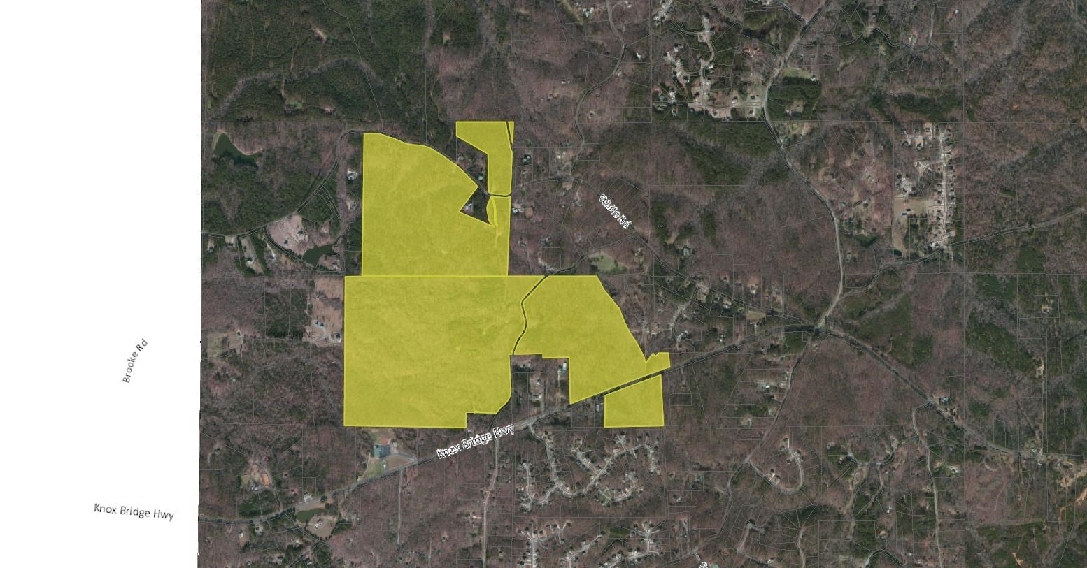
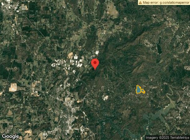
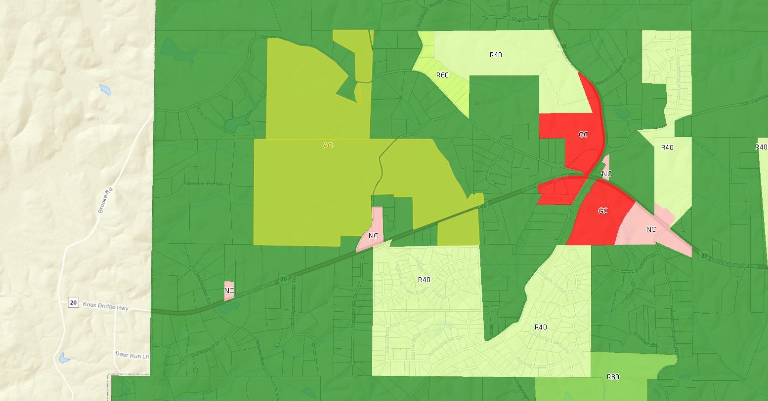
Property Record
Highway 20, White, GA 30184

NEARBY LISTINGS FOR SALE OR LEASE
Property Detail
Highway 20
022N06-00000-057-000-0000
LL 25 26 22ND D
Privatepreserveopenspacevacantlandforestlandconservation
Cherokee
X
Georgia
13057C0210E
379.14 AC
2024
Cherokee County
2024
Atlanta
960103
Atlanta-Sandy Springs-Roswell, GA
DEMOGRAPHICS near Highway 20
1 Mile
3 Mile
5 Mile
2024 Total Population
616
2,817
7,855
2029 Population
703
3,185
8,818
Pop Growth 2024-2029
+ 14.12%
+ 13.06%
+ 12.26%
Average Age
45
44
42
2024 Total Households
230
1,032
2,790
HH Growth 2024-2029
+ 14.35%
+ 13.28%
+ 12.33%
Median Household Inc
$91,826
$93,161
$98,417
Avg Household Size
2.70
2.70
2.80
2024 Avg HH Vehicles
2.00
2.00
2.00
Median Home Value
$407,500
$397,499
$344,665
Median Year Built
2003
2002
2002
Nearby Places
- Restaurants
- Banks
- Shops
- Fitness
- Groceries
SALE & LEASE HISTORY
LISTING DATE
SALE/LEASE

Jul 13, 2017
For Sale
Dec 22, 2016
For Sale
Nearby Properties
Address
Land Use
TOTAL SIZE
Lot Size
Zoning
Address
Land Use
TOTAL SIZE
Lot Size
Zoning
144,208 SF
585.38 AC
IN
Address
Land Use
TOTAL SIZE
Lot Size
Zoning
791,880 SF
77.99 AC
A1
Address
Land Use
TOTAL SIZE
Lot Size
Zoning
268,772 SF
168.31 AC
Address
Land Use
TOTAL SIZE
Lot Size
Zoning
587,459 SF
146.14 AC
A1
Address
Land Use
TOTAL SIZE
Lot Size
Zoning
972,763 SF
68.78 AC
Address
Land Use
TOTAL SIZE
Lot Size
Zoning
880,122 SF
146.14 AC
Address
Land Use
TOTAL SIZE
Lot Size
Zoning
107,992 SF
46 AC
IN
Address
Land Use
TOTAL SIZE
Lot Size
Zoning
823,607 SF
43.60 AC
A1
Address
Land Use
TOTAL SIZE
Lot Size
Zoning
311,878 SF
161.30 AC
Address
Land Use
TOTAL SIZE
Lot Size
Zoning
702,946 SF
146.14 AC
I2
Address
Land Use
TOTAL SIZE
Lot Size
Zoning
523,059 SF
72.54 AC
Address
Land Use
TOTAL SIZE
Lot Size
Zoning
288,480 SF
40.14 AC
A1
Address
Land Use
TOTAL SIZE
Lot Size
Zoning
262,316 SF
Address
Land Use
TOTAL SIZE
Lot Size
Zoning
Address
Land Use
TOTAL SIZE
Lot Size
Zoning
393,536 SF
146.14 AC
Address
Land Use
TOTAL SIZE
Lot Size
Zoning
189,430 SF
Address
Land Use
TOTAL SIZE
Lot Size
Zoning
165.60 AC
IN
Address
Land Use
TOTAL SIZE
Lot Size
Zoning
77,586 SF
4.57 AC
IN
Address
Land Use
TOTAL SIZE
Lot Size
Zoning
3,890 SF
Address
Land Use
TOTAL SIZE
Lot Size
Zoning
47,365 SF
Address
Land Use
TOTAL SIZE
Lot Size
Zoning
13,814.48 AC
Address
Land Use
TOTAL SIZE
Lot Size
Zoning
45,473 SF
31.81 AC
A1
Address
Land Use
TOTAL SIZE
Lot Size
Zoning
31,026 SF
5.47 AC
Address
Land Use
TOTAL SIZE
Lot Size
Zoning
34,000 SF
5.39 AC
IN
Address
Land Use
TOTAL SIZE
Lot Size
Zoning
80,376 SF
Address
Land Use
TOTAL SIZE
Lot Size
Zoning
57.56 AC
Address
Land Use
TOTAL SIZE
Lot Size
Zoning
37,131 SF
2.80 AC
IN
Address
Land Use
TOTAL SIZE
Lot Size
Zoning
49,800 SF
Address
Land Use
TOTAL SIZE
Lot Size
Zoning
77,036 SF
7.54 AC
A1
Address
Land Use
TOTAL SIZE
Lot Size
Zoning
8,500 SF
8.71 AC
IN
The World's #1 Commercial Real Estate Marketplace
Connect with us
© 2025 CoStar Group
The information above has been obtained from sources believed reliable. While we do not doubt its accuracy we have not verified it and make no guarantee, warranty or representation about it. It is your responsibility to independently confirm its accuracy and completeness. Any projections, opinions, assumptions, or estimates used are for example only and do not represent the current or future performance of the property. The value of this transaction to you depends on tax and other factors which should be evaluated by your tax, financial, and legal advisors. You and your advisors should conduct a careful, independent investigation of the property to determine to your satisfaction the suitability of the property for your needs.