Property Record
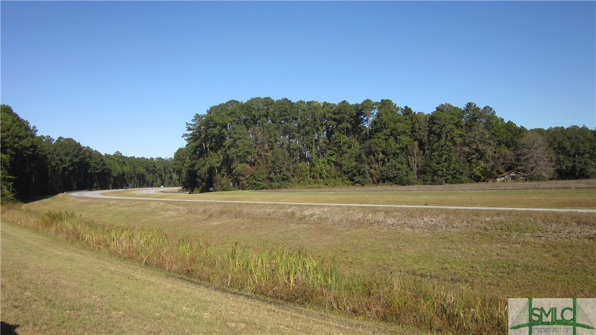
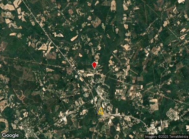
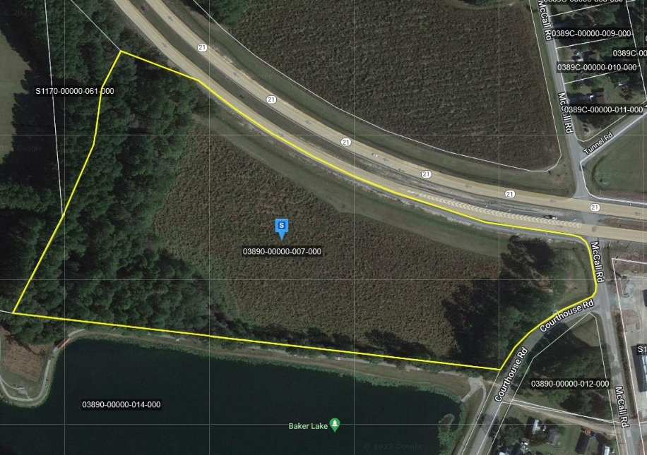
Highway 21, Springfield, GA 31329
NEARBY LISTINGS FOR SALE OR LEASE
-
-
View all Springfield listings for sale on LoopNet.com
Property Detail
Highway 21
03890-00000-007-000
23.64 AC PAR 1 (SPLT 389-7A) PLT 29/727
Agriculturalland
Effingham
X
Georgia
13103C0256E
23.64 AC
2024
Effingham County
2024
Savannah
030206
Savannah, GA
DEMOGRAPHICS near Highway 21
1 Mile
3 Mile
5 Mile
2024 Total Population
2,584
7,959
14,637
2029 Population
3,015
9,259
17,093
Pop Growth 2024-2029
+ 16.68%
+ 16.33%
+ 16.78%
Average Age
38
37
37
2024 Total Households
858
2,713
5,022
HH Growth 2024-2029
+ 16.67%
+ 16.29%
+ 16.77%
Median Household Inc
$65,678
$64,896
$71,369
Avg Household Size
2.80
2.80
2.80
2024 Avg HH Vehicles
2.00
2.00
2.00
Median Home Value
$226,211
$228,040
$224,320
Median Year Built
1998
2000
2001
Nearby Places
- Restaurants
- Banks
- Shops
- Fitness
- Groceries
PUBLIC TRANSPORTATION
AIRPORT
Savannah/Hilton Head International
DRIVE
WALK
Distance
Savannah/Hilton Head International
39 min
25.7 mi
Freight Ports
Georgia Ports - Savannah
DRIVE
WALK
Distance
Georgia Ports - Savannah
34 min
24.0 mi
SALE & LEASE HISTORY
LISTING DATE
SALE/LEASE

Mar 13, 2023
For Sale
Nearby Properties
Address
Land Use
TOTAL SIZE
Lot Size
Zoning
Address
Land Use
TOTAL SIZE
Lot Size
Zoning
6,914 SF
11.15 AC
B-1
Address
Land Use
TOTAL SIZE
Lot Size
Zoning
52,779 SF
0.82 AC
B-2
Address
Land Use
TOTAL SIZE
Lot Size
Zoning
42,403 SF
30 AC
AR-1
Address
Land Use
TOTAL SIZE
Lot Size
Zoning
10,118 SF
16.75 AC
R-3
Address
Land Use
TOTAL SIZE
Lot Size
Zoning
21,445 SF
1.60 AC
B-2
Address
Land Use
TOTAL SIZE
Lot Size
Zoning
14,472 SF
2.27 AC
B-1
Address
Land Use
TOTAL SIZE
Lot Size
Zoning
27,762 SF
1.45 AC
R-1
Address
Land Use
TOTAL SIZE
Lot Size
Zoning
17,855 SF
1.16 AC
B-2
Address
Land Use
TOTAL SIZE
Lot Size
Zoning
20,776 SF
0.92 AC
R-1
Address
Land Use
TOTAL SIZE
Lot Size
Zoning
14.57 AC
B-1
Address
Land Use
TOTAL SIZE
Lot Size
Zoning
21.20 AC
B-2
Address
Land Use
TOTAL SIZE
Lot Size
Zoning
155.21 AC
AR-1
Address
Land Use
TOTAL SIZE
Lot Size
Zoning
150.38 AC
R-6
Address
Land Use
TOTAL SIZE
Lot Size
Zoning
13,902 SF
3.85 AC
I-1
Address
Land Use
TOTAL SIZE
Lot Size
Zoning
13,036 SF
3.33 AC
B-1
Address
Land Use
TOTAL SIZE
Lot Size
Zoning
15.33 AC
R-6
Address
Land Use
TOTAL SIZE
Lot Size
Zoning
5.60 AC
AR-1
Address
Land Use
TOTAL SIZE
Lot Size
Zoning
6,916 SF
0.92 AC
B-2
Address
Land Use
TOTAL SIZE
Lot Size
Zoning
422 AC
AR-1
Address
Land Use
TOTAL SIZE
Lot Size
Zoning
195.57 AC
AR-1
Address
Land Use
TOTAL SIZE
Lot Size
Zoning
5,949 SF
3.26 AC
AR-1
Address
Land Use
TOTAL SIZE
Lot Size
Zoning
2,108 SF
2.29 AC
B-1
Address
Land Use
TOTAL SIZE
Lot Size
Zoning
287.92 AC
AR-1
Address
Land Use
TOTAL SIZE
Lot Size
Zoning
2 AC
SPLIT
Address
Land Use
TOTAL SIZE
Lot Size
Zoning
10,000 SF
0.57 AC
B-2
Address
Land Use
TOTAL SIZE
Lot Size
Zoning
7,800 SF
2.84 AC
B-2
Address
Land Use
TOTAL SIZE
Lot Size
Zoning
168.42 AC
AR-1
Address
Land Use
TOTAL SIZE
Lot Size
Zoning
362.20 AC
AR-1
Address
Land Use
TOTAL SIZE
Lot Size
Zoning
1,280 SF
427 AC
AR-1
The World's #1 Commercial Real Estate Marketplace
Connect with us
© 2025 CoStar Group
The information above has been obtained from sources believed reliable. While we do not doubt its accuracy we have not verified it and make no guarantee, warranty or representation about it. It is your responsibility to independently confirm its accuracy and completeness. Any projections, opinions, assumptions, or estimates used are for example only and do not represent the current or future performance of the property. The value of this transaction to you depends on tax and other factors which should be evaluated by your tax, financial, and legal advisors. You and your advisors should conduct a careful, independent investigation of the property to determine to your satisfaction the suitability of the property for your needs.