Property Record
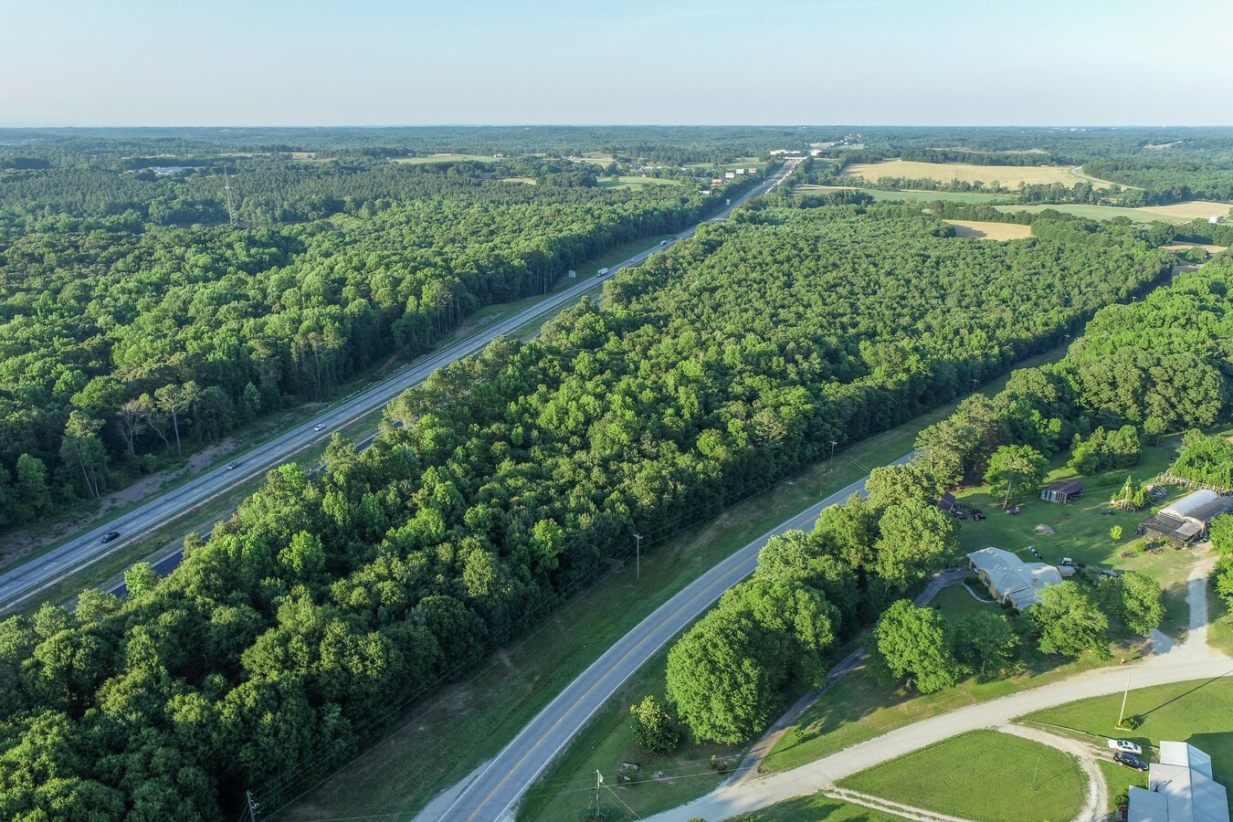
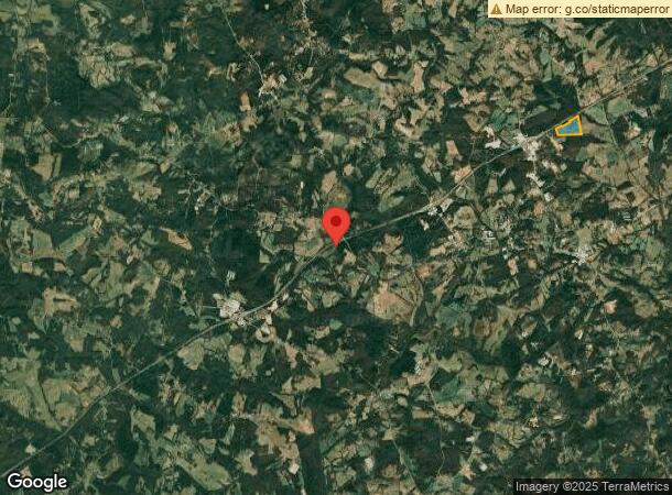
Highway 59, Carnesville, GA 30521
NEARBY LISTINGS FOR SALE OR LEASE
Property Detail
Highway 59
035-052
Acres Ga Hwy
Commercialacreage
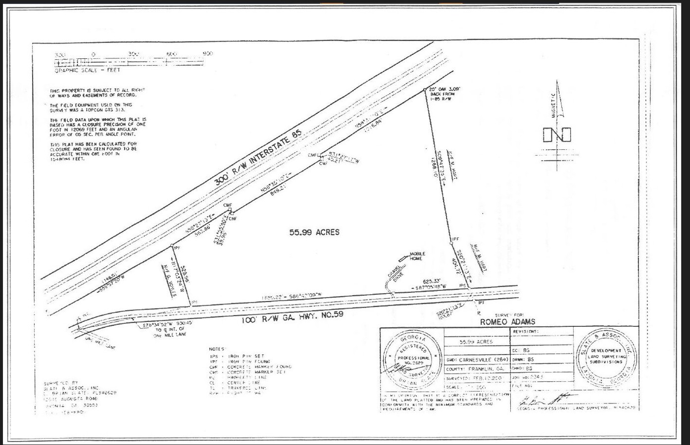
55.99 ACRES GA HWY 59
X
Franklin
13119C0115C
Georgia
2024
55.99 AC
2024
Georgia Northeast
890201
Other Market Areas
DEMOGRAPHICS near Highway 59
1 Mile
3 Mile
5 Mile
2024 Total Population
104
1,912
4,724
2029 Population
111
2,044
5,040
Pop Growth 2024-2029
+ 6.73%
+ 6.90%
+ 6.69%
Average Age
41
41
41
2024 Total Households
39
708
1,750
HH Growth 2024-2029
+ 5.13%
+ 6.64%
+ 6.46%
Median Household Inc
$46,666
$52,412
$54,358
Avg Household Size
2.50
2.60
2.60
2024 Avg HH Vehicles
2.00
3.00
3.00
Median Home Value
$105,000
$119,337
$128,803
Median Year Built
1988
1989
1990
Nearby Places
- Restaurants
- Banks
- Shops
- Fitness
- Groceries
SALE & LEASE HISTORY
LISTING DATE
SALE/LEASE

Jun 08, 2018
For Sale
Jul 06, 2020
For Sale
Nearby Properties
Address
Land Use
TOTAL SIZE
Lot Size
Zoning
Address
Land Use
TOTAL SIZE
Lot Size
Zoning
1,500 SF
31.67 AC
UNZONED RU
Address
Land Use
TOTAL SIZE
Lot Size
Zoning
66,800 SF
10 AC
UNZONED RU
Address
Land Use
TOTAL SIZE
Lot Size
Zoning
17,840 SF
36.64 AC
COMMERCIAL
Address
Land Use
TOTAL SIZE
Lot Size
Zoning
13,497 SF
32.18 AC
COMMERCIAL
Address
Land Use
TOTAL SIZE
Lot Size
Zoning
28,376 SF
30.69 AC
COMMERCIAL
Address
Land Use
TOTAL SIZE
Lot Size
Zoning
8,526 SF
20 AC
UNZONED RU
Address
Land Use
TOTAL SIZE
Lot Size
Zoning
960 SF
11.46 AC
UNZONED RU
Address
Land Use
TOTAL SIZE
Lot Size
Zoning
38.58 AC
UNZONED RU
Address
Land Use
TOTAL SIZE
Lot Size
Zoning
62.31 AC
UNZONED RU
Address
Land Use
TOTAL SIZE
Lot Size
Zoning
33.68 AC
COMMERCIAL
Address
Land Use
TOTAL SIZE
Lot Size
Zoning
304.06 AC
UNZONED RU
Address
Land Use
TOTAL SIZE
Lot Size
Zoning
5,632 SF
58.81 AC
COMMERCIAL
Address
Land Use
TOTAL SIZE
Lot Size
Zoning
32.82 AC
UNZONED RU
Address
Land Use
TOTAL SIZE
Lot Size
Zoning
1,064 SF
122.88 AC
UNZONED RU
Address
Land Use
TOTAL SIZE
Lot Size
Zoning
4,000 SF
5.94 AC
Address
Land Use
TOTAL SIZE
Lot Size
Zoning
50,000 SF
14 AC
UNZONED RU
Address
Land Use
TOTAL SIZE
Lot Size
Zoning
672 SF
5.48 AC
UNZONED RU
Address
Land Use
TOTAL SIZE
Lot Size
Zoning
304.44 AC
UNZONED RU
Address
Land Use
TOTAL SIZE
Lot Size
Zoning
1,968 SF
207.35 AC
UNZONED RU
Address
Land Use
TOTAL SIZE
Lot Size
Zoning
126.78 AC
UNZONED RU
Address
Land Use
TOTAL SIZE
Lot Size
Zoning
106.29 AC
UNZONED RU
Address
Land Use
TOTAL SIZE
Lot Size
Zoning
226.50 AC
UNZONED RU
Address
Land Use
TOTAL SIZE
Lot Size
Zoning
7,290 SF
2 AC
RESIDENTIA
Address
Land Use
TOTAL SIZE
Lot Size
Zoning
34.87 AC
UNZONED RU
Address
Land Use
TOTAL SIZE
Lot Size
Zoning
201.93 AC
UNZONED RU
Address
Land Use
TOTAL SIZE
Lot Size
Zoning
20,211 SF
4.18 AC
COMMERCIAL
Address
Land Use
TOTAL SIZE
Lot Size
Zoning
156.90 AC
UNZONED RU
Address
Land Use
TOTAL SIZE
Lot Size
Zoning
12,760 SF
RESIDENTIA
Address
Land Use
TOTAL SIZE
Lot Size
Zoning
7,324 SF
15 AC
COMMERCIAL
The World's #1 Commercial Real Estate Marketplace
Connect with us
© 2025 CoStar Group
The information above has been obtained from sources believed reliable. While we do not doubt its accuracy we have not verified it and make no guarantee, warranty or representation about it. It is your responsibility to independently confirm its accuracy and completeness. Any projections, opinions, assumptions, or estimates used are for example only and do not represent the current or future performance of the property. The value of this transaction to you depends on tax and other factors which should be evaluated by your tax, financial, and legal advisors. You and your advisors should conduct a careful, independent investigation of the property to determine to your satisfaction the suitability of the property for your needs.