Property Record
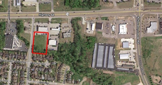
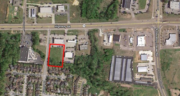
9765 Us Highway 64, Arlington, TN 38002


NEARBY LISTINGS FOR SALE OR LEASE
Property Detail
9765 Us Highway 64
09-6200-0-0156
Morning Sun Pd Phase 4 Pt Area A
Animalhospitalvet
ES MISTY BAY DR SEE MAP GRID# 103 G
X
Shelby
47157C0330G
Tennessee
2024
2.62 AC
2025
Northeast
021021
Memphis
7,700 SF
Memphis, TN-MS-AR
DEMOGRAPHICS near 9765 Us Highway 64
1 Mile
3 Mile
5 Mile
2024 Total Population
9,081
40,081
89,975
2029 Population
8,820
38,864
87,442
Pop Growth 2024-2029
(2.87%)
(3.04%)
(2.82%)
Average Age
37
38
39
2024 Total Households
3,595
15,005
34,196
HH Growth 2024-2029
(3.00%)
(3.15%)
(2.92%)
Median Household Inc
$63,239
$85,176
$83,213
Avg Household Size
2.50
2.60
2.60
2024 Avg HH Vehicles
2.00
2.00
2.00
Median Home Value
$225,036
$273,659
$263,854
Median Year Built
1998
1996
1995
Nearby Places
Map Layers
Map Styles
 Street
 Aerial
- Restaurants
- Banks
- Shops
- Fitness
- Groceries
PUBLIC TRANSPORTATION
AIRPORT
Memphis International
DRIVE
WALK
Distance
Memphis International
33 min
23.4 mi
Freight Ports
Port of Shreveport
DRIVE
WALK
Distance
Port of Shreveport
425 min
390.7 mi
SALE & LEASE HISTORY
LISTING DATE
SALE/LEASE

Sep 24, 2016
For Sale
Sep 24, 2016
For Sale
Jul 27, 2017
For Sale
Nearby Properties
Address
Land Use
TOTAL SIZE
Lot Size
Zoning
Address
Land Use
TOTAL SIZE
Lot Size
Zoning
591,149 SF
45.48 AC
CMU-3
Address
Land Use
TOTAL SIZE
Lot Size
Zoning
101,701 SF
39.63 AC
M-R
Address
Land Use
TOTAL SIZE
Lot Size
Zoning
19,050 SF
24.99 AC
R-M
Address
Land Use
TOTAL SIZE
Lot Size
Zoning
79,341 SF
31.15 AC
RU-3
Address
Land Use
TOTAL SIZE
Lot Size
Zoning
222,468 SF
37.55 AC
C-H
Address
Land Use
TOTAL SIZE
Lot Size
Zoning
86,056 SF
24.15 AC
CA
Address
Land Use
TOTAL SIZE
Lot Size
Zoning
32,171 SF
25.06 AC
CA
Address
Land Use
TOTAL SIZE
Lot Size
Zoning
38,480 SF
24.03 AC
CA
Address
Land Use
TOTAL SIZE
Lot Size
Zoning
94,022 SF
114.02 AC
C-2
Address
Land Use
TOTAL SIZE
Lot Size
Zoning
29,090 SF
22.71 AC
CA
Address
Land Use
TOTAL SIZE
Lot Size
Zoning
83,822 SF
25.27 AC
CA
Address
Land Use
TOTAL SIZE
Lot Size
Zoning
38,241 SF
3 AC
CMU-3
Address
Land Use
TOTAL SIZE
Lot Size
Zoning
61,430 SF
12.52 AC
RU-3
Address
Land Use
TOTAL SIZE
Lot Size
Zoning
211,953 SF
17.05 AC
C-H
Address
Land Use
TOTAL SIZE
Lot Size
Zoning
29,551 SF
1.89 AC
CMU-3
Address
Land Use
TOTAL SIZE
Lot Size
Zoning
177,324 SF
14.11 AC
RU-3
Address
Land Use
TOTAL SIZE
Lot Size
Zoning
69,158 SF
3.03 AC
CMU-3
Address
Land Use
TOTAL SIZE
Lot Size
Zoning
36,966 SF
16.83 AC
CA
Address
Land Use
TOTAL SIZE
Lot Size
Zoning
29,090 SF
11.51 AC
CA
Address
Land Use
TOTAL SIZE
Lot Size
Zoning
50,486 SF
10 AC
C-H
Address
Land Use
TOTAL SIZE
Lot Size
Zoning
131,470 SF
18.30 AC
C-H
Address
Land Use
TOTAL SIZE
Lot Size
Zoning
106,290 SF
12.08 AC
CMU-2
Address
Land Use
TOTAL SIZE
Lot Size
Zoning
20,056 SF
20.76 AC
R-E
Address
Land Use
TOTAL SIZE
Lot Size
Zoning
20.36 AC
RU-3
Address
Land Use
TOTAL SIZE
Lot Size
Zoning
8 AC
CMU-2
Address
Land Use
TOTAL SIZE
Lot Size
Zoning
71,197 SF
6.93 AC
C-2
Address
Land Use
TOTAL SIZE
Lot Size
Zoning
262,810 SF
11.16 AC
CMU-2
Address
Land Use
TOTAL SIZE
Lot Size
Zoning
149.79 AC
CA
Address
Land Use
TOTAL SIZE
Lot Size
Zoning
98,666 SF
5.71 AC
RU-3
Address
Land Use
TOTAL SIZE
Lot Size
Zoning
42,954 SF
8.01 AC
C-H
The World's #1 Commercial Real Estate Marketplace
Connect with us
© 2025 CoStar Group
The information above has been obtained from sources believed reliable. While we do not doubt its accuracy we have not verified it and make no guarantee, warranty or representation about it. It is your responsibility to independently confirm its accuracy and completeness. Any projections, opinions, assumptions, or estimates used are for example only and do not represent the current or future performance of the property. The value of this transaction to you depends on tax and other factors which should be evaluated by your tax, financial, and legal advisors. You and your advisors should conduct a careful, independent investigation of the property to determine to your satisfaction the suitability of the property for your needs.