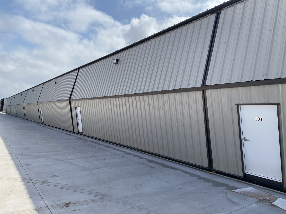
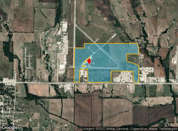
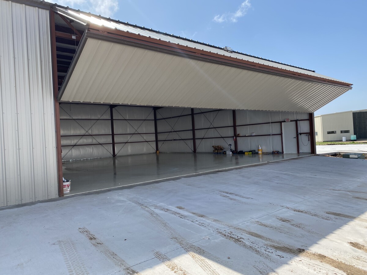
Property Record
Highway 82, Gainesville, TX 76240
NEARBY LISTINGS FOR SALE OR LEASE
-
-
View all Gainesville listings for sale on LoopNet.com
Property Detail
Highway 82
Gainesville, TX
Wingate E
25252
WINGATE E 1149 ACRES 364.4 AIRPORT AIRPORT
Taxexempt
Cooke
X
Texas
48097C0300C
364.40 AC
2023
Texas East Area
2024
Other Market Areas
000600
DEMOGRAPHICS near Highway 82
1 Mile
3 Mile
5 Mile
2024 Total Population
51
5,254
20,794
2029 Population
55
5,645
22,458
Pop Growth 2024-2029
+ 7.84%
+ 7.44%
+ 8.00%
Average Age
38
37
37
2024 Total Households
16
1,782
7,648
HH Growth 2024-2029
+ 6.25%
+ 7.74%
+ 8.25%
Median Household Inc
$49,999
$46,549
$47,670
Avg Household Size
2.30
2.70
2.60
2024 Avg HH Vehicles
2.00
2.00
2.00
Median Home Value
$166,666
$176,785
$135,147
Median Year Built
1989
1980
1971
Nearby Places
- Restaurants
- Banks
- Shops
- Fitness
- Groceries
PUBLIC TRANSPORTATION
COMMUTER RAIL
Gainesville Amtrak Station (Heartland Flyer - Amtrak)
DRIVE
WALK
Distance
Gainesville Amtrak Station (Heartland Flyer - Amtrak)
7 min
4.5 mi
Freight Ports
Tulsa Port of Inola
DRIVE
WALK
Distance
Tulsa Port of Inola
280 min
244.9 mi
SALE & LEASE HISTORY
LISTING DATE
SALE/LEASE

Nov 26, 2022
For Sale
Nearby Properties
Address
Land Use
TOTAL SIZE
Lot Size
Zoning
Address
Land Use
TOTAL SIZE
Lot Size
Zoning
78,598 SF
2.90 AC
Address
Land Use
TOTAL SIZE
Lot Size
Zoning
133,708 SF
47.68 AC
Address
Land Use
TOTAL SIZE
Lot Size
Zoning
58,770 SF
26.40 AC
Address
Land Use
TOTAL SIZE
Lot Size
Zoning
46,927 SF
2.50 AC
Address
Land Use
TOTAL SIZE
Lot Size
Zoning
116,474 SF
10.60 AC
Address
Land Use
TOTAL SIZE
Lot Size
Zoning
20,818 SF
3.92 AC
Address
Land Use
TOTAL SIZE
Lot Size
Zoning
346,704 SF
16.15 AC
Address
Land Use
TOTAL SIZE
Lot Size
Zoning
41,472 SF
1.67 AC
Address
Land Use
TOTAL SIZE
Lot Size
Zoning
126,570 SF
27.93 AC
Address
Land Use
TOTAL SIZE
Lot Size
Zoning
201,950 SF
20 AC
Address
Land Use
TOTAL SIZE
Lot Size
Zoning
60,254 SF
1.76 AC
Address
Land Use
TOTAL SIZE
Lot Size
Zoning
18,082 SF
6.81 AC
Address
Land Use
TOTAL SIZE
Lot Size
Zoning
112,412 SF
20 AC
Address
Land Use
TOTAL SIZE
Lot Size
Zoning
70,076 SF
19.20 AC
Address
Land Use
TOTAL SIZE
Lot Size
Zoning
14,400 SF
2.66 AC
Address
Land Use
TOTAL SIZE
Lot Size
Zoning
375.74 AC
Address
Land Use
TOTAL SIZE
Lot Size
Zoning
136,488 SF
30 AC
Address
Land Use
TOTAL SIZE
Lot Size
Zoning
181,282 SF
25 AC
Address
Land Use
TOTAL SIZE
Lot Size
Zoning
11,880 SF
3 AC
Address
Land Use
TOTAL SIZE
Lot Size
Zoning
76,290 SF
48.27 AC
Address
Land Use
TOTAL SIZE
Lot Size
Zoning
58,100 SF
26.05 AC
Address
Land Use
TOTAL SIZE
Lot Size
Zoning
30,256 SF
1.73 AC
Address
Land Use
TOTAL SIZE
Lot Size
Zoning
189,300 SF
8.12 AC
Address
Land Use
TOTAL SIZE
Lot Size
Zoning
34,503 SF
2.27 AC
Address
Land Use
TOTAL SIZE
Lot Size
Zoning
8,700 SF
3.71 AC
Address
Land Use
TOTAL SIZE
Lot Size
Zoning
80,390 SF
15.50 AC
Address
Land Use
TOTAL SIZE
Lot Size
Zoning
2,160 SF
19.84 AC
Address
Land Use
TOTAL SIZE
Lot Size
Zoning
23,590 SF
2.18 AC
Address
Land Use
TOTAL SIZE
Lot Size
Zoning
2,376 SF
13.74 AC
The World's #1 Commercial Real Estate Marketplace
Connect with us
© 2025 CoStar Group
The information above has been obtained from sources believed reliable. While we do not doubt its accuracy we have not verified it and make no guarantee, warranty or representation about it. It is your responsibility to independently confirm its accuracy and completeness. Any projections, opinions, assumptions, or estimates used are for example only and do not represent the current or future performance of the property. The value of this transaction to you depends on tax and other factors which should be evaluated by your tax, financial, and legal advisors. You and your advisors should conduct a careful, independent investigation of the property to determine to your satisfaction the suitability of the property for your needs.