Property Record
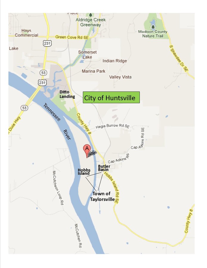
270 State Docks Rd Se, Huntsville, AL 35803

NEARBY LISTINGS FOR SALE OR LEASE
Property Detail
270 State Docks Rd Se
23-09-29-0-000-001.000
ALL THOSE PARTS OF SEC 29 & 32 & OF SEC 5 KNOWN AS HOBBS ISLAND PARTIC DESC AS BEG AT THE PT IN THE N LINE OF SD SEC 5 BEING
Vacantlandnec
Madison
AE
Alabama
01089C0458G
39 AC
2024
South Madison County
2024
Huntsville
002924
Huntsville, AL
DEMOGRAPHICS near 270 State Docks Rd Se
1 Mile
3 Mile
5 Mile
2024 Total Population
461
3,172
23,752
2029 Population
500
3,424
25,930
Pop Growth 2024-2029
+ 8.46%
+ 7.94%
+ 9.17%
Average Age
43
43
42
2024 Total Households
186
1,260
9,602
HH Growth 2024-2029
+ 8.06%
+ 8.10%
+ 9.50%
Median Household Inc
$87,500
$90,322
$92,282
Avg Household Size
2.50
2.50
2.40
2024 Avg HH Vehicles
3.00
3.00
2.00
Median Home Value
$277,777
$306,431
$256,434
Median Year Built
1992
1995
1991
Nearby Places
- Restaurants
- Banks
- Shops
- Fitness
- Groceries
PUBLIC TRANSPORTATION
AIRPORT
Huntsville International-Carl T Jones Field
DRIVE
WALK
Distance
Huntsville International-Carl T Jones Field
38 min
24.5 mi
Freight Ports
Port of Mobile
DRIVE
WALK
Distance
Port of Mobile
396 min
350.7 mi
SALE & LEASE HISTORY
LISTING DATE
SALE/LEASE

Sep 24, 2016
For Sale
Nearby Properties
Address
Land Use
TOTAL SIZE
Lot Size
Zoning
Address
Land Use
TOTAL SIZE
Lot Size
Zoning
63,237 SF
10.99 AC
Address
Land Use
TOTAL SIZE
Lot Size
Zoning
83,720 SF
109 AC
Address
Land Use
TOTAL SIZE
Lot Size
Zoning
1,351 SF
9.50 AC
Address
Land Use
TOTAL SIZE
Lot Size
Zoning
3,130 SF
11.18 AC
Address
Land Use
TOTAL SIZE
Lot Size
Zoning
43,168 SF
23 AC
Address
Land Use
TOTAL SIZE
Lot Size
Zoning
84,320 SF
7.73 AC
Address
Land Use
TOTAL SIZE
Lot Size
Zoning
10,836 SF
10 AC
Address
Land Use
TOTAL SIZE
Lot Size
Zoning
8,190 SF
18.58 AC
Address
Land Use
TOTAL SIZE
Lot Size
Zoning
24,800 SF
4.90 AC
Address
Land Use
TOTAL SIZE
Lot Size
Zoning
4,210 SF
71.20 AC
Address
Land Use
TOTAL SIZE
Lot Size
Zoning
16,260 SF
4.10 AC
Address
Land Use
TOTAL SIZE
Lot Size
Zoning
35.22 AC
Address
Land Use
TOTAL SIZE
Lot Size
Zoning
Address
Land Use
TOTAL SIZE
Lot Size
Zoning
Address
Land Use
TOTAL SIZE
Lot Size
Zoning
Address
Land Use
TOTAL SIZE
Lot Size
Zoning
2,480 SF
14.70 AC
Address
Land Use
TOTAL SIZE
Lot Size
Zoning
16,980 SF
2.07 AC
Address
Land Use
TOTAL SIZE
Lot Size
Zoning
Address
Land Use
TOTAL SIZE
Lot Size
Zoning
2,056 SF
3.06 AC
Address
Land Use
TOTAL SIZE
Lot Size
Zoning
8,334 SF
4.67 AC
Address
Land Use
TOTAL SIZE
Lot Size
Zoning
10,500 SF
10 AC
Address
Land Use
TOTAL SIZE
Lot Size
Zoning
54,909 SF
10.40 AC
Address
Land Use
TOTAL SIZE
Lot Size
Zoning
7,250 SF
11 AC
Address
Land Use
TOTAL SIZE
Lot Size
Zoning
Address
Land Use
TOTAL SIZE
Lot Size
Zoning
31,043 SF
2.58 AC
Address
Land Use
TOTAL SIZE
Lot Size
Zoning
2,500 SF
0.49 AC
Address
Land Use
TOTAL SIZE
Lot Size
Zoning
72.23 AC
Address
Land Use
TOTAL SIZE
Lot Size
Zoning
1,700 SF
1.39 AC
Address
Land Use
TOTAL SIZE
Lot Size
Zoning
Address
Land Use
TOTAL SIZE
Lot Size
Zoning
9,000 SF
2.40 AC
The World's #1 Commercial Real Estate Marketplace
Connect with us
© 2025 CoStar Group
The information above has been obtained from sources believed reliable. While we do not doubt its accuracy we have not verified it and make no guarantee, warranty or representation about it. It is your responsibility to independently confirm its accuracy and completeness. Any projections, opinions, assumptions, or estimates used are for example only and do not represent the current or future performance of the property. The value of this transaction to you depends on tax and other factors which should be evaluated by your tax, financial, and legal advisors. You and your advisors should conduct a careful, independent investigation of the property to determine to your satisfaction the suitability of the property for your needs.