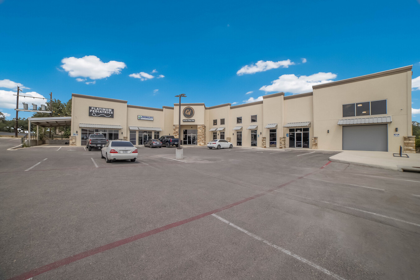
Property Record
Interstate 10, Spring Branch, TX 78070
NEARBY LISTINGS FOR SALE OR LEASE
-
-
View all Spring Branch listings for lease on LoopNet.com
Property Detail
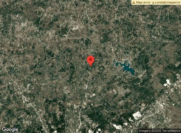
Interstate 10
San Antonio-New Braunfels, TX
Country Village
61387
COUNTRY VILLAGE LOT 4, .94 ACRES
Commercialbuilding
Kendall
X
Texas
48259C0415F
4
2023
0.94 AC
2024
Kendall County
310610
San Antonio
14,306 SF
DEMOGRAPHICS near Interstate 10
1 Mile
3 Mile
5 Mile
2024 Total Population
5,056
27,421
35,089
2029 Population
6,356
34,467
43,806
Pop Growth 2024-2029
+ 25.71%
+ 25.70%
+ 24.84%
Average Age
42
41
42
2024 Total Households
1,992
10,153
13,000
HH Growth 2024-2029
+ 26.05%
+ 26.11%
+ 25.32%
Median Household Inc
$64,529
$90,190
$96,631
Avg Household Size
2.50
2.60
2.60
2024 Avg HH Vehicles
2.00
2.00
2.00
Median Home Value
$352,531
$388,631
$416,229
Median Year Built
2004
2004
2004
Nearby Places
- Restaurants
- Banks
- Shops
- Fitness
- Groceries
PUBLIC TRANSPORTATION
AIRPORT
San Antonio International
DRIVE
WALK
Distance
San Antonio International
34 min
27.7 mi
Freight Ports
Calhoun Port
DRIVE
WALK
Distance
Calhoun Port
208 min
170.3 mi
SALE & LEASE HISTORY
LISTING DATE
SALE/LEASE

Sep 06, 2023
For Sale
Oct 12, 2021
For Lease
Nov 30, 2023
For Lease
May 07, 2024
For Lease
Jul 20, 2021
For Lease
Dec 08, 2019
For Lease
Nearby Properties
Address
Land Use
TOTAL SIZE
Lot Size
Zoning
Address
Land Use
TOTAL SIZE
Lot Size
Zoning
304.30 AC
Address
Land Use
TOTAL SIZE
Lot Size
Zoning
256.40 AC
Address
Land Use
TOTAL SIZE
Lot Size
Zoning
266.79 AC
Address
Land Use
TOTAL SIZE
Lot Size
Zoning
17,400 SF
3.76 AC
Address
Land Use
TOTAL SIZE
Lot Size
Zoning
21,786 SF
122.24 AC
Address
Land Use
TOTAL SIZE
Lot Size
Zoning
7,148 SF
21.01 AC
Address
Land Use
TOTAL SIZE
Lot Size
Zoning
194.26 AC
Address
Land Use
TOTAL SIZE
Lot Size
Zoning
194.26 AC
Address
Land Use
TOTAL SIZE
Lot Size
Zoning
174.90 AC
Address
Land Use
TOTAL SIZE
Lot Size
Zoning
5,288 SF
133.02 AC
Address
Land Use
TOTAL SIZE
Lot Size
Zoning
180 SF
2.24 AC
Address
Land Use
TOTAL SIZE
Lot Size
Zoning
3,584 SF
10.54 AC
Address
Land Use
TOTAL SIZE
Lot Size
Zoning
40.32 AC
Address
Land Use
TOTAL SIZE
Lot Size
Zoning
21,200 SF
15.54 AC
Address
Land Use
TOTAL SIZE
Lot Size
Zoning
Address
Land Use
TOTAL SIZE
Lot Size
Zoning
5,118 SF
2.93 AC
Address
Land Use
TOTAL SIZE
Lot Size
Zoning
8,329 SF
2.94 AC
Address
Land Use
TOTAL SIZE
Lot Size
Zoning
126.43 AC
Address
Land Use
TOTAL SIZE
Lot Size
Zoning
Address
Land Use
TOTAL SIZE
Lot Size
Zoning
8,357 SF
15.47 AC
Address
Land Use
TOTAL SIZE
Lot Size
Zoning
16,123 SF
1.79 AC
Address
Land Use
TOTAL SIZE
Lot Size
Zoning
Address
Land Use
TOTAL SIZE
Lot Size
Zoning
10,186 SF
3 AC
Address
Land Use
TOTAL SIZE
Lot Size
Zoning
113.02 AC
Address
Land Use
TOTAL SIZE
Lot Size
Zoning
20.76 AC
Address
Land Use
TOTAL SIZE
Lot Size
Zoning
8,688 SF
46.44 AC
Address
Land Use
TOTAL SIZE
Lot Size
Zoning
8,216 SF
3.47 AC
Address
Land Use
TOTAL SIZE
Lot Size
Zoning
Address
Land Use
TOTAL SIZE
Lot Size
Zoning
The World's #1 Commercial Real Estate Marketplace
Connect with us
© 2025 CoStar Group
The information above has been obtained from sources believed reliable. While we do not doubt its accuracy we have not verified it and make no guarantee, warranty or representation about it. It is your responsibility to independently confirm its accuracy and completeness. Any projections, opinions, assumptions, or estimates used are for example only and do not represent the current or future performance of the property. The value of this transaction to you depends on tax and other factors which should be evaluated by your tax, financial, and legal advisors. You and your advisors should conduct a careful, independent investigation of the property to determine to your satisfaction the suitability of the property for your needs.