Property Record
Bethsaida Rd, South Fulton, GA


NEARBY LISTINGS FOR SALE OR LEASE
Property Detail
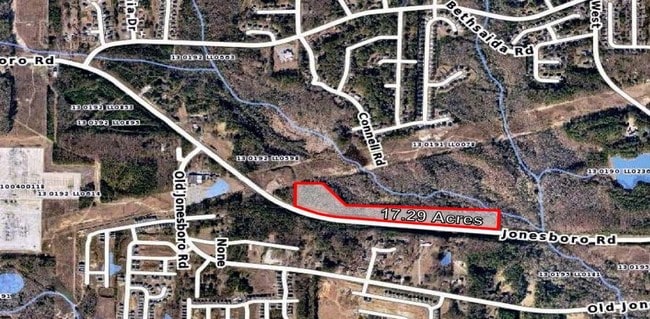
Bethsaida Rd
13-0191-LL-006-0
AN SPLIT FROM 003-7 VAC LAND 1/07
Residentialacreage
Fulton
AE
Georgia
13121C0490F
12.56 AC
2024
North Clayton/Airport
2025
Atlanta
010537
Atlanta-Sandy Springs-Roswell, GA
DEMOGRAPHICS near Bethsaida Rd
1 Mile
3 Mile
5 Mile
2024 Total Population
4,393
42,748
128,733
2029 Population
4,538
44,165
132,535
Pop Growth 2024-2029
+ 3.30%
+ 3.31%
+ 2.95%
Average Age
36
39
37
2024 Total Households
1,544
15,600
47,585
HH Growth 2024-2029
+ 3.43%
+ 3.50%
+ 2.98%
Median Household Inc
$78,696
$67,516
$57,742
Avg Household Size
2.80
2.70
2.60
2024 Avg HH Vehicles
2.00
2.00
2.00
Median Home Value
$204,102
$195,160
$182,886
Median Year Built
2000
1994
1992
Nearby Places
Map Layers
Map Styles
 Street
 Aerial
- Restaurants
- Banks
- Shops
- Fitness
- Groceries
PUBLIC TRANSPORTATION
AIRPORT
Hartsfield - Jackson Atlanta International
DRIVE
WALK
Distance
Hartsfield - Jackson Atlanta International
21 min
11.7 mi
Freight Ports
Georgia Ports - Savannah
DRIVE
WALK
Distance
Georgia Ports - Savannah
275 min
243.3 mi
SALE & LEASE HISTORY
LISTING DATE
SALE/LEASE

Sep 24, 2016
For Sale
Feb 01, 2018
For Sale
Dec 08, 2016
For Sale
Dec 07, 2016
For Sale
Nearby Properties
Address
Land Use
TOTAL SIZE
Lot Size
Zoning
Address
Land Use
TOTAL SIZE
Lot Size
Zoning
992,870 SF
59.71 AC
M1
Address
Land Use
TOTAL SIZE
Lot Size
Zoning
1,020,000 SF
59.94 AC
Address
Land Use
TOTAL SIZE
Lot Size
Zoning
1,026,040 SF
72.52 AC
M1
Address
Land Use
TOTAL SIZE
Lot Size
Zoning
948,900 SF
16.24 AC
RM
Address
Land Use
TOTAL SIZE
Lot Size
Zoning
744,000 SF
60.69 AC
GC
Address
Land Use
TOTAL SIZE
Lot Size
Zoning
85,347 SF
49.56 AC
AG1
Address
Land Use
TOTAL SIZE
Lot Size
Zoning
3,904,656 SF
30.58 AC
RM
Address
Land Use
TOTAL SIZE
Lot Size
Zoning
606,450 SF
34.63 AC
M1
Address
Land Use
TOTAL SIZE
Lot Size
Zoning
358,011 SF
60.44 AC
AG1
Address
Land Use
TOTAL SIZE
Lot Size
Zoning
247,088 SF
20.90 AC
Address
Land Use
TOTAL SIZE
Lot Size
Zoning
1,053,234 SF
14.47 AC
RM
Address
Land Use
TOTAL SIZE
Lot Size
Zoning
234,763 SF
22.43 AC
OI
Address
Land Use
TOTAL SIZE
Lot Size
Zoning
1,466,922 SF
21.58 AC
C1
Address
Land Use
TOTAL SIZE
Lot Size
Zoning
147,540 SF
47.10 AC
C RP
Address
Land Use
TOTAL SIZE
Lot Size
Zoning
375,700 SF
19.72 AC
M1
Address
Land Use
TOTAL SIZE
Lot Size
Zoning
64,075 SF
2.88 AC
RM
Address
Land Use
TOTAL SIZE
Lot Size
Zoning
312,240 SF
38.93 AC
MIA
Address
Land Use
TOTAL SIZE
Lot Size
Zoning
146,522 SF
22.04 AC
AG1
Address
Land Use
TOTAL SIZE
Lot Size
Zoning
369,000 SF
43.81 AC
AC
Address
Land Use
TOTAL SIZE
Lot Size
Zoning
350,434 SF
23.62 AC
M1
Address
Land Use
TOTAL SIZE
Lot Size
Zoning
257,723 SF
28.76 AC
C1
Address
Land Use
TOTAL SIZE
Lot Size
Zoning
59,778 SF
4.74 AC
RM
Address
Land Use
TOTAL SIZE
Lot Size
Zoning
356,885 SF
16.45 AC
M1
Address
Land Use
TOTAL SIZE
Lot Size
Zoning
760,578 SF
37.72 AC
RM
Address
Land Use
TOTAL SIZE
Lot Size
Zoning
102,992 SF
8.49 AC
GC
Address
Land Use
TOTAL SIZE
Lot Size
Zoning
316,680 SF
23.35 AC
M1
Address
Land Use
TOTAL SIZE
Lot Size
Zoning
359,498 SF
14.76 AC
M2
Address
Land Use
TOTAL SIZE
Lot Size
Zoning
782,860 SF
15.47 AC
RM
Address
Land Use
TOTAL SIZE
Lot Size
Zoning
311,703 SF
15.01 AC
M1
Address
Land Use
TOTAL SIZE
Lot Size
Zoning
288,861 SF
12.59 AC
M2
The World's #1 Commercial Real Estate Marketplace
Connect with us
© 2026 CoStar Group
The information above has been obtained from sources believed reliable. While we do not doubt its accuracy we have not verified it and make no guarantee, warranty or representation about it. It is your responsibility to independently confirm its accuracy and completeness. Any projections, opinions, assumptions, or estimates used are for example only and do not represent the current or future performance of the property. The value of this transaction to you depends on tax and other factors which should be evaluated by your tax, financial, and legal advisors. You and your advisors should conduct a careful, independent investigation of the property to determine to your satisfaction the suitability of the property for your needs.