Property Record
Lake Ariel Hwy, Honesdale, PA 18431
NEARBY LISTINGS FOR SALE OR LEASE
Property Detail
Lake Ariel Hwy
052317
Map Three Showing Part Of Lands William
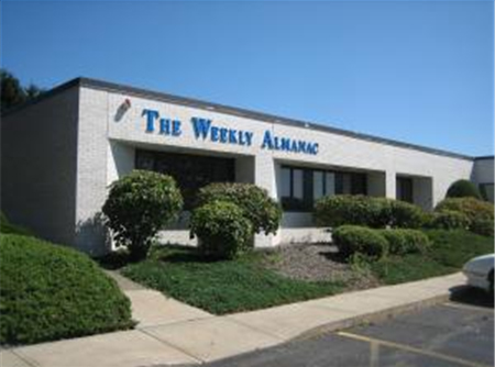
Professionalbldglegalinsurancerealestateetc
LOT 304
X
Wayne
42127C0292D
Pennsylvania
2023
304
2023
1.44 AC
960700
Other Market Areas
DEMOGRAPHICS near Lake Ariel Hwy
1 Mile
3 Mile
5 Mile
2024 Total Population
370
5,470
9,435
2029 Population
359
5,311
9,253
Pop Growth 2024-2029
(2.97%)
(2.91%)
(1.93%)
Average Age
43
43
44
2024 Total Households
153
2,434
4,008
HH Growth 2024-2029
(3.27%)
(3.12%)
(2.17%)
Median Household Inc
$61,250
$48,610
$50,559
Avg Household Size
2.30
2.20
2.20
2024 Avg HH Vehicles
2.00
2.00
2.00
Median Home Value
$226,316
$177,950
$194,808
Median Year Built
1978
1964
1969
Nearby Places
- Restaurants
- Banks
- Shops
- Fitness
- Groceries
PUBLIC TRANSPORTATION
AIRPORT
Wilkes-Barre/Scranton International
DRIVE
WALK
Distance
Wilkes-Barre/Scranton International
59 min
37.4 mi
Freight Ports
Maher Terminal
DRIVE
WALK
Distance
Maher Terminal
154 min
98.3 mi
Nearby Properties
Address
Land Use
TOTAL SIZE
Lot Size
Zoning
Address
Land Use
TOTAL SIZE
Lot Size
Zoning
5.43 AC
Address
Land Use
TOTAL SIZE
Lot Size
Zoning
4.32 AC
Address
Land Use
TOTAL SIZE
Lot Size
Zoning
35.70 AC
R1
Address
Land Use
TOTAL SIZE
Lot Size
Zoning
121.65 AC
RU
Address
Land Use
TOTAL SIZE
Lot Size
Zoning
21.08 AC
ID
Address
Land Use
TOTAL SIZE
Lot Size
Zoning
2.05 AC
R5
Address
Land Use
TOTAL SIZE
Lot Size
Zoning
25.67 AC
C2
Address
Land Use
TOTAL SIZE
Lot Size
Zoning
12.50 AC
C2
Address
Land Use
TOTAL SIZE
Lot Size
Zoning
0.42 AC
C1
Address
Land Use
TOTAL SIZE
Lot Size
Zoning
23.84 AC
C2
Address
Land Use
TOTAL SIZE
Lot Size
Zoning
400 SF
14.90 AC
C2
Address
Land Use
TOTAL SIZE
Lot Size
Zoning
8.73 AC
R6
Address
Land Use
TOTAL SIZE
Lot Size
Zoning
20.99 AC
C2
Address
Land Use
TOTAL SIZE
Lot Size
Zoning
3.50 AC
C2
Address
Land Use
TOTAL SIZE
Lot Size
Zoning
2.37 AC
R-3
Address
Land Use
TOTAL SIZE
Lot Size
Zoning
13.50 AC
C2
Address
Land Use
TOTAL SIZE
Lot Size
Zoning
0.46 AC
C1
Address
Land Use
TOTAL SIZE
Lot Size
Zoning
1,254 SF
6.17 AC
C2
Address
Land Use
TOTAL SIZE
Lot Size
Zoning
0.42 AC
C1
Address
Land Use
TOTAL SIZE
Lot Size
Zoning
10.53 AC
ID
Address
Land Use
TOTAL SIZE
Lot Size
Zoning
0.63 AC
R-5
Address
Land Use
TOTAL SIZE
Lot Size
Zoning
8.22 AC
ID
Address
Land Use
TOTAL SIZE
Lot Size
Zoning
2.62 AC
C2
Address
Land Use
TOTAL SIZE
Lot Size
Zoning
0.98 AC
R5
Address
Land Use
TOTAL SIZE
Lot Size
Zoning
4.03 AC
C2
Address
Land Use
TOTAL SIZE
Lot Size
Zoning
1.82 AC
C2
Address
Land Use
TOTAL SIZE
Lot Size
Zoning
1.79 AC
ID
Address
Land Use
TOTAL SIZE
Lot Size
Zoning
0.52 AC
R5
Address
Land Use
TOTAL SIZE
Lot Size
Zoning
2,184 SF
16.22 AC
R3
Address
Land Use
TOTAL SIZE
Lot Size
Zoning
1,560 SF
1.89 AC
R6
The World's #1 Commercial Real Estate Marketplace
Connect with us
© 2025 CoStar Group
The information above has been obtained from sources believed reliable. While we do not doubt its accuracy we have not verified it and make no guarantee, warranty or representation about it. It is your responsibility to independently confirm its accuracy and completeness. Any projections, opinions, assumptions, or estimates used are for example only and do not represent the current or future performance of the property. The value of this transaction to you depends on tax and other factors which should be evaluated by your tax, financial, and legal advisors. You and your advisors should conduct a careful, independent investigation of the property to determine to your satisfaction the suitability of the property for your needs.