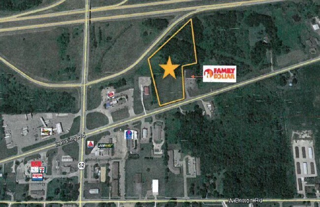
Property Record
Lansing Rd, Perry, MI 48872


NEARBY LISTINGS FOR SALE OR LEASE
-
-
View all Perry listings for sale on LoopNet.com
Property Detail
Lansing Rd
024-58-006-000
CITY OF PERRY SEC 10, T5N, R2E COM AT SW COR OF SEC, N0214'53!W 780.80 FT, N7137'34!E 834.40 FT TO PT OF BEG, N0240'35!W 536.
Commercialacreage
Shiawassee
X
Michigan
26155C0350C
7.41 AC
2025
Lansing/East Lansing
2025
Other Market Areas
031501
Owosso, MI
DEMOGRAPHICS near Lansing Rd
1 Mile
3 Mile
5 Mile
2024 Total Population
1,610
5,808
10,475
2029 Population
1,614
5,833
10,443
Pop Growth 2024-2029
+ 0.25%
+ 0.43%
(0.31%)
Average Age
41
40
41
2024 Total Households
627
2,218
4,001
HH Growth 2024-2029
+ 0.32%
+ 0.27%
(0.42%)
Median Household Inc
$52,127
$61,681
$68,856
Avg Household Size
2.50
2.60
2.60
2024 Avg HH Vehicles
2.00
2.00
2.00
Median Home Value
$149,442
$160,539
$176,395
Median Year Built
1971
1979
1978
Nearby Places
Map Layers
Map Styles
 Street
 Aerial
- Restaurants
- Banks
- Shops
- Fitness
- Groceries
PUBLIC TRANSPORTATION
AIRPORT
Bishop International
DRIVE
WALK
Distance
Bishop International
40 min
29.3 mi
Capital Region International
DRIVE
WALK
Distance
Capital Region International
47 min
41.0 mi
Freight Ports
Port of Toledo
DRIVE
WALK
Distance
Port of Toledo
157 min
138.2 mi
SALE & LEASE HISTORY
LISTING DATE
SALE/LEASE

Sep 15, 2023
For Sale
Dec 05, 2016
For Sale
Aug 05, 2022
For Sale
Nearby Properties
Address
Land Use
TOTAL SIZE
Lot Size
Zoning
Address
Land Use
TOTAL SIZE
Lot Size
Zoning
120 AC
Address
Land Use
TOTAL SIZE
Lot Size
Zoning
45,000 SF
1.70 AC
B-2
Address
Land Use
TOTAL SIZE
Lot Size
Zoning
198 AC
Address
Land Use
TOTAL SIZE
Lot Size
Zoning
2.06 AC
Address
Land Use
TOTAL SIZE
Lot Size
Zoning
5,264 SF
1 AC
Address
Land Use
TOTAL SIZE
Lot Size
Zoning
6.50 AC
Address
Land Use
TOTAL SIZE
Lot Size
Zoning
7,286 SF
8 AC
Address
Land Use
TOTAL SIZE
Lot Size
Zoning
2.24 AC
Address
Land Use
TOTAL SIZE
Lot Size
Zoning
4.66 AC
Address
Land Use
TOTAL SIZE
Lot Size
Zoning
4.69 AC
Address
Land Use
TOTAL SIZE
Lot Size
Zoning
18.30 AC
Address
Land Use
TOTAL SIZE
Lot Size
Zoning
5.10 AC
Address
Land Use
TOTAL SIZE
Lot Size
Zoning
15,992 SF
1.38 AC
R-M
Address
Land Use
TOTAL SIZE
Lot Size
Zoning
1.20 AC
Address
Land Use
TOTAL SIZE
Lot Size
Zoning
5.60 AC
Address
Land Use
TOTAL SIZE
Lot Size
Zoning
Address
Land Use
TOTAL SIZE
Lot Size
Zoning
7,788 SF
1.84 AC
R-M
Address
Land Use
TOTAL SIZE
Lot Size
Zoning
8,836 SF
1.90 AC
Address
Land Use
TOTAL SIZE
Lot Size
Zoning
1.60 AC
Address
Land Use
TOTAL SIZE
Lot Size
Zoning
Address
Land Use
TOTAL SIZE
Lot Size
Zoning
Address
Land Use
TOTAL SIZE
Lot Size
Zoning
9,600 SF
1.26 AC
Address
Land Use
TOTAL SIZE
Lot Size
Zoning
24,658 SF
1.86 AC
Address
Land Use
TOTAL SIZE
Lot Size
Zoning
Address
Land Use
TOTAL SIZE
Lot Size
Zoning
195.68 AC
Address
Land Use
TOTAL SIZE
Lot Size
Zoning
3,476 SF
2.95 AC
Address
Land Use
TOTAL SIZE
Lot Size
Zoning
56.20 AC
Address
Land Use
TOTAL SIZE
Lot Size
Zoning
Address
Land Use
TOTAL SIZE
Lot Size
Zoning
98 AC
Address
Land Use
TOTAL SIZE
Lot Size
Zoning
98.40 AC
The World's #1 Commercial Real Estate Marketplace
Connect with us
© 2025 CoStar Group
The information above has been obtained from sources believed reliable. While we do not doubt its accuracy we have not verified it and make no guarantee, warranty or representation about it. It is your responsibility to independently confirm its accuracy and completeness. Any projections, opinions, assumptions, or estimates used are for example only and do not represent the current or future performance of the property. The value of this transaction to you depends on tax and other factors which should be evaluated by your tax, financial, and legal advisors. You and your advisors should conduct a careful, independent investigation of the property to determine to your satisfaction the suitability of the property for your needs.