Property Record
Leary Rd, , TX
NEARBY LISTINGS FOR SALE OR LEASE
-
-
View all listings for sale on LoopNet.com
Property Detail
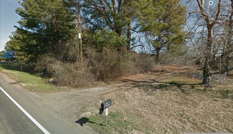
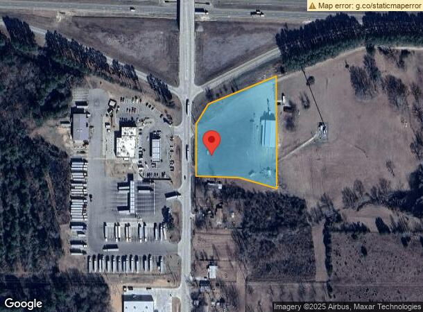
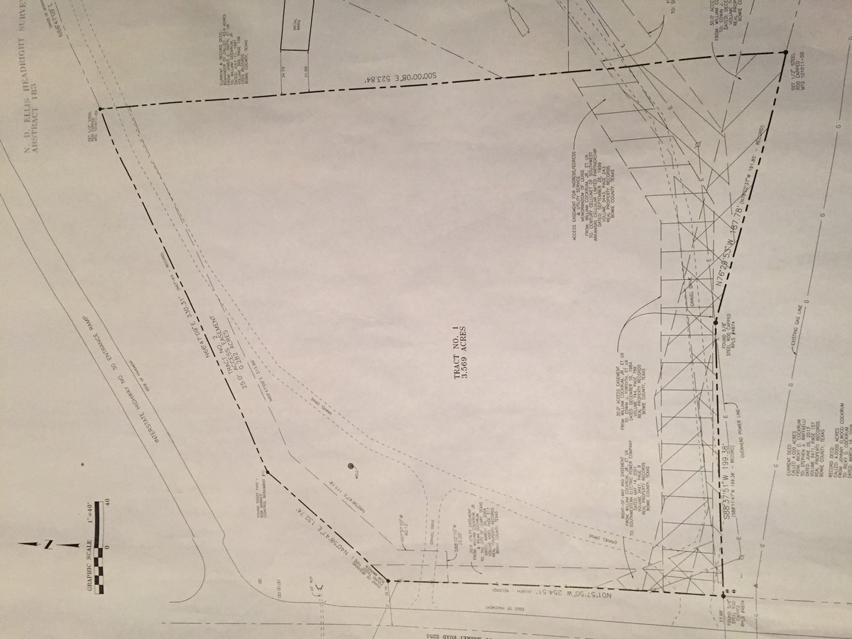
Leary Rd
07180000100
N D Ellis A-183
Commercialnec
N D ELLIS A-183 2017-8475 07/31/17 BLK/TRACT 1E 3.569 ACRES
X
Bowie
48037C0350E
Texas
2023
3.57 AC
2023
Texas East Area
010901
Other Market Areas
7,560 SF
Texarkana, TX-AR
DEMOGRAPHICS near Leary Rd
1 Mile
3 Mile
5 Mile
2024 Total Population
264
3,209
14,842
2029 Population
267
3,231
14,744
Pop Growth 2024-2029
+ 1.14%
+ 0.69%
(0.66%)
Average Age
41
41
40
2024 Total Households
104
1,228
5,722
HH Growth 2024-2029
+ 1.92%
+ 0.73%
(0.70%)
Median Household Inc
$65,000
$81,406
$66,703
Avg Household Size
2.50
2.60
2.60
2024 Avg HH Vehicles
2.00
2.00
2.00
Median Home Value
$179,999
$239,333
$189,999
Median Year Built
1995
1997
1991
Nearby Places
- Restaurants
- Banks
- Shops
- Fitness
- Groceries
PUBLIC TRANSPORTATION
AIRPORT
Texarkana Regional-Webb Field
DRIVE
WALK
Distance
Texarkana Regional-Webb Field
23 min
16.0 mi
Freight Ports
Port of Shreveport
DRIVE
WALK
Distance
Port of Shreveport
118 min
104.0 mi
SALE & LEASE HISTORY
LISTING DATE
SALE/LEASE

Mar 30, 2017
For Sale
Nearby Properties
Address
Land Use
TOTAL SIZE
Lot Size
Zoning
Address
Land Use
TOTAL SIZE
Lot Size
Zoning
73,862 SF
9.30 AC
Address
Land Use
TOTAL SIZE
Lot Size
Zoning
3.74 AC
Address
Land Use
TOTAL SIZE
Lot Size
Zoning
36,980 SF
3.90 AC
Address
Land Use
TOTAL SIZE
Lot Size
Zoning
17,418 SF
20 AC
Address
Land Use
TOTAL SIZE
Lot Size
Zoning
36,240 SF
7.50 AC
Address
Land Use
TOTAL SIZE
Lot Size
Zoning
165.54 AC
Address
Land Use
TOTAL SIZE
Lot Size
Zoning
10,955 SF
14.14 AC
Address
Land Use
TOTAL SIZE
Lot Size
Zoning
82,160 SF
20 AC
Address
Land Use
TOTAL SIZE
Lot Size
Zoning
6,187 SF
2.32 AC
Address
Land Use
TOTAL SIZE
Lot Size
Zoning
12,800 SF
0.82 AC
Address
Land Use
TOTAL SIZE
Lot Size
Zoning
31,328 SF
7.26 AC
Address
Land Use
TOTAL SIZE
Lot Size
Zoning
13,045 SF
1.38 AC
Address
Land Use
TOTAL SIZE
Lot Size
Zoning
6,187 SF
1.65 AC
Address
Land Use
TOTAL SIZE
Lot Size
Zoning
11,880 SF
2.50 AC
Address
Land Use
TOTAL SIZE
Lot Size
Zoning
22,909 SF
4.40 AC
Address
Land Use
TOTAL SIZE
Lot Size
Zoning
29,440 SF
1.72 AC
Address
Land Use
TOTAL SIZE
Lot Size
Zoning
5,680 SF
5 AC
Address
Land Use
TOTAL SIZE
Lot Size
Zoning
8,008 SF
3 AC
Address
Land Use
TOTAL SIZE
Lot Size
Zoning
4,648 SF
0.64 AC
Address
Land Use
TOTAL SIZE
Lot Size
Zoning
11,360 SF
4.60 AC
Address
Land Use
TOTAL SIZE
Lot Size
Zoning
23,359 SF
5.13 AC
Address
Land Use
TOTAL SIZE
Lot Size
Zoning
3.05 AC
Address
Land Use
TOTAL SIZE
Lot Size
Zoning
5,893 SF
0.64 AC
Address
Land Use
TOTAL SIZE
Lot Size
Zoning
7,175 SF
22.70 AC
Address
Land Use
TOTAL SIZE
Lot Size
Zoning
10,000 SF
2.10 AC
Address
Land Use
TOTAL SIZE
Lot Size
Zoning
4,400 SF
1.11 AC
Address
Land Use
TOTAL SIZE
Lot Size
Zoning
2,811 SF
0.61 AC
Address
Land Use
TOTAL SIZE
Lot Size
Zoning
6,297 SF
3 AC
Address
Land Use
TOTAL SIZE
Lot Size
Zoning
6,760 SF
8.15 AC
The World's #1 Commercial Real Estate Marketplace
Connect with us
© 2025 CoStar Group
The information above has been obtained from sources believed reliable. While we do not doubt its accuracy we have not verified it and make no guarantee, warranty or representation about it. It is your responsibility to independently confirm its accuracy and completeness. Any projections, opinions, assumptions, or estimates used are for example only and do not represent the current or future performance of the property. The value of this transaction to you depends on tax and other factors which should be evaluated by your tax, financial, and legal advisors. You and your advisors should conduct a careful, independent investigation of the property to determine to your satisfaction the suitability of the property for your needs.