No Photo
Property Record
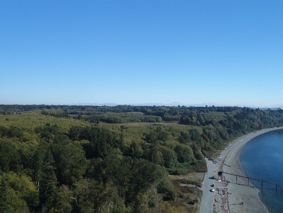
Lonseth Rd, Blaine, WA 98248

NEARBY LISTINGS FOR SALE OR LEASE
Property Detail
Lonseth Rd
Bellingham, WA
E 1/3 OF W 1/2 OF GOVT LOT 4-EXC CO RD DESC AF 510264-510394-TOG WI 2ND CLASS TIDELANDS ABTG
390117-065466-0000
Whatcom
Miningfacilityoilgasmineralpreciousmetals
Washington
X
4
53073C1155F
505.89 AC
2024
Bellingham/Northwest
2023
Other Market Areas
010503
DEMOGRAPHICS near Lonseth Rd
1 Mile
3 Mile
5 Mile
2024 Total Population
0
2,618
11,943
2029 Population
0
2,780
12,819
Pop Growth 2024-2029
0.00%
+ 6.19%
+ 7.33%
Average Age
0
41
43
2024 Total Households
0
983
4,801
HH Growth 2024-2029
0.00%
+ 6.31%
+ 7.71%
Median Household Inc
$0
$81,748
$74,982
Avg Household Size
.00
2.60
2.50
2024 Avg HH Vehicles
.00
2.00
2.00
Median Home Value
$0
$583,333
$530,488
Median Year Built
0
1999
1995
Nearby Places
- Restaurants
- Banks
- Shops
- Fitness
- Groceries
PUBLIC TRANSPORTATION
AIRPORT
Bellingham International
Drive
Walk
Distance
Bellingham International
14 min
8.4 mi
Abbotsford International
Drive
Walk
Distance
Abbotsford International
49 min
25.2 mi
Freight Ports
Port of Bellingham, WA
Drive
Walk
Distance
Port of Bellingham, WA
19 min
11.4 mi
SALE & LEASE HISTORY
LISTING DATE
SALE/LEASE

Sep 27, 2023
For Sale
Jan 24, 2018
For Sale
Nearby Properties
Address
Land Use
TOTAL SIZE
Lot Size
Zoning
Address
Land Use
TOTAL SIZE
Lot Size
Zoning
260143
36.13 AC
NC
Address
Land Use
TOTAL SIZE
Lot Size
Zoning
116159
24.54 AC
P
Address
Land Use
TOTAL SIZE
Lot Size
Zoning
37698
8.43 AC
GB
Address
Land Use
TOTAL SIZE
Lot Size
Zoning
74027
3.54 AC
RO
Address
Land Use
TOTAL SIZE
Lot Size
Zoning
63802
8.93 AC
MCD
Address
Land Use
TOTAL SIZE
Lot Size
Zoning
235594
56.20 AC
PBI
Address
Land Use
TOTAL SIZE
Lot Size
Zoning
66344
4.30 AC
RO
Address
Land Use
TOTAL SIZE
Lot Size
Zoning
2059
8.27 AC
RM
Address
Land Use
TOTAL SIZE
Lot Size
Zoning
203305
13.80 AC
LII
Address
Land Use
TOTAL SIZE
Lot Size
Zoning
64509
4.40 AC
GB
Address
Land Use
TOTAL SIZE
Lot Size
Zoning
153557
39.70 AC
PBI
Address
Land Use
TOTAL SIZE
Lot Size
Zoning
156099
11.44 AC
GB
Address
Land Use
TOTAL SIZE
Lot Size
Zoning
60446
4.03 AC
PBI
Address
Land Use
TOTAL SIZE
Lot Size
Zoning
72720
3.94 AC
LII
Address
Land Use
TOTAL SIZE
Lot Size
Zoning
103600
7 AC
LII
Address
Land Use
TOTAL SIZE
Lot Size
Zoning
77782
5.90 AC
GB
Address
Land Use
TOTAL SIZE
Lot Size
Zoning
49744
5.92 AC
GB
Address
Land Use
TOTAL SIZE
Lot Size
Zoning
140381
9.76 AC
M
Address
Land Use
TOTAL SIZE
Lot Size
Zoning
1536
5 AC
RM1.5
Address
Land Use
TOTAL SIZE
Lot Size
Zoning
23499
4.46 AC
MCD
Address
Land Use
TOTAL SIZE
Lot Size
Zoning
48409
2.24 AC
GB
Address
Land Use
TOTAL SIZE
Lot Size
Zoning
48728
2.30 AC
RM1.5
Address
Land Use
TOTAL SIZE
Lot Size
Zoning
46333
2.03 AC
RM1.5
Address
Land Use
TOTAL SIZE
Lot Size
Zoning
52100
4.07 AC
GB
Address
Land Use
TOTAL SIZE
Lot Size
Zoning
59899
2.94 AC
GB
Address
Land Use
TOTAL SIZE
Lot Size
Zoning
17415
332.54 AC
ROS
Address
Land Use
TOTAL SIZE
Lot Size
Zoning
61534
6 AC
M
Address
Land Use
TOTAL SIZE
Lot Size
Zoning
115975
9.21 AC
LII
Address
Land Use
TOTAL SIZE
Lot Size
Zoning
73190
3.19 AC
MCD
Start a new search to find other properties for sale or lease
Connect with us
© 2024 CoStar Group
The information above has been obtained from sources believed reliable. While we do not doubt its accuracy we have not verified it and make no guarantee, warranty or representation about it. It is your responsibility to independently confirm its accuracy and completeness. Any projections, opinions, assumptions, or estimates used are for example only and do not represent the current or future performance of the property. The value of this transaction to you depends on tax and other factors which should be evaluated by your tax, financial, and legal advisors. You and your advisors should conduct a careful, independent investigation of the property to determine to your satisfaction the suitability of the property for your needs.