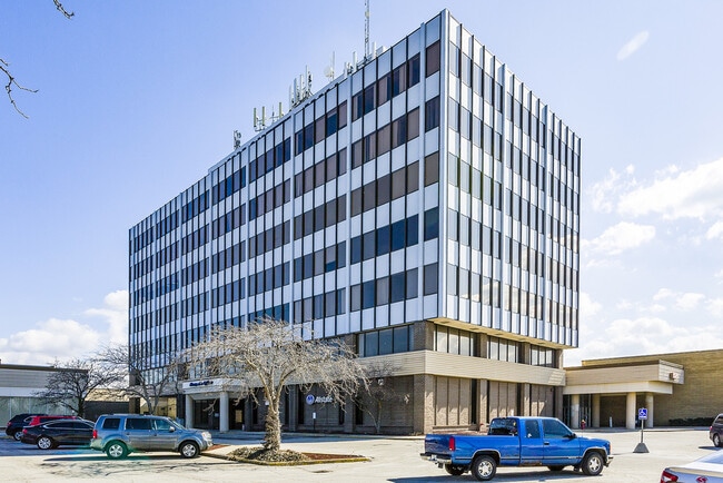
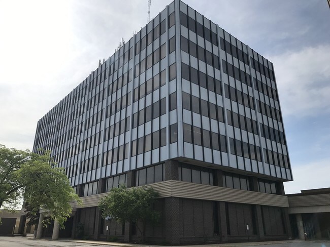
Property Record
226 W Marquette Mall, Michigan City, IN 46360
NEARBY LISTINGS FOR SALE OR LEASE
Property Detail
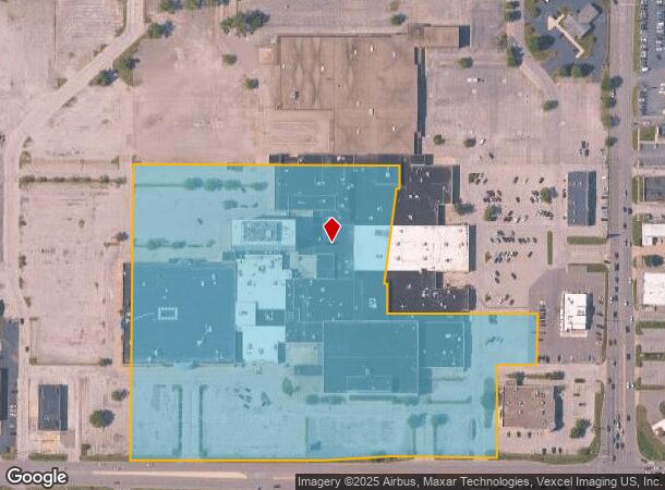
226 W Marquette Mall
46-05-05-476-002.000-009
13-05-05-476-002 IN SE1/4 SE1/4 S5 T37 R4 18.072
Regionalshoppingcenterormallwithanchorstore
La Porte
X
Indiana
18127C0095D
18.07 AC
2024
South Bend/Elkhart
2025
Other Market Areas
040700
Michigan City-La Porte, IN
11,850 SF
DEMOGRAPHICS near 226 W Marquette Mall
1 Mile
3 Mile
5 Mile
2024 Total Population
5,006
32,197
44,890
2029 Population
4,905
31,910
44,779
Pop Growth 2024-2029
(2.02%)
(0.89%)
(0.25%)
Average Age
43
40
42
2024 Total Households
2,189
12,620
18,148
HH Growth 2024-2029
(2.24%)
(1.15%)
(0.28%)
Median Household Inc
$50,160
$49,085
$56,238
Avg Household Size
2.10
2.30
2.30
2024 Avg HH Vehicles
2.00
2.00
2.00
Median Home Value
$131,649
$111,175
$145,888
Median Year Built
1972
1960
1965
Nearby Places
Map Layers
Map Styles
 Street
 Aerial
- Restaurants
- Banks
- Shops
- Fitness
- Groceries
PUBLIC TRANSPORTATION
COMMUTER RAIL
DRIVE
WALK
Distance
7 min
2.3 mi
Carroll Avenue (Michigan City) Station (South Shore Line - Northern Indiana Commuter Transportation District (South Shore Line))
DRIVE
WALK
Distance
Carroll Avenue (Michigan City) Station (South Shore Line - Northern Indiana Commuter Transportation District (South Shore Line))
10 min
3.9 mi
AIRPORT
South Bend International
DRIVE
WALK
Distance
South Bend International
58 min
34.4 mi
SALE & LEASE HISTORY
LISTING DATE
SALE/LEASE

Sep 25, 2016
For Lease
Nearby Properties
Address
Land Use
TOTAL SIZE
Lot Size
Zoning
Address
Land Use
TOTAL SIZE
Lot Size
Zoning
47,454 SF
88.01 AC
Address
Land Use
TOTAL SIZE
Lot Size
Zoning
87,360 SF
34.37 AC
Address
Land Use
TOTAL SIZE
Lot Size
Zoning
391,582 SF
46.06 AC
Address
Land Use
TOTAL SIZE
Lot Size
Zoning
136,799 SF
7.36 AC
Address
Land Use
TOTAL SIZE
Lot Size
Zoning
34,691 SF
10.66 AC
Address
Land Use
TOTAL SIZE
Lot Size
Zoning
88,360 SF
9.47 AC
Address
Land Use
TOTAL SIZE
Lot Size
Zoning
41,672 SF
23.23 AC
Address
Land Use
TOTAL SIZE
Lot Size
Zoning
20,340 SF
31.58 AC
Address
Land Use
TOTAL SIZE
Lot Size
Zoning
660 SF
21.97 AC
Address
Land Use
TOTAL SIZE
Lot Size
Zoning
5,380 SF
7.95 AC
Address
Land Use
TOTAL SIZE
Lot Size
Zoning
41,030 SF
24.13 AC
Address
Land Use
TOTAL SIZE
Lot Size
Zoning
79,706 SF
7.50 AC
Address
Land Use
TOTAL SIZE
Lot Size
Zoning
12,510 SF
2.25 AC
Address
Land Use
TOTAL SIZE
Lot Size
Zoning
2,700 SF
23.11 AC
Address
Land Use
TOTAL SIZE
Lot Size
Zoning
22,934 SF
15.21 AC
Address
Land Use
TOTAL SIZE
Lot Size
Zoning
3,689 SF
3.25 AC
Address
Land Use
TOTAL SIZE
Lot Size
Zoning
16,887 SF
20.17 AC
Address
Land Use
TOTAL SIZE
Lot Size
Zoning
33,230 SF
5.83 AC
Address
Land Use
TOTAL SIZE
Lot Size
Zoning
31,332 SF
4.11 AC
Address
Land Use
TOTAL SIZE
Lot Size
Zoning
9,221 SF
24 AC
Address
Land Use
TOTAL SIZE
Lot Size
Zoning
112,125 SF
18.28 AC
Address
Land Use
TOTAL SIZE
Lot Size
Zoning
65,488 SF
10.99 AC
Address
Land Use
TOTAL SIZE
Lot Size
Zoning
29,332 SF
17.27 AC
Address
Land Use
TOTAL SIZE
Lot Size
Zoning
12,469 SF
2.78 AC
Address
Land Use
TOTAL SIZE
Lot Size
Zoning
1,200 SF
33.69 AC
Address
Land Use
TOTAL SIZE
Lot Size
Zoning
78,030 SF
9.92 AC
Address
Land Use
TOTAL SIZE
Lot Size
Zoning
33,872 SF
4.03 AC
Address
Land Use
TOTAL SIZE
Lot Size
Zoning
28,662 SF
3.85 AC
Address
Land Use
TOTAL SIZE
Lot Size
Zoning
1,965 SF
14.49 AC
Address
Land Use
TOTAL SIZE
Lot Size
Zoning
56,638 SF
8.02 AC
The World's #1 Commercial Real Estate Marketplace
Connect with us
© 2026 CoStar Group
The information above has been obtained from sources believed reliable. While we do not doubt its accuracy we have not verified it and make no guarantee, warranty or representation about it. It is your responsibility to independently confirm its accuracy and completeness. Any projections, opinions, assumptions, or estimates used are for example only and do not represent the current or future performance of the property. The value of this transaction to you depends on tax and other factors which should be evaluated by your tax, financial, and legal advisors. You and your advisors should conduct a careful, independent investigation of the property to determine to your satisfaction the suitability of the property for your needs.