Property Record
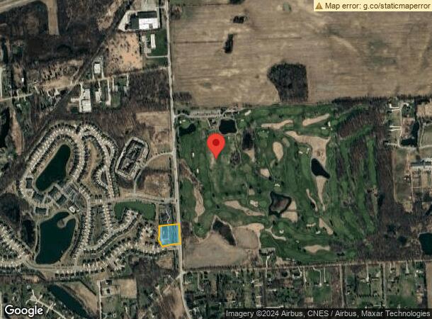
28805 Milford Rd, New Hudson, MI 48165

NEARBY LISTINGS FOR SALE OR LEASE
-
-
-
-
-
No Photo
-
-
-
View all New Hudson listings for sale on LoopNet.com
Property Detail
28805 Milford Rd
21-09-400-016
T1N, R7E, SEC 9 PART OF SE 1/4 BEG AT PT DIST N 02-34-47 W 476.09 FT FROM SE SEC COR, TH S 87-25-13 W 107.03 FT, TH ALG CURVE TO LEFT, RAD 246.50 FT, CHORD BEARS S 82-10-47 W 45.03 FT, DIST OF 45.09 FT, TH S 76-56-21 W 93.42 FT, TH ALG CURVE TO RIGHT
Daycare
Oakland
X
Michigan
26163C0025E
2.46 AC
2024
Central I-96 Corridor
2024
Detroit
138600
Detroit-Warren-Dearborn, MI
18,567 SF
DEMOGRAPHICS near 28805 Milford Rd
1 Mile
3 Mile
5 Mile
2024 Total Population
2,778
26,264
60,330
2029 Population
2,765
26,269
60,093
Pop Growth 2024-2029
(0.47%)
+ 0.02%
(0.39%)
Average Age
40
40
39
2024 Total Households
1,048
9,838
22,456
HH Growth 2024-2029
(0.67%)
(0.03%)
(0.61%)
Median Household Inc
$117,463
$108,200
$105,744
Avg Household Size
2.60
2.60
2.70
2024 Avg HH Vehicles
2.00
2.00
2.00
Median Home Value
$384,098
$351,320
$374,581
Median Year Built
2004
1996
1995
Nearby Places
- Restaurants
- Banks
- Shops
- Fitness
- Groceries
PUBLIC TRANSPORTATION
AIRPORT
Detroit Metro Wayne County
DRIVE
WALK
Distance
Detroit Metro Wayne County
42 min
35.8 mi
Freight Ports
Port of Toledo
DRIVE
WALK
Distance
Port of Toledo
92 min
77.4 mi
SALE & LEASE HISTORY
LISTING DATE
SALE/LEASE

Sep 24, 2016
For Sale
Aug 14, 2019
For Sale
Nearby Properties
Address
Land Use
TOTAL SIZE
Lot Size
Zoning
Address
Land Use
TOTAL SIZE
Lot Size
Zoning
433,305 SF
19.63 AC
Address
Land Use
TOTAL SIZE
Lot Size
Zoning
317,215 SF
23.63 AC
Address
Land Use
TOTAL SIZE
Lot Size
Zoning
306,804 SF
Address
Land Use
TOTAL SIZE
Lot Size
Zoning
140,366 SF
30.67 AC
II
Address
Land Use
TOTAL SIZE
Lot Size
Zoning
195,802 SF
9.87 AC
BV
Address
Land Use
TOTAL SIZE
Lot Size
Zoning
172,700 SF
Address
Land Use
TOTAL SIZE
Lot Size
Zoning
325,725 SF
30.46 AC
Address
Land Use
TOTAL SIZE
Lot Size
Zoning
279,807 SF
31.24 AC
II
Address
Land Use
TOTAL SIZE
Lot Size
Zoning
154,490 SF
Address
Land Use
TOTAL SIZE
Lot Size
Zoning
287,382 SF
42.91 AC
II
Address
Land Use
TOTAL SIZE
Lot Size
Zoning
286,708 SF
Address
Land Use
TOTAL SIZE
Lot Size
Zoning
223,110 SF
18.53 AC
BI
Address
Land Use
TOTAL SIZE
Lot Size
Zoning
325,725 SF
Address
Land Use
TOTAL SIZE
Lot Size
Zoning
150,217 SF
10.22 AC
IV
Address
Land Use
TOTAL SIZE
Lot Size
Zoning
148,298 SF
20.43 AC
Address
Land Use
TOTAL SIZE
Lot Size
Zoning
9,784 SF
68.90 AC
MM
Address
Land Use
TOTAL SIZE
Lot Size
Zoning
66,070 SF
Address
Land Use
TOTAL SIZE
Lot Size
Zoning
117,308 SF
Address
Land Use
TOTAL SIZE
Lot Size
Zoning
167,616 SF
39.18 AC
Address
Land Use
TOTAL SIZE
Lot Size
Zoning
154,500 SF
11.64 AC
II
Address
Land Use
TOTAL SIZE
Lot Size
Zoning
101,749 SF
8.51 AC
Address
Land Use
TOTAL SIZE
Lot Size
Zoning
286,708 SF
33.46 AC
Address
Land Use
TOTAL SIZE
Lot Size
Zoning
107,850 SF
21.38 AC
Address
Land Use
TOTAL SIZE
Lot Size
Zoning
137,373 SF
16.51 AC
AI
Address
Land Use
TOTAL SIZE
Lot Size
Zoning
132,821 SF
13.48 AC
BI
Address
Land Use
TOTAL SIZE
Lot Size
Zoning
167,616 SF
20.53 AC
ME
Address
Land Use
TOTAL SIZE
Lot Size
Zoning
119,060 SF
7.45 AC
Address
Land Use
TOTAL SIZE
Lot Size
Zoning
32,826 SF
22.12 AC
BI
Address
Land Use
TOTAL SIZE
Lot Size
Zoning
126,194 SF
10.70 AC
KI
Address
Land Use
TOTAL SIZE
Lot Size
Zoning
86,802 SF
7.09 AC
IV
The World's #1 Commercial Real Estate Marketplace
Connect with us
© 2025 CoStar Group
The information above has been obtained from sources believed reliable. While we do not doubt its accuracy we have not verified it and make no guarantee, warranty or representation about it. It is your responsibility to independently confirm its accuracy and completeness. Any projections, opinions, assumptions, or estimates used are for example only and do not represent the current or future performance of the property. The value of this transaction to you depends on tax and other factors which should be evaluated by your tax, financial, and legal advisors. You and your advisors should conduct a careful, independent investigation of the property to determine to your satisfaction the suitability of the property for your needs.