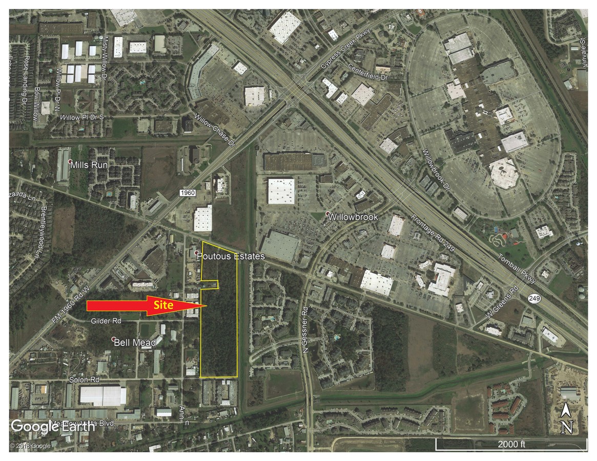
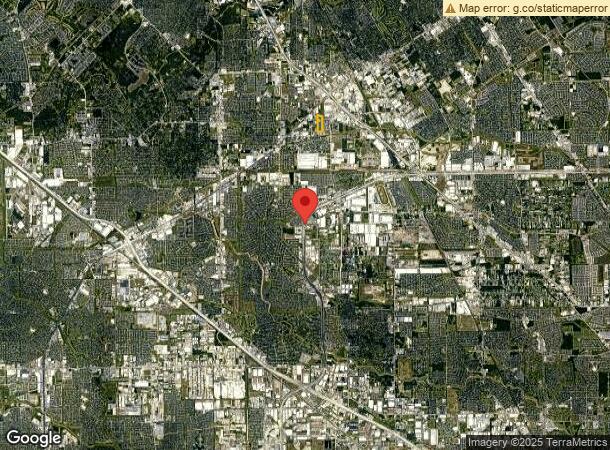
Property Record
0 Mills Rd, Houston, TX 77064
NEARBY LISTINGS FOR SALE OR LEASE
Property Detail
0 Mills Rd
Houston-The Woodlands-Sugar Land, TX
Abst 217 G W Childress
0420710000025
TR 3B ABST 217 G W CHILDRESS
Commercialacreage
Harris
AE
Texas
48201C0435M
19.15 AC
2023
FM 1960/Hwy 249
2023
Houston
534201
DEMOGRAPHICS near 0 Mills Rd
1 Mile
3 Mile
5 Mile
2024 Total Population
8,241
91,594
294,800
2029 Population
8,456
93,121
298,689
Pop Growth 2024-2029
+ 2.61%
+ 1.67%
+ 1.32%
Average Age
34
37
38
2024 Total Households
3,118
33,846
105,022
HH Growth 2024-2029
+ 2.60%
+ 1.68%
+ 1.31%
Median Household Inc
$51,897
$65,219
$69,285
Avg Household Size
2.60
2.70
2.70
2024 Avg HH Vehicles
2.00
2.00
2.00
Median Home Value
$180,317
$223,435
$228,725
Median Year Built
1999
1994
1990
Nearby Places
- Restaurants
- Banks
- Shops
- Fitness
- Groceries
PUBLIC TRANSPORTATION
AIRPORT
George Bush Intcntl/Houston
DRIVE
WALK
Distance
George Bush Intcntl/Houston
20 min
16.9 mi
William P Hobby
DRIVE
WALK
Distance
William P Hobby
49 min
34.5 mi
Freight Ports
Port of Houston
DRIVE
WALK
Distance
Port of Houston
41 min
30.2 mi
SALE & LEASE HISTORY
LISTING DATE
SALE/LEASE

Oct 14, 2019
For Sale
Nearby Properties
Address
Land Use
TOTAL SIZE
Lot Size
Zoning
Address
Land Use
TOTAL SIZE
Lot Size
Zoning
587,609 SF
42.44 AC
Address
Land Use
TOTAL SIZE
Lot Size
Zoning
625,701 SF
52.20 AC
Address
Land Use
TOTAL SIZE
Lot Size
Zoning
778,140 SF
40.25 AC
Address
Land Use
TOTAL SIZE
Lot Size
Zoning
660,000 SF
104.88 AC
Address
Land Use
TOTAL SIZE
Lot Size
Zoning
664,361 SF
39.18 AC
Address
Land Use
TOTAL SIZE
Lot Size
Zoning
682,700 SF
37 AC
Address
Land Use
TOTAL SIZE
Lot Size
Zoning
388,333 SF
41.17 AC
Address
Land Use
TOTAL SIZE
Lot Size
Zoning
546,420 SF
40.07 AC
Address
Land Use
TOTAL SIZE
Lot Size
Zoning
339,301 SF
68.40 AC
Address
Land Use
TOTAL SIZE
Lot Size
Zoning
527,744 SF
35.46 AC
Address
Land Use
TOTAL SIZE
Lot Size
Zoning
463,932 SF
26.62 AC
Address
Land Use
TOTAL SIZE
Lot Size
Zoning
365,711 SF
26.61 AC
Address
Land Use
TOTAL SIZE
Lot Size
Zoning
402,712 SF
25.64 AC
Address
Land Use
TOTAL SIZE
Lot Size
Zoning
326,807 SF
29.43 AC
Address
Land Use
TOTAL SIZE
Lot Size
Zoning
365,380 SF
19.17 AC
Address
Land Use
TOTAL SIZE
Lot Size
Zoning
375,251 SF
14.85 AC
Address
Land Use
TOTAL SIZE
Lot Size
Zoning
412,911 SF
7.09 AC
Address
Land Use
TOTAL SIZE
Lot Size
Zoning
347,694 SF
17.61 AC
Address
Land Use
TOTAL SIZE
Lot Size
Zoning
324,699 SF
8.34 AC
Address
Land Use
TOTAL SIZE
Lot Size
Zoning
495,024 SF
23.96 AC
Address
Land Use
TOTAL SIZE
Lot Size
Zoning
320,985 SF
14.88 AC
Address
Land Use
TOTAL SIZE
Lot Size
Zoning
237,742 SF
13.80 AC
Address
Land Use
TOTAL SIZE
Lot Size
Zoning
441,000 SF
23.07 AC
Address
Land Use
TOTAL SIZE
Lot Size
Zoning
297,351 SF
13.47 AC
Address
Land Use
TOTAL SIZE
Lot Size
Zoning
399,828 SF
20.32 AC
Address
Land Use
TOTAL SIZE
Lot Size
Zoning
275,561 SF
19.78 AC
Address
Land Use
TOTAL SIZE
Lot Size
Zoning
238,819 SF
13.83 AC
Address
Land Use
TOTAL SIZE
Lot Size
Zoning
310,043 SF
15.65 AC
Address
Land Use
TOTAL SIZE
Lot Size
Zoning
361,800 SF
18.20 AC
Address
Land Use
TOTAL SIZE
Lot Size
Zoning
322,226 SF
14.99 AC
The World's #1 Commercial Real Estate Marketplace
Connect with us
© 2025 CoStar Group
The information above has been obtained from sources believed reliable. While we do not doubt its accuracy we have not verified it and make no guarantee, warranty or representation about it. It is your responsibility to independently confirm its accuracy and completeness. Any projections, opinions, assumptions, or estimates used are for example only and do not represent the current or future performance of the property. The value of this transaction to you depends on tax and other factors which should be evaluated by your tax, financial, and legal advisors. You and your advisors should conduct a careful, independent investigation of the property to determine to your satisfaction the suitability of the property for your needs.