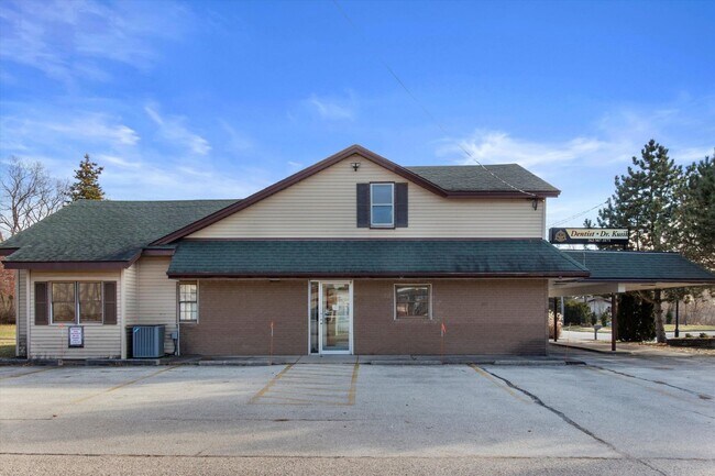
Property Record
N50w34838 Wisconsin Ave, Okauchee, WI 53069


NEARBY LISTINGS FOR SALE OR LEASE
Property Detail
N50w34838 Wisconsin Ave
Milwaukee-Waukesha-West Allis, WI
Map Of State Road Addition
OCOT-0575-022
LOT 22 MAP OF STATE ROAD ADDITION TO OKAUCHEE PT W1/2 SEC 36 T8N R17E
Commercialnec
Waukesha
X
Wisconsin
55133C0152G
22
2024
0.34 AC
2024
NE/Delafield
204503
Milwaukee/Madison
DEMOGRAPHICS near N50w34838 Wisconsin Ave
1 Mile
3 Mile
5 Mile
2024 Total Population
3,330
23,207
49,498
2029 Population
3,382
24,127
51,312
Pop Growth 2024-2029
+ 1.56%
+ 3.96%
+ 3.66%
Average Age
47
44
43
2024 Total Households
1,433
9,453
20,342
HH Growth 2024-2029
+ 1.40%
+ 4.02%
+ 3.73%
Median Household Inc
$108,349
$104,845
$102,637
Avg Household Size
2.30
2.40
2.40
2024 Avg HH Vehicles
2.00
2.00
2.00
Median Home Value
$421,464
$386,167
$391,728
Median Year Built
1973
1982
1984
Nearby Places
Map Layers
Map Styles
 Street
 Aerial
- Restaurants
- Banks
- Shops
- Fitness
- Groceries
PUBLIC TRANSPORTATION
AIRPORT
General Mitchell International
DRIVE
WALK
Distance
General Mitchell International
50 min
36.4 mi
Freight Ports
Port Milwaukee
DRIVE
WALK
Distance
Port Milwaukee
43 min
32.9 mi
SALE & LEASE HISTORY
LISTING DATE
SALE/LEASE

Dec 21, 2023
For Sale
Aug 15, 2024
For Sale
Nearby Properties
Address
Land Use
TOTAL SIZE
Lot Size
Zoning
Address
Land Use
TOTAL SIZE
Lot Size
Zoning
25.09 AC
Address
Land Use
TOTAL SIZE
Lot Size
Zoning
85.90 AC
Address
Land Use
TOTAL SIZE
Lot Size
Zoning
Address
Land Use
TOTAL SIZE
Lot Size
Zoning
12.32 AC
Address
Land Use
TOTAL SIZE
Lot Size
Zoning
11.16 AC
Address
Land Use
TOTAL SIZE
Lot Size
Zoning
12.01 AC
Address
Land Use
TOTAL SIZE
Lot Size
Zoning
Address
Land Use
TOTAL SIZE
Lot Size
Zoning
Address
Land Use
TOTAL SIZE
Lot Size
Zoning
Address
Land Use
TOTAL SIZE
Lot Size
Zoning
8.92 AC
Address
Land Use
TOTAL SIZE
Lot Size
Zoning
22.10 AC
Address
Land Use
TOTAL SIZE
Lot Size
Zoning
Address
Land Use
TOTAL SIZE
Lot Size
Zoning
Address
Land Use
TOTAL SIZE
Lot Size
Zoning
Address
Land Use
TOTAL SIZE
Lot Size
Zoning
Address
Land Use
TOTAL SIZE
Lot Size
Zoning
Address
Land Use
TOTAL SIZE
Lot Size
Zoning
Address
Land Use
TOTAL SIZE
Lot Size
Zoning
3.52 AC
Address
Land Use
TOTAL SIZE
Lot Size
Zoning
Address
Land Use
TOTAL SIZE
Lot Size
Zoning
15.06 AC
Address
Land Use
TOTAL SIZE
Lot Size
Zoning
Address
Land Use
TOTAL SIZE
Lot Size
Zoning
6.87 AC
Address
Land Use
TOTAL SIZE
Lot Size
Zoning
6.20 AC
Address
Land Use
TOTAL SIZE
Lot Size
Zoning
1.57 AC
Address
Land Use
TOTAL SIZE
Lot Size
Zoning
4.70 AC
Address
Land Use
TOTAL SIZE
Lot Size
Zoning
Address
Land Use
TOTAL SIZE
Lot Size
Zoning
Address
Land Use
TOTAL SIZE
Lot Size
Zoning
Address
Land Use
TOTAL SIZE
Lot Size
Zoning
1.42 AC
Address
Land Use
TOTAL SIZE
Lot Size
Zoning
2.31 AC
The World's #1 Commercial Real Estate Marketplace
Connect with us
© 2026 CoStar Group
The information above has been obtained from sources believed reliable. While we do not doubt its accuracy we have not verified it and make no guarantee, warranty or representation about it. It is your responsibility to independently confirm its accuracy and completeness. Any projections, opinions, assumptions, or estimates used are for example only and do not represent the current or future performance of the property. The value of this transaction to you depends on tax and other factors which should be evaluated by your tax, financial, and legal advisors. You and your advisors should conduct a careful, independent investigation of the property to determine to your satisfaction the suitability of the property for your needs.