Property Record
Nina Lee Dr, Columbia, SC 29203
NEARBY LISTINGS FOR SALE OR LEASE
Property Detail
Nina Lee Dr
14600-03-27
PARCEL C #SU #PR RB2538-1587 S-130
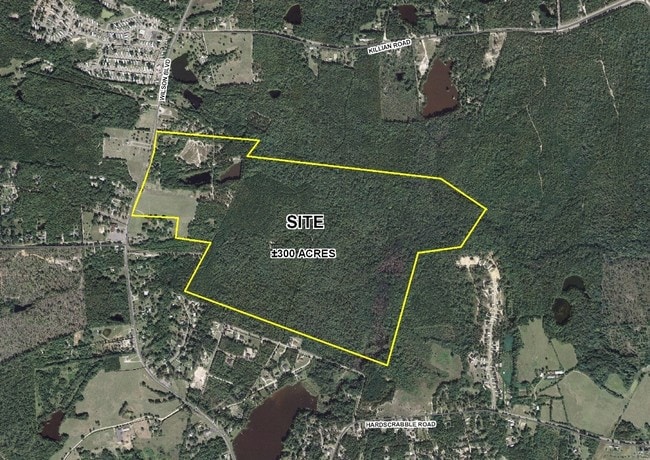
Agriculturalland
Richland
AE
South Carolina
45079C0251L
245.08 AC
2025
Northeast Columbia
2024
Columbia
010701
Columbia, SC
DEMOGRAPHICS near Nina Lee Dr
1 Mile
3 Mile
5 Mile
2024 Total Population
1,919
20,189
82,777
2029 Population
1,953
20,656
84,281
Pop Growth 2024-2029
+ 1.77%
+ 2.31%
+ 1.82%
Average Age
39
37
39
2024 Total Households
745
8,295
33,256
HH Growth 2024-2029
+ 1.61%
+ 2.37%
+ 1.84%
Median Household Inc
$66,744
$60,572
$55,977
Avg Household Size
2.40
2.30
2.40
2024 Avg HH Vehicles
2.00
2.00
2.00
Median Home Value
$189,859
$194,478
$176,738
Median Year Built
1998
2000
1994
Nearby Places
Map Layers
Map Styles
 Street
 Aerial
- Restaurants
- Banks
- Shops
- Fitness
- Groceries
PUBLIC TRANSPORTATION
AIRPORT
Columbia Metro
DRIVE
WALK
Distance
Columbia Metro
37 min
21.1 mi
Freight Ports
North Charleston Terminal
DRIVE
WALK
Distance
North Charleston Terminal
137 min
117.4 mi
Nearby Properties
Address
Land Use
TOTAL SIZE
Lot Size
Zoning
Address
Land Use
TOTAL SIZE
Lot Size
Zoning
231,760 SF
23.84 AC
M-1
Address
Land Use
TOTAL SIZE
Lot Size
Zoning
144,849 SF
26.14 AC
OI
Address
Land Use
TOTAL SIZE
Lot Size
Zoning
456,536 SF
42.16 AC
M-1
Address
Land Use
TOTAL SIZE
Lot Size
Zoning
83,808 SF
95.58 AC
PDD
Address
Land Use
TOTAL SIZE
Lot Size
Zoning
325,344 SF
71.41 AC
HI
Address
Land Use
TOTAL SIZE
Lot Size
Zoning
234,990 SF
16.50 AC
RM-HD
Address
Land Use
TOTAL SIZE
Lot Size
Zoning
301,627 SF
25.08 AC
PDD
Address
Land Use
TOTAL SIZE
Lot Size
Zoning
462,800 SF
104.82 AC
M-1
Address
Land Use
TOTAL SIZE
Lot Size
Zoning
253,136 SF
18.85 AC
PUD-1R
Address
Land Use
TOTAL SIZE
Lot Size
Zoning
176,878 SF
15.48 AC
PDD
Address
Land Use
TOTAL SIZE
Lot Size
Zoning
239,450 SF
16.85 AC
GC
Address
Land Use
TOTAL SIZE
Lot Size
Zoning
51,803 SF
11.99 AC
M-1
Address
Land Use
TOTAL SIZE
Lot Size
Zoning
217,580 SF
32.47 AC
M-1
Address
Land Use
TOTAL SIZE
Lot Size
Zoning
242,894 SF
14.97 AC
RM-HD
Address
Land Use
TOTAL SIZE
Lot Size
Zoning
138,552 SF
12.02 AC
RM-HD
Address
Land Use
TOTAL SIZE
Lot Size
Zoning
46,032 SF
11.11 AC
RM-HD
Address
Land Use
TOTAL SIZE
Lot Size
Zoning
148,809 SF
17.52 AC
M-1
Address
Land Use
TOTAL SIZE
Lot Size
Zoning
111,327 SF
7.96 AC
RM-HD
Address
Land Use
TOTAL SIZE
Lot Size
Zoning
129,017 SF
14.70 AC
PDD
Address
Land Use
TOTAL SIZE
Lot Size
Zoning
71,394 SF
12.05 AC
M-1
Address
Land Use
TOTAL SIZE
Lot Size
Zoning
72,938 SF
3.22 AC
M-1
Address
Land Use
TOTAL SIZE
Lot Size
Zoning
133,348 SF
18 AC
M-1
Address
Land Use
TOTAL SIZE
Lot Size
Zoning
80,000 SF
4.77 AC
M-1
Address
Land Use
TOTAL SIZE
Lot Size
Zoning
88,710 SF
3.13 AC
GC
Address
Land Use
TOTAL SIZE
Lot Size
Zoning
55,747 SF
5.80 AC
M-1
Address
Land Use
TOTAL SIZE
Lot Size
Zoning
72,549 SF
2.49 AC
PDD
Address
Land Use
TOTAL SIZE
Lot Size
Zoning
37,971 SF
8.40 AC
PDD
Address
Land Use
TOTAL SIZE
Lot Size
Zoning
42,938 SF
7.30 AC
HI
Address
Land Use
TOTAL SIZE
Lot Size
Zoning
103,719 SF
4.05 AC
RM-HD
Address
Land Use
TOTAL SIZE
Lot Size
Zoning
25,937 SF
9 AC
M-1
The World's #1 Commercial Real Estate Marketplace
Connect with us
© 2026 CoStar Group
The information above has been obtained from sources believed reliable. While we do not doubt its accuracy we have not verified it and make no guarantee, warranty or representation about it. It is your responsibility to independently confirm its accuracy and completeness. Any projections, opinions, assumptions, or estimates used are for example only and do not represent the current or future performance of the property. The value of this transaction to you depends on tax and other factors which should be evaluated by your tax, financial, and legal advisors. You and your advisors should conduct a careful, independent investigation of the property to determine to your satisfaction the suitability of the property for your needs.