Property Record
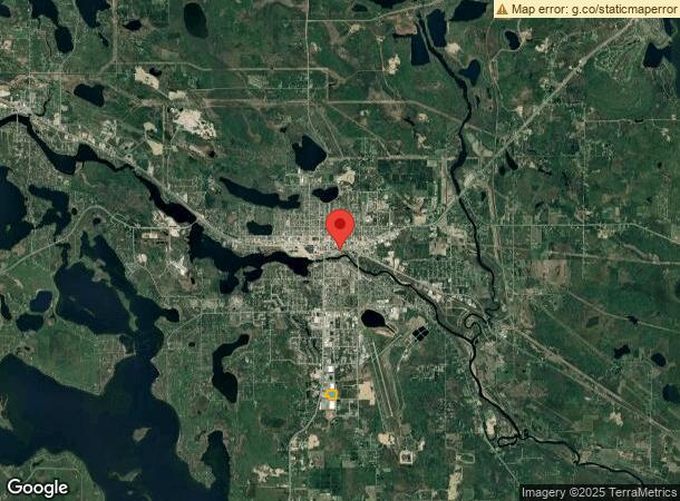
None Pokegama Avenue And 29Th Street, Grand Rapids, MN 55744
NEARBY LISTINGS FOR SALE OR LEASE
-
-
View all Grand Rapids listings for sale on LoopNet.com
Property Detail
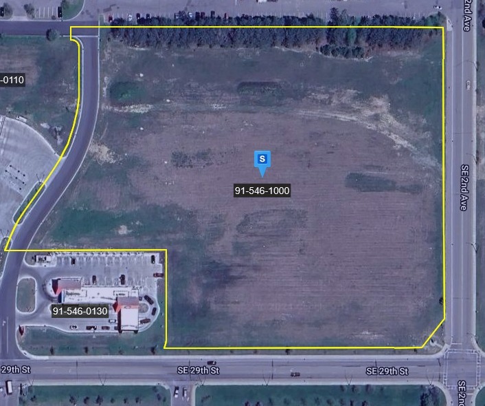
None Pokegama Avenue And 29Th Street
Other Market Areas
Hawkinson Commercial Development
Grand Rapids, MN
OUTLOT A
91-546-1000
Itasca
Commercialacreage
Minnesota
2024
a
2023
9.75 AC
480805
Minnesota North Area
DEMOGRAPHICS near None Pokegama Avenue And 29Th Street
1 Mile
3 Mile
5 Mile
2024 Total Population
1,570
11,427
16,550
2029 Population
1,572
11,457
16,620
Pop Growth 2024-2029
+ 0.13%
+ 0.26%
+ 0.42%
Average Age
44
42
43
2024 Total Households
655
4,852
6,910
HH Growth 2024-2029
0.00%
+ 0.14%
+ 0.32%
Median Household Inc
$49,254
$55,632
$59,658
Avg Household Size
2.20
2.20
2.20
2024 Avg HH Vehicles
2.00
2.00
2.00
Median Home Value
$206,316
$187,718
$207,823
Median Year Built
1994
1980
1980
Nearby Places
- Restaurants
- Banks
- Shops
- Fitness
- Groceries
Nearby Properties
Address
Land Use
TOTAL SIZE
Lot Size
Zoning
Address
Land Use
TOTAL SIZE
Lot Size
Zoning
5,932 SF
2 AC
M
Address
Land Use
TOTAL SIZE
Lot Size
Zoning
296,020 SF
38.94 AC
M
Address
Land Use
TOTAL SIZE
Lot Size
Zoning
6,284 SF
132.01 AC
Address
Land Use
TOTAL SIZE
Lot Size
Zoning
50,649 SF
39.11 AC
M
Address
Land Use
TOTAL SIZE
Lot Size
Zoning
201,959 SF
18.90 AC
M
Address
Land Use
TOTAL SIZE
Lot Size
Zoning
165,195 SF
36.80 AC
M
Address
Land Use
TOTAL SIZE
Lot Size
Zoning
58,978 SF
7.19 AC
M
Address
Land Use
TOTAL SIZE
Lot Size
Zoning
45,097 SF
2.30 AC
M
Address
Land Use
TOTAL SIZE
Lot Size
Zoning
85,069 SF
6.22 AC
Address
Land Use
TOTAL SIZE
Lot Size
Zoning
18,465 SF
7.60 AC
M
Address
Land Use
TOTAL SIZE
Lot Size
Zoning
128,378 SF
10.79 AC
M
Address
Land Use
TOTAL SIZE
Lot Size
Zoning
28,064 SF
1.76 AC
Address
Land Use
TOTAL SIZE
Lot Size
Zoning
92,630 SF
40.42 AC
M
Address
Land Use
TOTAL SIZE
Lot Size
Zoning
32,525 SF
7.35 AC
Address
Land Use
TOTAL SIZE
Lot Size
Zoning
35,288 SF
14.01 AC
M
Address
Land Use
TOTAL SIZE
Lot Size
Zoning
36,646 SF
4.97 AC
M
Address
Land Use
TOTAL SIZE
Lot Size
Zoning
23,988 SF
36.34 AC
M
Address
Land Use
TOTAL SIZE
Lot Size
Zoning
5,000 SF
1.49 AC
Address
Land Use
TOTAL SIZE
Lot Size
Zoning
80,076 SF
9.89 AC
M
Address
Land Use
TOTAL SIZE
Lot Size
Zoning
95,008 SF
9.52 AC
M
Address
Land Use
TOTAL SIZE
Lot Size
Zoning
66,269 SF
9.82 AC
M
Address
Land Use
TOTAL SIZE
Lot Size
Zoning
68,789 SF
15.28 AC
M
Address
Land Use
TOTAL SIZE
Lot Size
Zoning
31,322 SF
1.93 AC
M
Address
Land Use
TOTAL SIZE
Lot Size
Zoning
81,418 SF
4.50 AC
M
Address
Land Use
TOTAL SIZE
Lot Size
Zoning
97,534 SF
10.35 AC
M
Address
Land Use
TOTAL SIZE
Lot Size
Zoning
42,037 SF
8.94 AC
M
Address
Land Use
TOTAL SIZE
Lot Size
Zoning
13,262 SF
23.48 AC
M
The World's #1 Commercial Real Estate Marketplace
Connect with us
© 2025 CoStar Group
The information above has been obtained from sources believed reliable. While we do not doubt its accuracy we have not verified it and make no guarantee, warranty or representation about it. It is your responsibility to independently confirm its accuracy and completeness. Any projections, opinions, assumptions, or estimates used are for example only and do not represent the current or future performance of the property. The value of this transaction to you depends on tax and other factors which should be evaluated by your tax, financial, and legal advisors. You and your advisors should conduct a careful, independent investigation of the property to determine to your satisfaction the suitability of the property for your needs.