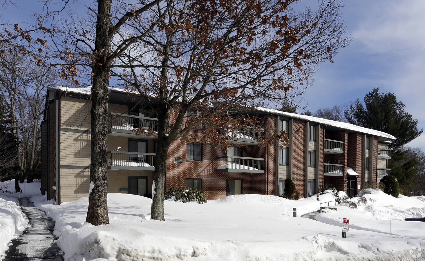
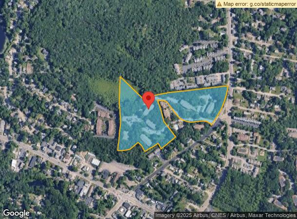
Property Record
Old Stone Way, Weymouth, MA 02188
NEARBY LISTINGS FOR SALE OR LEASE
Property Detail
Old Stone Way
WEYM-000031-000403-000006
Norfolk
Apartment
Massachusetts
X
6
25021C0233E
13.40 AC
2024
East Weymouth
2024
Boston
422401
Boston-Cambridge-Newton, MA-NH
DEMOGRAPHICS near Old Stone Way
1 Mile
3 Mile
5 Mile
2024 Total Population
9,578
65,418
172,439
2029 Population
9,575
65,288
172,038
Pop Growth 2024-2029
(0.03%)
(0.20%)
(0.23%)
Average Age
46
43
42
2024 Total Households
4,520
27,043
70,320
HH Growth 2024-2029
+ 0.02%
(0.20%)
(0.22%)
Median Household Inc
$61,503
$103,159
$102,418
Avg Household Size
2.10
2.40
2.40
2024 Avg HH Vehicles
1.00
2.00
2.00
Median Home Value
$465,351
$500,959
$556,131
Median Year Built
1977
1964
1963
Nearby Places
- Restaurants
- Banks
- Shops
- Fitness
- Groceries
PUBLIC TRANSPORTATION
COMMUTER RAIL
East Weymouth (Greenbush Line - Massachusetts Bay Transportation Authority Commuter Rail (Purple Line))
DRIVE
WALK
Distance
East Weymouth (Greenbush Line - Massachusetts Bay Transportation Authority Commuter Rail (Purple Line))
4 min
1.7 mi
Weymouth Landing/East Braintree (Greenbush Line - MBTA)
DRIVE
WALK
Distance
Weymouth Landing/East Braintree (Greenbush Line - MBTA)
6 min
3.5 mi
AIRPORT
General Edward Lawrence Logan International
DRIVE
WALK
Distance
General Edward Lawrence Logan International
31 min
19.4 mi
Freight Ports
Port of Boston
DRIVE
WALK
Distance
Port of Boston
29 min
17.2 mi
Nearby Properties
Address
Land Use
TOTAL SIZE
Lot Size
Zoning
Address
Land Use
TOTAL SIZE
Lot Size
Zoning
48.16 AC
Address
Land Use
TOTAL SIZE
Lot Size
Zoning
50.61 AC
IND
Address
Land Use
TOTAL SIZE
Lot Size
Zoning
31.29 AC
100
Address
Land Use
TOTAL SIZE
Lot Size
Zoning
32.04 AC
Address
Land Use
TOTAL SIZE
Lot Size
Zoning
3.65 AC
100
Address
Land Use
TOTAL SIZE
Lot Size
Zoning
33.81 AC
A3
Address
Land Use
TOTAL SIZE
Lot Size
Zoning
296,238 SF
15.87 AC
100
Address
Land Use
TOTAL SIZE
Lot Size
Zoning
7.62 AC
A2
Address
Land Use
TOTAL SIZE
Lot Size
Zoning
240,481 SF
25.23 AC
CL2
Address
Land Use
TOTAL SIZE
Lot Size
Zoning
19.08 AC
A1
Address
Land Use
TOTAL SIZE
Lot Size
Zoning
8.54 AC
100
Address
Land Use
TOTAL SIZE
Lot Size
Zoning
144,377 SF
9.39 AC
Address
Land Use
TOTAL SIZE
Lot Size
Zoning
11.39 AC
100
Address
Land Use
TOTAL SIZE
Lot Size
Zoning
6.50 AC
A2
Address
Land Use
TOTAL SIZE
Lot Size
Zoning
20.23 AC
Address
Land Use
TOTAL SIZE
Lot Size
Zoning
3.92 AC
R-4
Address
Land Use
TOTAL SIZE
Lot Size
Zoning
141,687 SF
17.27 AC
Address
Land Use
TOTAL SIZE
Lot Size
Zoning
172,027 SF
3.73 AC
100
Address
Land Use
TOTAL SIZE
Lot Size
Zoning
79,687 SF
3.52 AC
75
Address
Land Use
TOTAL SIZE
Lot Size
Zoning
2.56 AC
100
Address
Land Use
TOTAL SIZE
Lot Size
Zoning
107,410 SF
1.22 AC
85
Address
Land Use
TOTAL SIZE
Lot Size
Zoning
1.48 AC
100
Address
Land Use
TOTAL SIZE
Lot Size
Zoning
9.56 AC
A3
Address
Land Use
TOTAL SIZE
Lot Size
Zoning
103,128 SF
13.02 AC
85
Address
Land Use
TOTAL SIZE
Lot Size
Zoning
154.20 AC
Address
Land Use
TOTAL SIZE
Lot Size
Zoning
74,600 SF
6.29 AC
Address
Land Use
TOTAL SIZE
Lot Size
Zoning
2.81 AC
A3
Address
Land Use
TOTAL SIZE
Lot Size
Zoning
237,417 SF
13.60 AC
Address
Land Use
TOTAL SIZE
Lot Size
Zoning
3.76 AC
A3
The World's #1 Commercial Real Estate Marketplace
Connect with us
© 2025 CoStar Group
The information above has been obtained from sources believed reliable. While we do not doubt its accuracy we have not verified it and make no guarantee, warranty or representation about it. It is your responsibility to independently confirm its accuracy and completeness. Any projections, opinions, assumptions, or estimates used are for example only and do not represent the current or future performance of the property. The value of this transaction to you depends on tax and other factors which should be evaluated by your tax, financial, and legal advisors. You and your advisors should conduct a careful, independent investigation of the property to determine to your satisfaction the suitability of the property for your needs.