Property Record
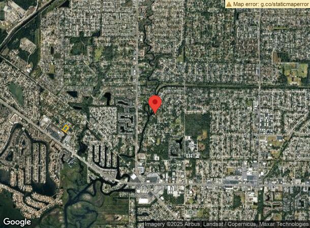
Oslin St, Tampa, FL 33615

NEARBY LISTINGS FOR SALE OR LEASE
Property Detail
Oslin St
Tampa-St. Petersburg-Clearwater, FL
Elliott And Harrison Subdivision
U-34-28-17-0BV-000000-00036.0
ELLIOTT AND HARRISON SUBDIVISION LOTS 36 AND 37 AND NWLY 60 FT OF LOTS 26 AND 27
Residentialacreage
Hillsborough
AE
Florida
12057C0188J
36
2023
1.21 AC
2023
Northwest Tampa
011613
Tampa/St Petersburg
DEMOGRAPHICS near Oslin St
1 Mile
3 Mile
5 Mile
2024 Total Population
15,835
87,381
143,898
2029 Population
17,210
94,722
155,645
Pop Growth 2024-2029
+ 8.68%
+ 8.40%
+ 8.16%
Average Age
39
40
40
2024 Total Households
6,534
34,325
56,625
HH Growth 2024-2029
+ 8.98%
+ 8.72%
+ 8.47%
Median Household Inc
$62,155
$64,106
$68,369
Avg Household Size
2.40
2.50
2.50
2024 Avg HH Vehicles
2.00
2.00
2.00
Median Home Value
$288,271
$276,404
$296,044
Median Year Built
1987
1985
1988
Nearby Places
- Restaurants
- Banks
- Shops
- Fitness
- Groceries
PUBLIC TRANSPORTATION
AIRPORT
Tampa International
DRIVE
WALK
Distance
Tampa International
16 min
6.9 mi
St Pete-Clearwater International
DRIVE
WALK
Distance
St Pete-Clearwater International
36 min
18.4 mi
Freight Ports
Port of Tampa Bay
DRIVE
WALK
Distance
Port of Tampa Bay
29 min
14.8 mi
Nearby Properties
Address
Land Use
TOTAL SIZE
Lot Size
Zoning
Address
Land Use
TOTAL SIZE
Lot Size
Zoning
596,669 SF
65.71 AC
PD
Address
Land Use
TOTAL SIZE
Lot Size
Zoning
439,758 SF
22.14 AC
PD
Address
Land Use
TOTAL SIZE
Lot Size
Zoning
356,025 SF
4.57 AC
PD
Address
Land Use
TOTAL SIZE
Lot Size
Zoning
467,085 SF
13.16 AC
PD
Address
Land Use
TOTAL SIZE
Lot Size
Zoning
382,217 SF
29.74 AC
PD
Address
Land Use
TOTAL SIZE
Lot Size
Zoning
459,627 SF
23.28 AC
PD
Address
Land Use
TOTAL SIZE
Lot Size
Zoning
423,639 SF
10.62 AC
PD
Address
Land Use
TOTAL SIZE
Lot Size
Zoning
449,097 SF
75.52 AC
PD
Address
Land Use
TOTAL SIZE
Lot Size
Zoning
351,344 SF
84.32 AC
PD
Address
Land Use
TOTAL SIZE
Lot Size
Zoning
400,781 SF
43.59 AC
PD
Address
Land Use
TOTAL SIZE
Lot Size
Zoning
369,417 SF
13.42 AC
PD
Address
Land Use
TOTAL SIZE
Lot Size
Zoning
521,097 SF
30.92 AC
RMC-20
Address
Land Use
TOTAL SIZE
Lot Size
Zoning
373,594 SF
19.75 AC
PD
Address
Land Use
TOTAL SIZE
Lot Size
Zoning
247,794 SF
11.19 AC
PD
Address
Land Use
TOTAL SIZE
Lot Size
Zoning
2,226 SF
438.48 AC
SPI-AP-1
Address
Land Use
TOTAL SIZE
Lot Size
Zoning
356,818 SF
27.12 AC
RMC-16
Address
Land Use
TOTAL SIZE
Lot Size
Zoning
346,527 SF
18.54 AC
PD
Address
Land Use
TOTAL SIZE
Lot Size
Zoning
438,367 SF
24.83 AC
PD
Address
Land Use
TOTAL SIZE
Lot Size
Zoning
254,169 SF
3.12 AC
PD
Address
Land Use
TOTAL SIZE
Lot Size
Zoning
384,891 SF
18.49 AC
PD
Address
Land Use
TOTAL SIZE
Lot Size
Zoning
335,251 SF
20.34 AC
PD
Address
Land Use
TOTAL SIZE
Lot Size
Zoning
145,665 SF
3.99 AC
PD
Address
Land Use
TOTAL SIZE
Lot Size
Zoning
300,966 SF
29.46 AC
PD
Address
Land Use
TOTAL SIZE
Lot Size
Zoning
238,535 SF
11.50 AC
PD
Address
Land Use
TOTAL SIZE
Lot Size
Zoning
294,690 SF
25.28 AC
PD
Address
Land Use
TOTAL SIZE
Lot Size
Zoning
251,753 SF
15.96 AC
RMC-20
Address
Land Use
TOTAL SIZE
Lot Size
Zoning
210,966 SF
6.49 AC
PD
Address
Land Use
TOTAL SIZE
Lot Size
Zoning
308,606 SF
25.18 AC
RMC-20
Address
Land Use
TOTAL SIZE
Lot Size
Zoning
226,867 SF
9.19 AC
PD
Address
Land Use
TOTAL SIZE
Lot Size
Zoning
182,668 SF
6.04 AC
PD
The World's #1 Commercial Real Estate Marketplace
Connect with us
© 2025 CoStar Group
The information above has been obtained from sources believed reliable. While we do not doubt its accuracy we have not verified it and make no guarantee, warranty or representation about it. It is your responsibility to independently confirm its accuracy and completeness. Any projections, opinions, assumptions, or estimates used are for example only and do not represent the current or future performance of the property. The value of this transaction to you depends on tax and other factors which should be evaluated by your tax, financial, and legal advisors. You and your advisors should conduct a careful, independent investigation of the property to determine to your satisfaction the suitability of the property for your needs.