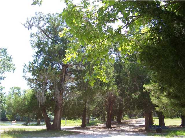
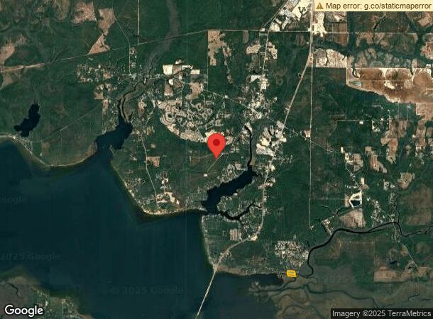
Property Record
Pitts Ave, Freeport, FL 32439
NEARBY LISTINGS FOR SALE OR LEASE
Property Detail
Pitts Ave
Other Market Areas
Magnolia Baye
Crestview-Fort Walton Beach-Destin, FL
COM AT THE NW/C OF THE SW1/4 OF THE SE1/4 OF SEC 02-2S-19W, S 00 DEG 02'24E 158FT TO POB; S 00 DEG 02'24E 1162FT THENCE RUN E 1219.36FT RUN N 13 DEG 58'00W 931.05FT RUN S 87 DEG 26'13W 376.84FT RUN N 83 DEG 08'33W 447.05FT RUN N 00 DEG 06'50W 221.95F
02-2S-19-24000-034-0040
Walton
Campgroundrvpark
Florida
2023
40
2023
17.96 AC
950502
Florida Panhandle Area
8,074 SF
DEMOGRAPHICS near Pitts Ave
1 Mile
3 Mile
5 Mile
2024 Total Population
739
2,221
8,506
2029 Population
892
2,707
10,524
Pop Growth 2024-2029
+ 20.70%
+ 21.88%
+ 23.72%
Average Age
39
38
39
2024 Total Households
288
839
3,202
HH Growth 2024-2029
+ 20.83%
+ 22.05%
+ 23.99%
Median Household Inc
$42,838
$46,470
$63,783
Avg Household Size
2.50
2.50
2.60
2024 Avg HH Vehicles
2.00
2.00
2.00
Median Home Value
$133,582
$209,302
$344,171
Median Year Built
2002
2001
2005
Nearby Places
- Restaurants
- Banks
- Shops
- Fitness
- Groceries
PUBLIC TRANSPORTATION
AIRPORT
Eglin AFB/Destin-Ft Walton Beach
DRIVE
WALK
Distance
Eglin AFB/Destin-Ft Walton Beach
64 min
30.4 mi
Northwest Florida Beaches International
DRIVE
WALK
Distance
Northwest Florida Beaches International
48 min
33.4 mi
Freight Ports
Port of Panama City
DRIVE
WALK
Distance
Port of Panama City
65 min
44.1 mi
Nearby Properties
Address
Land Use
TOTAL SIZE
Lot Size
Zoning
Address
Land Use
TOTAL SIZE
Lot Size
Zoning
262,344 SF
13.94 AC
MUNI
Address
Land Use
TOTAL SIZE
Lot Size
Zoning
54,534 SF
9.06 AC
3310
Address
Land Use
TOTAL SIZE
Lot Size
Zoning
88.24 AC
3310
Address
Land Use
TOTAL SIZE
Lot Size
Zoning
30,473 SF
5.45 AC
3310
Address
Land Use
TOTAL SIZE
Lot Size
Zoning
2,000 SF
6.89 AC
3310
Address
Land Use
TOTAL SIZE
Lot Size
Zoning
12,080 SF
3.12 AC
Address
Land Use
TOTAL SIZE
Lot Size
Zoning
Address
Land Use
TOTAL SIZE
Lot Size
Zoning
248.65 AC
BAYN
Address
Land Use
TOTAL SIZE
Lot Size
Zoning
58,068 SF
4.84 AC
MUNI
Address
Land Use
TOTAL SIZE
Lot Size
Zoning
9,150 SF
7.60 AC
BAYN
Address
Land Use
TOTAL SIZE
Lot Size
Zoning
22,380 SF
5.51 AC
BAYN
Address
Land Use
TOTAL SIZE
Lot Size
Zoning
8.65 AC
3310
Address
Land Use
TOTAL SIZE
Lot Size
Zoning
100.36 AC
Address
Land Use
TOTAL SIZE
Lot Size
Zoning
1,240 SF
99.84 AC
BAYN
Address
Land Use
TOTAL SIZE
Lot Size
Zoning
11.37 AC
BAYN
Address
Land Use
TOTAL SIZE
Lot Size
Zoning
10,729 SF
2.02 AC
3310
Address
Land Use
TOTAL SIZE
Lot Size
Zoning
15,875 SF
0.92 AC
MUNI
Address
Land Use
TOTAL SIZE
Lot Size
Zoning
231 AC
EG
Address
Land Use
TOTAL SIZE
Lot Size
Zoning
4,417 SF
3.41 AC
BAYN
Address
Land Use
TOTAL SIZE
Lot Size
Zoning
5,976 SF
0.38 AC
MUNI
Address
Land Use
TOTAL SIZE
Lot Size
Zoning
15,225 SF
0.92 AC
MUNI
Address
Land Use
TOTAL SIZE
Lot Size
Zoning
12,754 SF
2.23 AC
3310
Address
Land Use
TOTAL SIZE
Lot Size
Zoning
17,442 SF
4.51 AC
Address
Land Use
TOTAL SIZE
Lot Size
Zoning
7,931 SF
8.45 AC
3310
Address
Land Use
TOTAL SIZE
Lot Size
Zoning
20,100 SF
3.64 AC
Address
Land Use
TOTAL SIZE
Lot Size
Zoning
23,925 SF
1 AC
3310
Address
Land Use
TOTAL SIZE
Lot Size
Zoning
3,623 SF
13.93 AC
Address
Land Use
TOTAL SIZE
Lot Size
Zoning
4,397 SF
0.92 AC
BAYN
Address
Land Use
TOTAL SIZE
Lot Size
Zoning
8,787 SF
10.63 AC
Address
Land Use
TOTAL SIZE
Lot Size
Zoning
10,575 SF
0.92 AC
MUNI
The World's #1 Commercial Real Estate Marketplace
Connect with us
© 2025 CoStar Group
The information above has been obtained from sources believed reliable. While we do not doubt its accuracy we have not verified it and make no guarantee, warranty or representation about it. It is your responsibility to independently confirm its accuracy and completeness. Any projections, opinions, assumptions, or estimates used are for example only and do not represent the current or future performance of the property. The value of this transaction to you depends on tax and other factors which should be evaluated by your tax, financial, and legal advisors. You and your advisors should conduct a careful, independent investigation of the property to determine to your satisfaction the suitability of the property for your needs.