Property Record
135 Highway 70, Lakewood, NJ 08701
NEARBY LISTINGS FOR SALE OR LEASE
Property Detail
135 Highway 70
15-01077-0000-00021
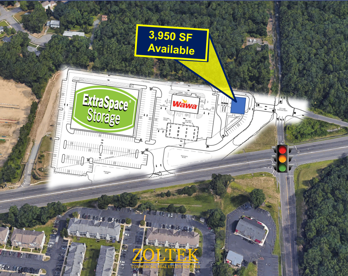
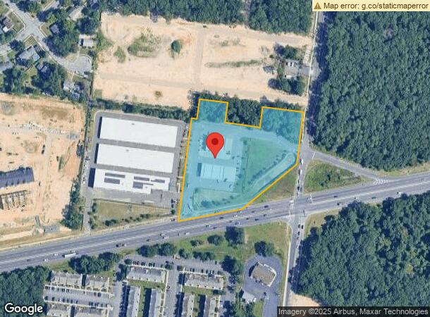
4.24 AC SUPER WAWA
Commercialnec
Ocean
X
New Jersey
34029C0187F
21.1
2023
4.24 AC
2024
Ocean County
715800
Northern New Jersey
5,208 SF
New York-Jersey City-White Plains, NY-NJ
DEMOGRAPHICS near 135 Highway 70
1 Mile
3 Mile
5 Mile
2024 Total Population
13,017
83,648
208,249
2029 Population
13,758
87,263
216,900
Pop Growth 2024-2029
+ 5.69%
+ 4.32%
+ 4.15%
Average Age
27
33
34
2024 Total Households
3,350
24,436
62,166
HH Growth 2024-2029
+ 5.07%
+ 3.67%
+ 3.56%
Median Household Inc
$63,697
$56,317
$63,854
Avg Household Size
3.50
3.00
3.00
2024 Avg HH Vehicles
1.00
2.00
2.00
Median Home Value
$364,554
$317,915
$324,138
Median Year Built
1999
1992
1984
Nearby Places
- Restaurants
- Banks
- Shops
- Fitness
- Groceries
SALE & LEASE HISTORY
LISTING DATE
SALE/LEASE

Feb 21, 2023
For Lease
Nearby Properties
Address
Land Use
TOTAL SIZE
Lot Size
Zoning
Address
Land Use
TOTAL SIZE
Lot Size
Zoning
12.43 AC
HD7
Address
Land Use
TOTAL SIZE
Lot Size
Zoning
338.52 AC
OSP
Address
Land Use
TOTAL SIZE
Lot Size
Zoning
2,382 SF
341 AC
OSP
Address
Land Use
TOTAL SIZE
Lot Size
Zoning
56.58 AC
DA-1
Address
Land Use
TOTAL SIZE
Lot Size
Zoning
29.34 AC
B4
Address
Land Use
TOTAL SIZE
Lot Size
Zoning
5,011 SF
37.83 AC
B5
Address
Land Use
TOTAL SIZE
Lot Size
Zoning
38.98 AC
R20C
Address
Land Use
TOTAL SIZE
Lot Size
Zoning
253,435 SF
17.88 AC
M1
Address
Land Use
TOTAL SIZE
Lot Size
Zoning
2,250 SF
326.26 AC
SPLT
Address
Land Use
TOTAL SIZE
Lot Size
Zoning
3,342 SF
19.32 AC
RM
Address
Land Use
TOTAL SIZE
Lot Size
Zoning
23,400 SF
15.17 AC
M1
Address
Land Use
TOTAL SIZE
Lot Size
Zoning
1.80 AC
B5
Address
Land Use
TOTAL SIZE
Lot Size
Zoning
22.34 AC
ABC
Address
Land Use
TOTAL SIZE
Lot Size
Zoning
50,125 SF
19.18 AC
M1
Address
Land Use
TOTAL SIZE
Lot Size
Zoning
3,136 SF
14.92 AC
R40C
Address
Land Use
TOTAL SIZE
Lot Size
Zoning
2,603 SF
15.97 AC
RHB
Address
Land Use
TOTAL SIZE
Lot Size
Zoning
15,680 SF
8.71 AC
B4
Address
Land Use
TOTAL SIZE
Lot Size
Zoning
8.66 AC
RHB
Address
Land Use
TOTAL SIZE
Lot Size
Zoning
19,536 SF
3.50 AC
M1
Address
Land Use
TOTAL SIZE
Lot Size
Zoning
69.33 AC
DA-1
Address
Land Use
TOTAL SIZE
Lot Size
Zoning
216,206 SF
15.35 AC
RM
Address
Land Use
TOTAL SIZE
Lot Size
Zoning
85,995 SF
7.60 AC
M1
Address
Land Use
TOTAL SIZE
Lot Size
Zoning
13,928 SF
22.96 AC
MF8
Address
Land Use
TOTAL SIZE
Lot Size
Zoning
39.28 AC
R12
Address
Land Use
TOTAL SIZE
Lot Size
Zoning
9,180 SF
49.38 AC
OSP
Address
Land Use
TOTAL SIZE
Lot Size
Zoning
66,922 SF
12.95 AC
LP
Address
Land Use
TOTAL SIZE
Lot Size
Zoning
19.11 AC
M1
Address
Land Use
TOTAL SIZE
Lot Size
Zoning
38,920 SF
9.70 AC
M1
Address
Land Use
TOTAL SIZE
Lot Size
Zoning
2,056 SF
15.74 AC
RUR
Address
Land Use
TOTAL SIZE
Lot Size
Zoning
170,849 SF
12.89 AC
M1
The World's #1 Commercial Real Estate Marketplace
Connect with us
© 2025 CoStar Group
The information above has been obtained from sources believed reliable. While we do not doubt its accuracy we have not verified it and make no guarantee, warranty or representation about it. It is your responsibility to independently confirm its accuracy and completeness. Any projections, opinions, assumptions, or estimates used are for example only and do not represent the current or future performance of the property. The value of this transaction to you depends on tax and other factors which should be evaluated by your tax, financial, and legal advisors. You and your advisors should conduct a careful, independent investigation of the property to determine to your satisfaction the suitability of the property for your needs.